The date on the object dates one layer of it
Seven dated objects in this archive show that a date belongs to one layer of the thing: the parchment, the copying, the printing, the compilation. The record has to say which layer, because the other layers carry their own dates and sometimes their own centuries.
Records in this piece: Tabula Peutingeriana, The Mainz Psalter, The Piri Reis World Map of 1513, The Voynich Manuscript, The Genoese World Map of 1457, The Behaim Globe (Erdapfel), The Selden Map of China
On this page 10 sections
ContentsClose
In short
- Seven dated objects in this archive each carry a date that belongs to one physical or textual layer: the animal's death, the copying, the printing, the compilation or the annotation. In no case does that date cover the whole object.
- The Tabula Peutingeriana is dated about 1200 by the library that holds it, and the map it copies is dated anywhere from Augustus to about 435 by scholars who disagree in print. Both dates are correct about different layers.
- A laboratory date is the narrowest of all. The Voynich radiocarbon result of 1404 to 1438 dates the calves whose skins became the parchment, and the University of Arizona said so; it does not date the ink, the text or the drawings.
- Where an object carries no date, three scholars can supply three, as they have for the Selden map: about 1608, about 1619, the 1620s. A date_made field that holds one number without the layer and the dissent is a compression that reads as a fact.
Seven objects here carry a date, and in each case it belongs to one layer
Seven objects in this archive carry a date, written on them, measured from them or argued for them, and in every case that date belongs to a single layer of the object rather than to the whole. A map is at least three things: a sheet, a drawing on the sheet, and the information the drawing was made from. A printed book is a text, a printing and, where somebody wrote on it afterwards, an annotation. Each layer has its own date, and the one that gets written in the catalogue is usually the one that was easiest to find. This piece sets seven of ours side by side to show how far the layers can drift apart, and what a record should do about it.
We chose maps, a psalter and a manuscript because those are the object types where the drift is largest. A panel painting's paint and support are usually a few years apart. A map's parchment and its coastlines can be a millennium apart, and its colophon can be precise to the day while its content is a compilation of sources it names but that no longer exist.
| Object | The date | What that date belongs to | What it leaves undated |
|---|---|---|---|
| Tabula Peutingeriana, Vienna | About 1200 | The parchment copy | The Roman original, argued from Augustus to about 435 |
| Mainz Psalter, Windsor | 14 August 1457 | The printing, by colophon | The psalms; the music added by hand afterwards |
| Piri Reis map, Istanbul | Muharrem 919, March to April 1513 | The drawing at Gallipoli | The twenty or more source maps, one of them Columbus's |
| Voynich manuscript, Yale | 1404 to 1438, 95 percent probability | The calfskin | The ink, the text, the drawings |
| Genoese world map, Florence | 1457, on the sheet | The drawing | Conti's account of 1439-44 and Ptolemy's second-century geography |
| Behaim globe, Nuremberg | 1490 to 1494, from council accounts | The making; horizon ring about 1510 | The geography, which stops with Dias in 1488 |
| Selden map, Oxford | None on the object | Argued: about 1608, about 1619, the 1620s | The 1687 Latin annotations are a dated layer of their own |
The Peutinger map: the parchment is about 1200, the roads are centuries older
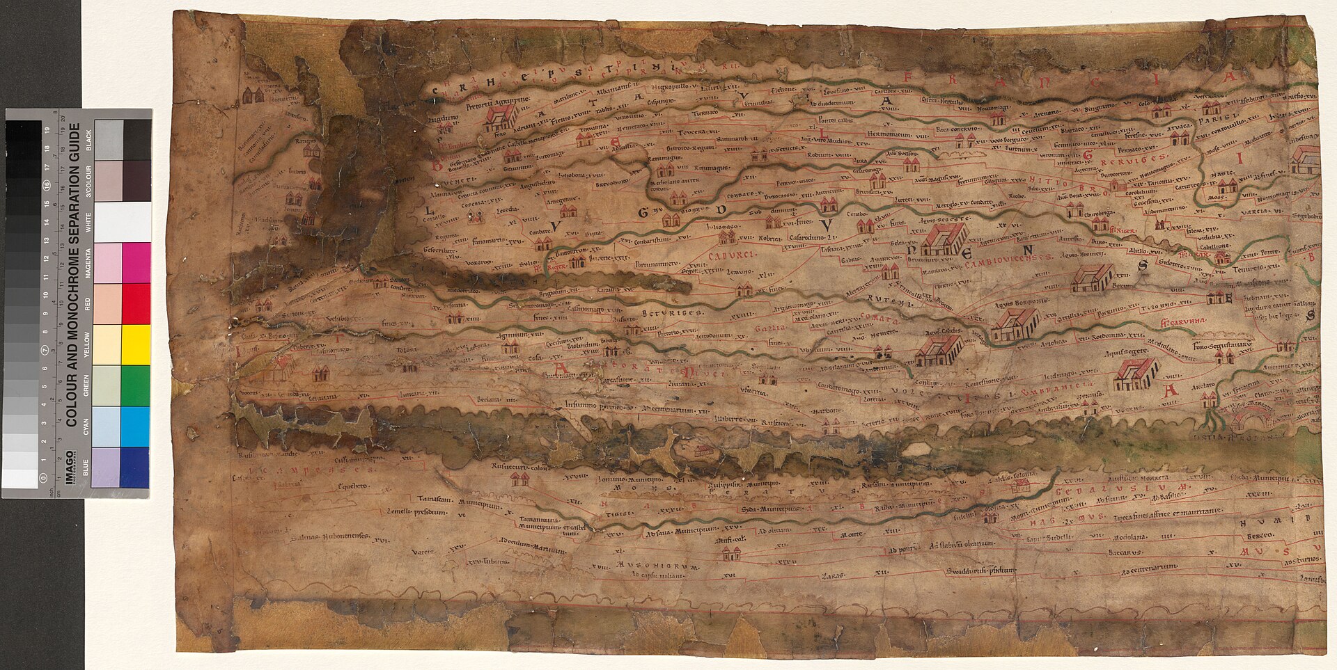
The Tabula Peutingeriana in the Austrian National Library is a copy made around the year 1200 of a Roman road map whose own date is not agreed. The library's own account, by Michael Rathmann on its blog, calls the object the copy, probably made about 1200, of a late antique original, and the paleographic study behind Richard Talbert's 2010 monograph found it was drawn in one campaign by a single hand, layer by layer, in the south German or Alsatian region. A rival hypothesis in some secondary literature gives a monk at Colmar in 1265; our record flags it as unverified against the primary paleography.
That is the copy. The thing copied has at least four incompatible dates in print. The older view, still in general reference works, descends the map from a survey associated with Agrippa under Augustus, revised in the fourth or fifth century. Konrad Miller argued for a revision of 365 to 366 from the prominence of Rome, Constantinople and Antioch. Wilhelm Kubitschek put the underlying material no later than Caracalla. Talbert argued for something different in kind, and other proposals run to a Hellenistic base revised as late as about 435. Our date_made field carries the copy date and the dispute together, because a single year in that field would be true of the skin and false of the roads.
Two further layers sit on the same object. The westernmost sheet, which would have shown Britain, Iberia and Morocco, has been missing since at least 1526, when Michael Hummelberg reasoned from the map's geometry that sheets were absent; that absence has a date of its own. And a multispectral imaging project now under way has recovered at least one place name invisible to the naked eye, confirming a sixteenth-century reader's transcription four hundred years later. The map's legibility, too, is a layer with dates.
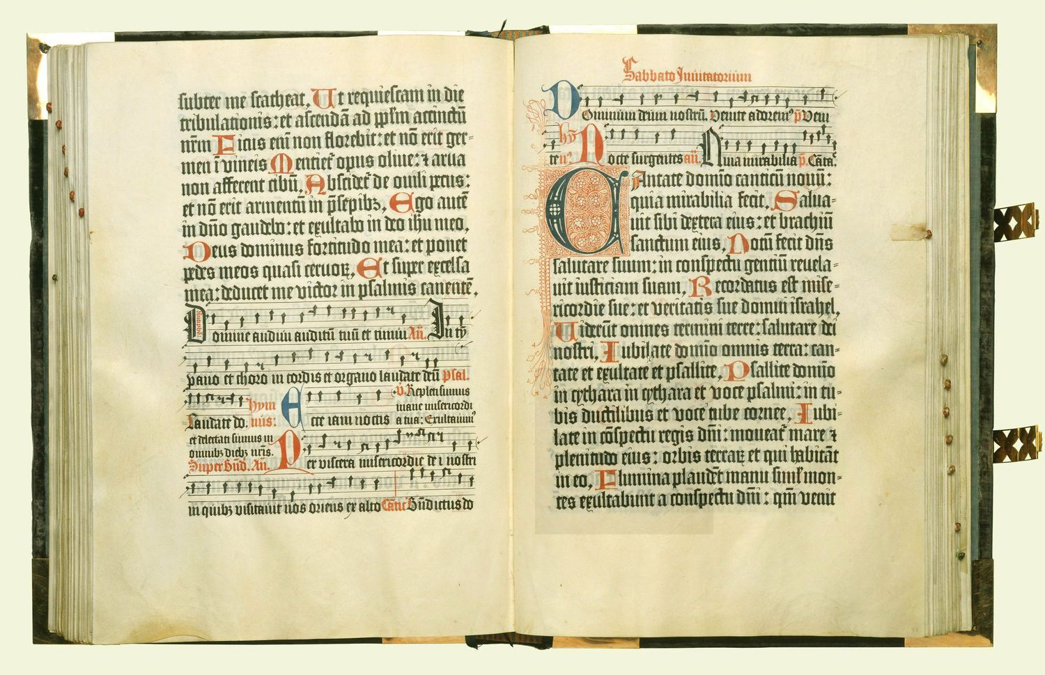
The Mainz Psalter's colophon dates the printing to the day, and nothing else
The Mainz Psalter carries the first printed colophon in Europe, and it dates one thing: the completion of the printing by Johann Fust and Peter Schoffer on the eve of the Assumption, 14 August 1457. The abbreviated Latin on the page says the volume was fashioned by a mechanical process of printing and producing characters, without use of a pen, and it names the two printers and the city. It is the first printed book to say who made it, where and when, and the first to carry initials printed in colour rather than painted in.
The date does not touch the other layers. The text is the Psalms, older than the Latin it is printed in. The initials were printed in the same campaign, so they share the colophon's date. The square musical notation, on the other hand, was added by hand after printing, and the Royal Collection's copy, RCIN 1071478, carries that manuscript layer on top of the printed one; its date is not the colophon's, and the sources we consulted do not give it. The purple velvet binding with George III's monogram is a fourth layer, added at or after the University of Gottingen's presentation of the book to the king in 1800.
What the colophon does is set the standard the other six objects fall short of. It names the maker, the place and the day of one layer. A record that copied 14 August 1457 into a date_made field and stopped would be right about the printing and silent about the music and the binding, and a reader looking at the opening in the photograph would be looking at two dates and reading one.
Piri Reis dated his own sheet and named the twenty maps it was copied from
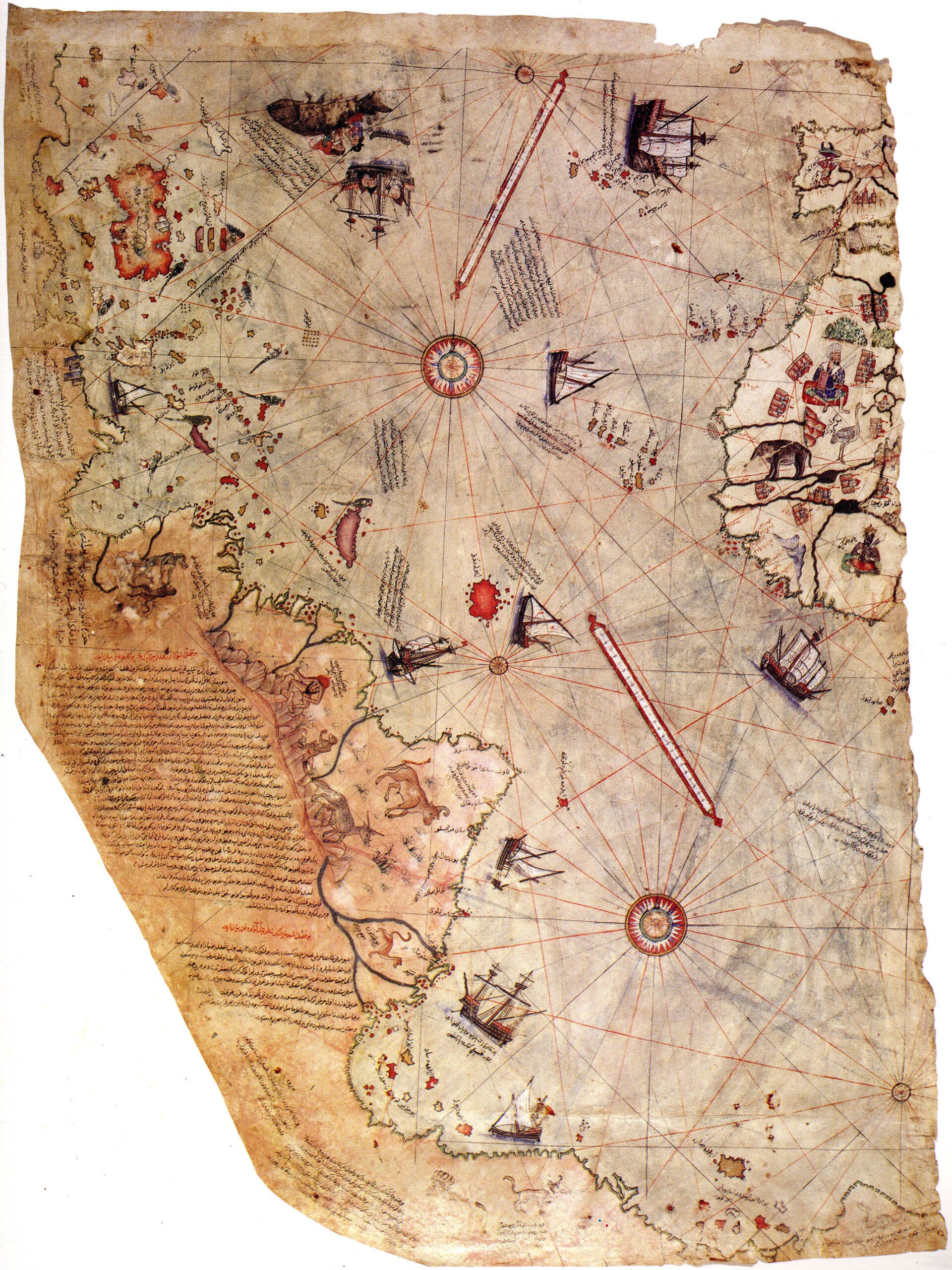
The Piri Reis map is dated by its maker to Muharrem 919, which runs from 9 March to 7 April 1513, and it lists on its own surface the older maps it was compiled from. The sheet is gazelle-skin parchment, 87 cm long, about a third of the original, drawn at Gallipoli and presented to Sultan Selim I in Cairo in 1517. The inscription names some twenty old charts and mappae mundi going back, Piri Reis says, to the era of Alexander, eight of one particular type, an Arabic map of India, four new Portuguese maps, and a map by Colombo for the western lands. Counted item by item the total comes to thirty-four, though twenty is the figure usually quoted.
So the drawing has a date to the month, and its content has none, or rather has twenty. The Columbus source is the layer everyone wants and nobody has: no copy of it survives outside what Piri Reis says he took from it, and Gregory McIntosh's 2000 monograph argues its credibility from internal evidence, the Cuba-as-mainland error matching Columbus's own belief. A colophon in Arabic, in a different hand from the rest of the inscriptions, is where the Columbus material is described most fully, which makes even the writing on the sheet a two-handed layer.
The parchment then adds its own dates. Roughly two thirds of the original sheet is lost, apparently to moisture before or shortly after it reached the palace library; that loss has an undocumented date. The sheet disappears from the record for four centuries and is identified in the Topkapi library in 1929 by Gustav Adolf Deissmann and Paul Kahle, which is the date it re-entered scholarship. A 1513 written on the object, a 1517 for its presentation, a 1929 for its rediscovery and a 2021 for its return to a climate-controlled case are all dates of this one object, and only the first is the map's.
The Voynich radiocarbon date is a date for the calves
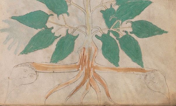
The Voynich manuscript's radiocarbon date of 1404 to 1438 at 95 percent probability is a date for the animals whose skins became its parchment, and the laboratory that produced it said so. In 2009 the University of Arizona's accelerator mass spectrometry laboratory, led by Greg Hodgins, dated four samples of one to six millimetres cut from folios 8, 26, 47 and 68, from areas Beinecke conservators had identified as unrebound original parchment. The four results were statistically consistent, the announcement came at a press conference on 8 December 2009, and the results were presented at a Yale centenary event in May 2012. Rene Zandbergen's specialist page on the dating, which we read for this piece, puts the principle plainly: the result gives the time that the animal whose skin was used died.
Everything else on the object is undated by that result. The iron gall ink is typical of the period and cannot be carbon-dated to a year. The text, in a script nobody has read, is presumed to have been added within a similar window because vellum was normally used within a few years of preparation, but that is an inference from practice, not a measurement. The drawings and the folio numbers are further layers, and the folio and quire numbers were added while more of the book was intact than survives, which dates the losses to after the numbering and before 1912.
The date does real work all the same. It kills the Roger Bacon attribution that Marci's letter of 1665 or 1666 reported at second hand, and it kills the theory that John Dee and Edward Kelley forged the book for Rudolf II in the 1580s, because the skins were already a century and a half old. A laboratory date of one layer can rule out claims about another. What it cannot do is date the other layer, and the record says which it did.
The Genoese map says 1457, and its Asia is from 1444 and its frame from the second century
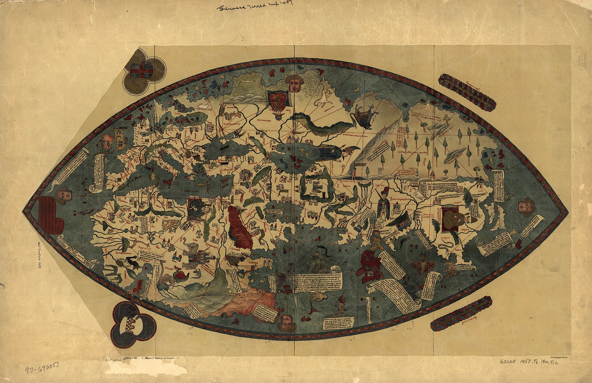
The Genoese world map in Florence is dated 1457 on the sheet, and its content is a documented compilation whose sources have dates of their own: Niccolo de' Conti's account of India and Southeast Asia, dictated to Poggio Bracciolini after Conti's return to Venice in 1439 and written down by 1444; Ptolemy's Geography, translated into Latin in 1406 and supplying, by one analysis, about 87 percent of the content for regions beyond direct European knowledge; the portolan tradition for the Mediterranean; Isidore and al-Idrisi for Africa. The map says so itself, in a marginal inscription describing it as the true description of the cosmographers, drawn according to nautical maps.
The Biblioteca Nazionale Centrale's cataloguers separate the hands: a cartographer for the coastlines, grid and rhumb network, assisted by a miniaturist and possibly a scribe for the toponyms, vignettes and sea creatures. So even the drawing layer is plural, and nothing on the sheet names either hand. The Genoese and Spinola arms give it a patron's city, and the Castilian orthography of the place names gives its letterer a training, and neither is a date.
The practical consequence is the one this map keeps attracting. Since the 1960s a genre of writing about supposed pre-Columbian Chinese voyages has treated maps of exactly this type, unexpectedly detailed and unexpectedly early, as evidence of a hidden source. Our record checked and found that Gavin Menzies's own book does not mention this map at all. The documented sources leave no gap for a hidden voyage, and the reason is layered dating: 1457 is when the drawing was made, 1439 to 1444 is when its Asian information was gathered, and the second century is when its frame was written. There is nowhere in that stack for a secret to sit.
The Behaim globe: the accounts date the making 1490 to 1494, the geography stops in 1488
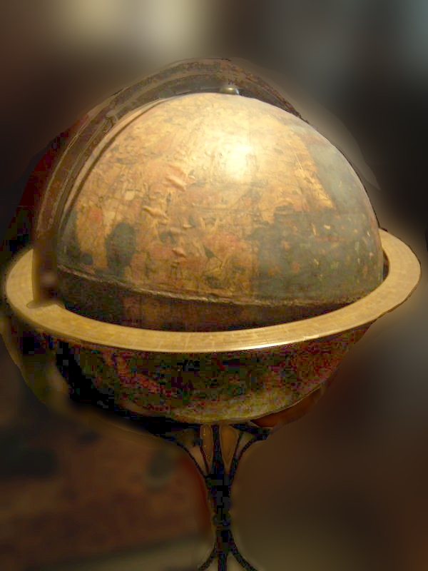
The Behaim globe is dated by the Nuremberg council's own records, which financed it from 1490 and saw the sphere finished in 1492, with painting and lettering continuing into 1493 and 1494 and a brass horizon ring added about 1510, and its geography is dated by what it does not show. The Germanisches Nationalmuseum's catalogue names the craftsmen from those records: Hans Glockengiesser cast the clay hemispheres, Ruprecht Kolberger laminated the linen and parchment, Georg Glockendon the Elder painted the gores, Petrus Gagenhart lettered them, and Glockendon's wife, unnamed, painted too. Martin Behaim supplied the content and did not build it.
The content stops in 1488. The African coast reflects Bartolomeu Dias's rounding of the Cape that year; the Atlantic runs straight into an oversized Asia with Cipangu far south of its place; there are no Americas, because the sphere was finished in the winter of 1492 and Columbus did not return to Spain until March 1493. The globe is therefore regularly mistaken for something Columbus consulted, which the calendar rules out in both directions: it could not have reached him before August 1492, and it was still being painted when he came back. What the two men shared was a source layer, Ptolemy's undersized earth and Marco Polo's land distances, not an object.
Our record carries three dates on this object and names each: 1490 to 1494 for the commission and making, about 1510 for the ring, and 1488 as the terminus of the geography. It could add 1937, when the city bought the globe it had paid for in 1490, and 2023, when UNESCO inscribed it. None of those is the globe's date, and the field that says 1492 is true of the sphere and not of the map on it.
The Selden map has no date, so three scholars supply three
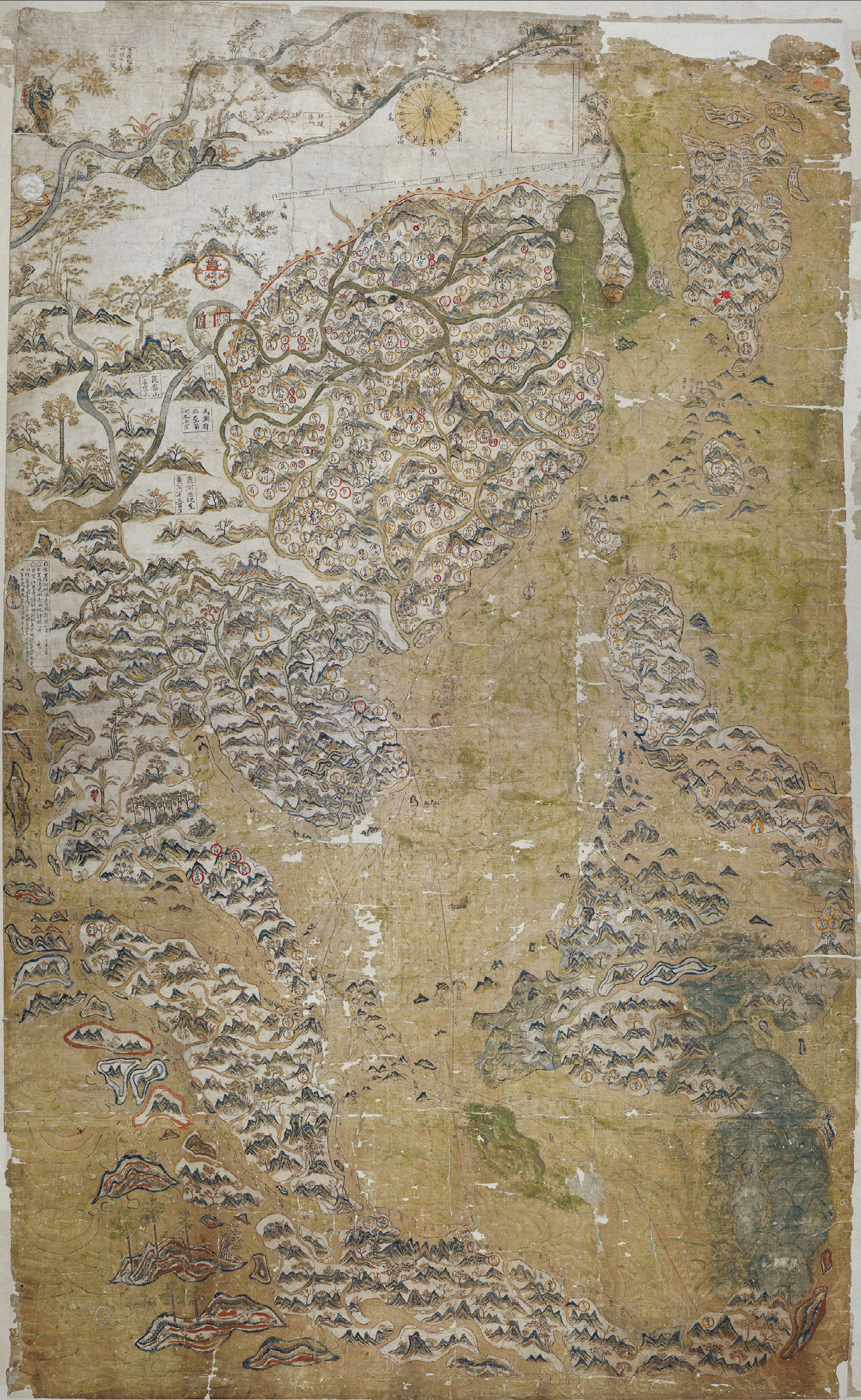
The Selden map carries no date, and the three most specific proposals for one differ by more than a decade: Timothy Brook argues for about 1608, Robert Batchelor for about 1619, and the Bodleian's conservation project page, which we read for this piece, says the map is thought to date from the 1620s. Internal evidence narrows the window to 1607 to 1624. Brook's date rests on a proposed transmission event, that the East India Company captain John Saris obtained the map in 1608 and brought it to England in 1609; Batchelor's on the detail with which Taiwan is drawn, which he reads as knowledge that accumulated through the 1610s. They are different kinds of evidence, and neither is the map's own statement.
The object then acquires dated layers that are not in dispute. John Selden's codicil of 11 June 1653 describes a map of China taken by an English commander, which is the first documented reference to it in England, and the map reached the Bodleian in 1659. In 1687 the librarian Thomas Hyde, with Michael Shen Fuzong, added Latin translations of the place names in the margins, the only annotation added after the map left its maker; the 2011 conservation kept an early paper border carrying some of those annotations as evidence of the original mounting. And removing the twentieth-century lining in 2011 exposed a draft of the main shipping routes on the verso, a layer that had been invisible for as long as the map had been lined.
So the record for this object holds one undated layer, the drawing, with three argued dates and their authors; one dated layer, the 1687 annotations; one dated discovery, the 2011 verso; and a 2008 date for the reading, by Batchelor, that told everyone the faint lines were shipping routes. Which of those is the map's date? The drawing's, and we do not have it, and the honest field says so and lists the three candidates.
How we write a date in this archive
A date in a record should name the layer it belongs to, and where a layer has no date or a disputed one, the field should carry the dispute rather than a number chosen to look settled. That is the rule we draw from these seven, and it is already how the date_made field on each of them reads: the Peutinger entry gives the copy date and the four proposals for the original; the Selden entry gives the window and the three scholars; the Voynich entry gives the radiocarbon range and says the text is presumed, not proven, to belong to it. We would rather a field ran to three lines than to a year that was true of the skin and false of the map.
Three habits follow. First, ask of every date which physical or textual layer produced it: a colophon, a council account, a laboratory, a scholar's inference from Taiwan's coastline. Second, look for the layers a single date leaves undated, because that is where a later claim will try to sit; the Genoese map's stack of 1457, 1444 and the second century is what leaves no room for a hidden voyage. Third, record the dates that belong to the object's later life, the 1687 annotation, the 1929 identification, the 2011 verso, as their own events with their own sources, and never let one of them drift into the date_made field.
Is this pedantry? We think it is the opposite. A single date is a summary, and a summary of seven layers written as one number is where most of the wrong things people believe about these objects come from, Columbus's globe and the Bacon manuscript among them.
Why this archive is free to read
We do this for everyone who loves art. The people who have studied it for years, and the people who just stopped to look. Iconotheca exists so that what we learn belongs to all of them.
Nobody pays us for this. No ads, no sponsors, no commercial interest. These works belong to all of us, and we would rather share them with as many people as we can than keep them to ourselves.
If it gave you something today, tell us to keep going. Follow us, leave a like, or write a positive comment. We read every one, and they are what keeps us going.
Questions
The parchment scroll in Vienna is a copy made about 1200, according to the Austrian National Library, with a minority hypothesis of 1265 at Colmar. The Roman road map it copies is of disputed date, with proposals in print running from an Augustan survey revised in the fourth or fifth century to a base revised as late as about 435.
The calfskin parchment. Four samples from folios 8, 26, 47 and 68 were dated by the University of Arizona in 2009 to 1404 to 1438 at 95 percent probability, which gives the time the animals died. The ink, text and drawings are presumed to be close in date because vellum was normally used within a few years, but they are not measured.
Nobody knows exactly, because the map carries no date. Internal evidence puts it between 1607 and 1624. Timothy Brook argues for about 1608, Robert Batchelor for about 1619, and the Bodleian Library's conservation page says the 1620s. The Latin annotations in the margins were added in 1687.
No. The sphere was finished in Nuremberg in the winter of 1492, after Columbus had sailed in August, and it was still being painted and lettered in 1493 and 1494. Its geography stops with Dias's rounding of the Cape in 1488 and shows no Americas. The two men shared sources, Ptolemy and Marco Polo, not an object.
Sources
- 1Michael Rathmann, 'Die Tabula Peutingeriana', Osterreichische Nationalbibliothek blog, 21 November 2018. Read in the in-app browser. Source for the copy date of about 1200, the eleven sheets, the dimensions and the acquisition history to 1738. onb.ac.at/mehr/...
- 2Renate Burri, review of Richard J. A. Talbert, Rome's World: The Peutinger Map Reconsidered, Bryn Mawr Classical Review 2012.04.14, for the single-hand, layer-by-layer copying and the south German or Alsatian attribution. bmcr.brynmawr.edu/2012/...
- 3Iconotheca, record for the Mainz Psalter, Royal Collection RCIN 1071478, with the colophon text and translation and the record of the hand-added notation and the 1800 presentation. iconotheca.com/artworks/...
- 4Republic of Turkey, nomination form for the Piri Reis World Map to the UNESCO Memory of the World Register, 2016, PDF, for the date Muharrem 919, the dimensions, the shelfmark Revan 1633 and the 1929 identification. media.unesco.org/sites/...
- 5Wikisource, 'Piri Reis' Map', translated inscriptions and colophon, for the list of source maps and the Colombo map. en.wikisource.org/wiki/...
- 6Rene Zandbergen, voynich.nu, 'Radio-carbon dating of the Voynich MS'. Read in the in-app browser. Source for the 1404 to 1438 range at 95 percent, the University of Arizona, the press conference of 8 December 2009 and the statement that the result dates the animal's death. voynich.nu/extra/...
- 7Beinecke Rare Book and Manuscript Library, Yale University, catalogue description of Beinecke MS 408, for the collation, folio count and materials. pre1600ms.beinecke.library.yale.edu/docs/...
- 8Encyclopaedia of Portuguese Expansion, CHAM, Universidade Nova de Lisboa, 'Genoese World Map drawn 1457', for the dimensions, shelfmark, sources and the translated marginal inscription. eve.fcsh.unl.pt/en/...
- 9Wikimedia Commons, file description and Library of Congress note for the 1912 Stevenson facsimile plate of the Genoese world map, LOC 97690053, used as the in-body plate and identified as a facsimile. commons.wikimedia.org/wiki/...
- 10Germanisches Nationalmuseum, Objektkatalog, 'Erdglobus, sogenannter Behaim-Globus', WI 1826, for the craftsmen named from the council records, the 1490 to 1494 making, the 1510 ring and the 1937 purchase. objektkatalog.gnm.de/objekt/...
- 11Bodleian Libraries, 'The Selden Map of China conservation project'. Read in the in-app browser. Source for the 1620s dating, the 1659 arrival, the 1687 annotation by Hyde and Shen Fuzong, the retained border and the draft routes found on the verso in 2011. bodleian.ox.ac.uk/about/...
- 12Robert K. Batchelor, 'The Selden Map Rediscovered: A Chinese Map of East Asian Shipping Routes, c.1619', Imago Mundi 65:1, 2013, for the about-1619 dating and the January 2008 reading. digitalcommons.georgiasouthern.edu/history-facpubs/...

More in Research and Method
The partThe Object on Display Is the Last Restorer's Reading of It
The British Museum gives the Sutton Hoo helmet two production dates: late 6th to early 7th century for the components, and 1971 for the...
The Fields This Archive Cannot Count, and What That Costs
2,592 technical facts wear 1,598 different labels and 1,754 ticket prices wear 1,355.
The First Number in a Hoard Is a Counting Rule
The Staffordshire Hoard is 4,600 pieces, or just under 4,000, or around 700, or more than 600, depending on which official page you read.