The Piri Reis World Map of 1513
Piri Reis (Haci Ahmed Muhiddin Piri) · 1513 (Muharrem 919 AH, 9 March - 7 April 1513)
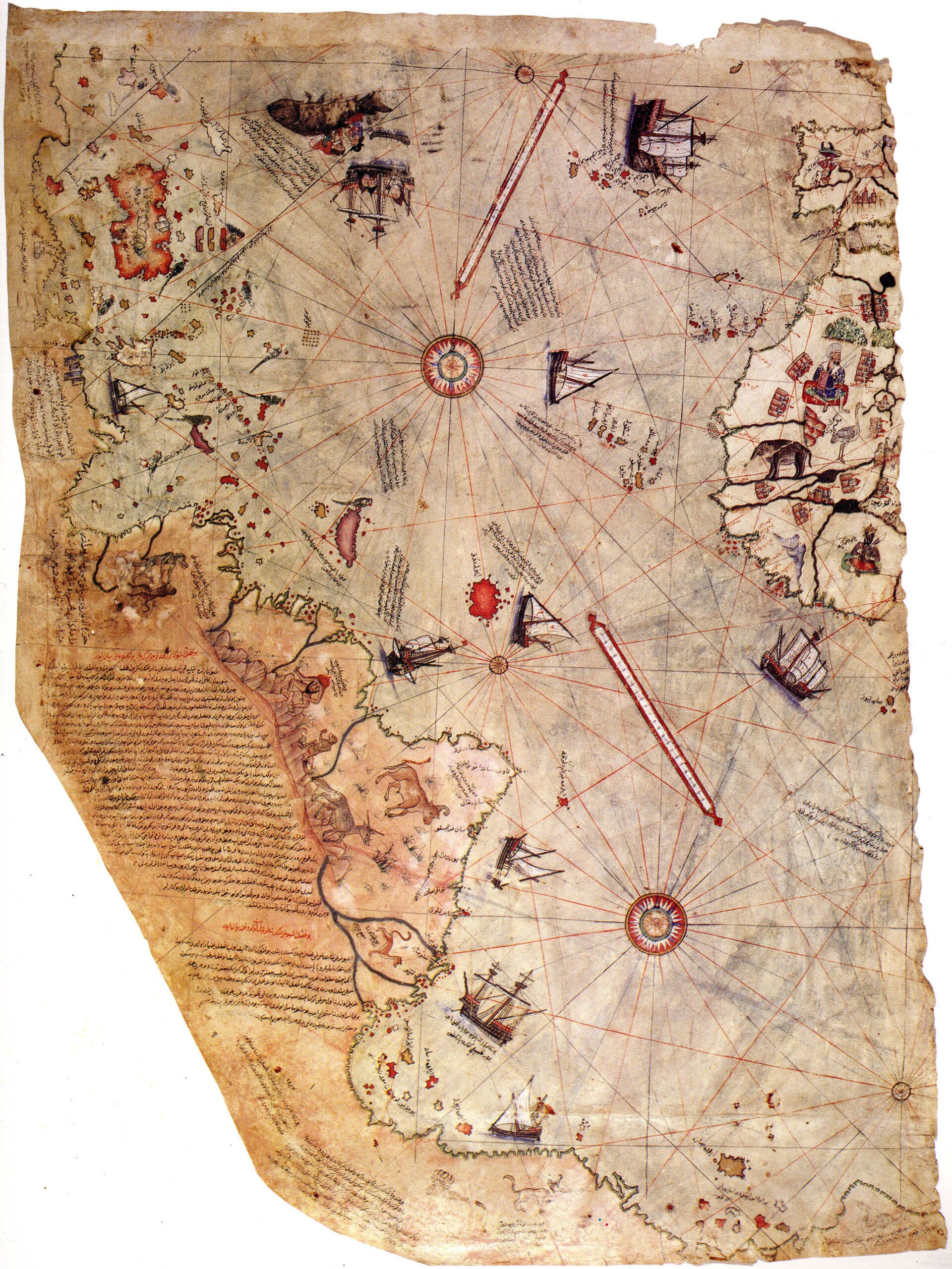
The surviving western fragment of the map, showing the Atlantic coasts of Europe and Africa and the eastern shores of the Americas. Topkapi Palace Museum Library.
| Artist | Piri Reis (Haci Ahmed Muhiddin Piri) |
|---|---|
| Date | 1513 (Muharrem 919 AH, 9 March - 7 April 1513) |
| Medium | Ink and pigment in eight colors on gazelle-skin parchment |
| Dimensions | 87 cm long, 63 cm wide at the top edge, narrowing to 41 cm at the bottom; the surviving sheet is estimated at roughly one third of the original, which one modern reconstruction puts at about 140 x 165 cm complete |
| Where it is now | Topkapi Palace Museum Library, Istanbul (Sultan Ahmed III / Enderun Library, Third Courtyard)last confirmed |
| Inventory number | Revan Kosku Collection, no. 1633, per Turkey's own 2016 UNESCO Memory of the World nomination form; several secondary sources instead give the number H. 1824 for this map, a discrepancy not resolved in the sources consulted for this record |
| Attribution | AcceptedPiri Reis names himself as the maker in his own inscription on the sheet: drawn by Piri, son of Haci Mehmed, known as the nephew of Kemal Reis, at Gallipoli, in the month of Muharrem 919 AH (9 March - 7 April 1513 CE). Full note |
| Object type | Map |
| Period | Ottoman, early sixteenth century, Age of Discovery |
| Cases | Has a provenance gap · Rediscovered |
| Inscriptions | Extensive marginal notes and place-name glosses in Ottoman Turkish, Arabic script; the colophon is in Arabic, in a different hand from the rest, and gives the date, the maker's name and lineage, and a list of the source maps used |
| Owners on record | 10 links9 documented, 1 unknown |
| Sources | 17 cited |
About this record Last verified · 17 sources cited · Change log
On this page 9 sections
ContentsClose
A fragment of a world map drawn at Gallipoli in the spring of 1513 by the Ottoman corsair-turned-admiral Piri Reis, on gazelle-skin parchment, showing the Atlantic coasts of Europe and Africa and the newly reported shores of the Americas. Piri Reis names his sources on the sheet itself: some twenty older charts and mappae mundi, Portuguese charts of Asia, an Arabic map of India, and, he says, a map made by Christopher Columbus. Presented to Sultan Selim I in Cairo in 1517, it then disappears from the historical record for four centuries.
It resurfaced in the Topkapi Palace library in 1929, identified by the German theologian Gustav Adolf Deissmann and the orientalist Paul Kahle. Since the 1960s it has also carried a persistent pseudo-archaeological claim, that its southern coastline shows an ice-free Antarctica proving access to lost ancient survey data. Historians of cartography reject this: the disputed coastline reads as a distorted, bent extension of South America, a common convention on maps of the period, and the claim rests on methodology that a geologist reviewer has shown conflates subglacial rock beneath Antarctica's ice with a hypothetical ice-free surface.
Roughly two thirds of the original sheet is lost, apparently to moisture damage before or shortly after it reached the palace library. What survives is extremely light-sensitive and is shown only rarely, most recently returned to a climate-controlled case at Topkapi in November 2021. It was inscribed on UNESCO's Memory of the World International Register in 2016.
Provenance
Each link is graded. Documented: a cited source supports it. Disputed: the identification is argued but not established. Unknown: no owner for that span, and the gap is not smoothed into a narrative. The grades in the glossary.
- 1513 - 1517Piri Reisdocumented
Drawn at Gallipoli in Muharrem 919 AH (9 March - 7 April 1513), per the map's own colophon, compiling material Piri Reis says was drawn from about twenty older mappae mundi, four Portuguese charts, an Arabic map of India, and a map attributed to Christopher Columbus.71
- 1517 - 1517Sultan Selim Idocumented
Presented by Piri Reis to Selim I in Cairo during the campaign that completed the Ottoman conquest of Mamluk Egypt.13
- 1517 - 1924Unknown, presumed within the Ottoman palace librariesunknown
No document, inventory entry or reference records the map's location, custody or use for roughly four hundred years. It must have remained within the Topkapi Palace complex, since that is where it later surfaced, but no more specific custody is documented.1
- 1924 - 1929Topkapi Palace Museum Library (state property, under reorganization)documented
Set aside as an unidentified parchment map during museum director Halil Edhem's project to consolidate the palace's scattered libraries. Not yet identified or dated at this stage, per Turkey's own 2016 account.1
- 1929 - 1933Topkapi Palace Museum Librarydocumented
Identified and dated by Gustav Adolf Deissmann and Paul Kahle in 1929. Kahle published the first facsimile in 1931 and a detailed study in 1933; Eugen Oberhummer published independently in 1931; Yusuf Akcura publicized the find for the Turkish Historical Society in the Illustrated London News in 1932.13
- 1933 - 1965Topkapi Palace Museum Library, Republic of Turkeydocumented
Held as Turkish state property. Mustafa Kemal Ataturk took a personal interest and ordered facsimiles produced.34
- 1966 - 1988Topkapi Palace Museum Library, Republic of Turkeydocumented
Exhibited abroad on four occasions in this period, twice in the United States and twice in Europe, per the Topkapi Palace Museum's own director. Specific venues and dates are not given in the sources consulted for this record.14
- 2013 - 2013Topkapi Palace Museum Library, Republic of Turkeydocumented
Displayed at Topkapi from 23 January to 11 February 2013 for the UNESCO-designated Piri Reis Year, marking the map's five hundredth anniversary, alongside the 1528 map, organized with the Bilkent Cultural Initiative.15
- 2016 - 2016Topkapi Palace Museum Library, Republic of Turkeydocumented
Inscribed on UNESCO's Memory of the World International Register.21
- 2021-11-19 - presentTopkapi Palace Museum Library, Republic of Turkeydocumented
Returned to public display in a climate-controlled case in the Sultan Ahmed III (Enderun) Library, Third Courtyard, Topkapi Palace. Not permanently displayed; exhibition periods are set by the museum's National Palaces Science Board because of the sheet's sensitivity to light.161
Technical evidence
| Attribution note | Piri Reis names himself as the maker in his own inscription on the sheet: drawn by Piri, son of Haci Mehmed, known as the nephew of Kemal Reis, at Gallipoli, in the month of Muharrem 919 AH (9 March - 7 April 1513 CE). Turkey's 2016 UNESCO Memory of the World nomination states plainly that there has been no scholarly opposition to the map's authenticity since Paul Kahle confirmed it in 1929-31. |
|---|---|
| Support | Gazelle-skin parchment, a single sheet.1 |
| Medium | Ink and pigment in eight colors; rhumb lines in red and black.1 |
| Dimensions | 87 cm long, 63 cm wide at top, narrowing to 41 cm at the bottom (a trapezoid, not a rectangle, because of loss). Estimated at roughly one third of the original sheet, which one modern reconstruction puts at about 140 x 165 cm complete.1 |
| Navigational apparatus | Two thirty-two-point compass roses (north and south sections) plus three minor roses and rhumb lines covering the surface, in the standard portolan chart manner; the spacing implies seventeen compass roses on the complete original sheet.1 |
| Scale | No scale legend survives on the fragment. A presumptive calculation based on an assumed Italian-mile unit suggests roughly 1:1,200,000, but Piri Reis's actual unit of distance is not known.1 |
| Illustrations | Fifty-eight figures in total: eleven vessels (ten ships, one boat), eight human figures, three ruler portraits in national dress, eighteen fortresses or fortified towns, twelve parrots, and fourteen animals or mythological and semi-mythological creatures.112 |
| Script and inscriptions | Marginal notes and place-name glosses in Ottoman Turkish, Arabic script. The colophon is written in Arabic, in a hand distinct from the rest of the inscriptions, and records the date, the maker, and his source maps.71 |
| Condition | The eastern portion of the sheet is entirely missing and the southern fragment is partially distorted. Conservators attribute the loss to prolonged exposure to moisture rather than to a single recorded event; the surviving sheet is now extremely light-sensitive.1 |
| Inventory | Given as Revan Kosku Collection, no. 1633, in Turkey's 2016 UNESCO Memory of the World nomination form for this specific object. Several secondary sources instead give H. 1824. This record has not resolved which is correct, or whether both numbers are in concurrent use under different cataloguing systems.1 |
Images
The record in full
Chapter 1What survives, and what it does not
The object in the Topkapi Palace Library today is a single sheet of gazelle-skin parchment, painted in eight colors, measuring 87 centimeters along its top edge and narrowing to 41 centimeters at the...
The object in the Topkapi Palace Library today is a single sheet of gazelle-skin parchment, painted in eight colors, measuring 87 centimeters along its top edge and narrowing to 41 centimeters at the bottom, a trapezoid rather than a rectangle because two of its four sides are simply gone. Turkey's own 2016 nomination to UNESCO's Memory of the World register states that the eastern portion of the map is completely missing and the southern fragment is partially distorted, and attributes the loss to prolonged exposure to moisture rather than to any single dramatic event.
What survives is generally held to be about one third of the whole sheet: the western coasts of Europe and Africa, the Atlantic, and the eastern coastline of the Americas as they were understood in 1513. A recent reconstruction cited in the same nomination estimates the complete map, had it survived whole, at roughly 140 by 165 centimeters. The surviving fragment carries two thirty-two-point compass roses in its north and south sections, three smaller ones, and red and black rhumb lines covering the surface in the standard manner of a portolan chart; the spacing of the surviving roses implies a total of seventeen across the original sheet.
Chapter 2How it was compiled
Piri Reis did not claim to have surveyed any of this himself.
Piri Reis did not claim to have surveyed any of this himself. His own inscription lists his sources in specific terms: about twenty older charts and mappae mundi going back, he says, to the era of Alexander the Great, which the Arabs call Jaferiye; eight of that Jaferiye type in particular; one Arabic map of India; four newly drawn Portuguese maps showing India, Sind and China; and, for the western lands, a map by Colombo. Counted item by item across the inscription the total comes to thirty-four individual source maps, though the figure of twenty is the one usually quoted, referring to the core group of old mappae mundi rather than the full list.
The colophon, written in Arabic in a different hand from the rest of the inscriptions, is where the Columbus material is described most fully: a book, it says, fell into the hands of the said Colombo, describing lands at the end of the Western Sea, and Colombo used it to persuade the great of Genoa to give him ships. Piri Reis's own account of how he came by Columbus material is more specific still: he says he learned of Columbus's voyages from a slave or servant of his uncle Kemal Reis, a man who had reportedly sailed with Columbus's Spanish expeditions three times.
Chapter 3A corsair's nephew becomes a cartographer
Piri Reis was born Muhiddin Piri at Gallipoli, an Ottoman naval base, sometime around 1465 to 1470, the son of Haci Mehmed.
Piri Reis was born Muhiddin Piri at Gallipoli, an Ottoman naval base, sometime around 1465 to 1470, the son of Haci Mehmed. From roughly 1487 he sailed as a corsair alongside his uncle Kemal Reis, raiding Spanish and French coasts and Mediterranean islands in support of the Emirate of Granada, in the fluid zone between piracy and formal service that also produced many of the Ottoman navy's admirals. After the fall of Granada in 1492 the two ferried Muslim and Jewish refugees from Spain to North Africa on the sultan's instructions, and both were eventually absorbed into the regular Ottoman navy under Bayezid II.
Kemal Reis drowned at sea in 1510 or 1511, in circumstances Piri Reis himself recorded only briefly, though a Venetian report at the time alleged that a rival had sent him out in an unsound ship. After his uncle's death Piri Reis returned to Gallipoli and turned from corsairing toward cartography and writing, a shift that produced both the 1513 map and, later, his navigational atlas of the Mediterranean, the Kitab-i Bahriye.
Chapter 4The gift to Selim I
Piri Reis presented the finished map to Sultan Selim I in Cairo in 1517, during the campaign that completed the Ottoman conquest of Mamluk Egypt.
Piri Reis presented the finished map to Sultan Selim I in Cairo in 1517, during the campaign that completed the Ottoman conquest of Mamluk Egypt. The decoration on the surviving portion is fine enough that historians take it as a work made deliberately to be presented, not a working chart for shipboard use, and the presentation fits a broader pattern in which command of geographic intelligence, at a moment when the Ottoman state was expanding into the Indian Ocean and needed to understand Portuguese and Spanish activity in the Atlantic, was itself a form of service to the sultan.
What Selim I made of the gift, if anything, is not recorded. No inventory entry, correspondence or later reference documents its reception, use, or storage between 1517 and its rediscovery four centuries later. That silence is itself informative: an object this elaborate, presented to a sultan personally, still generated no surviving paper trail for four hundred years.
Chapter 5Wonders at the edge of the known world
The surviving fragment carries fifty-eight illustrations: eleven vessels, eight human figures, three ruler portraits in national dress, eighteen fortresses and fortified towns, twelve parrots, and...
The surviving fragment carries fifty-eight illustrations: eleven vessels, eight human figures, three ruler portraits in national dress, eighteen fortresses and fortified towns, twelve parrots, and fourteen animals and mythological or semi-mythological creatures, including figures drawn from the classical and medieval tradition of monstrous races said to inhabit the edges of the world. A 2016 study by the zoologists Marco Masseti and Cecilia Veracini, published in Anthropozoologica, examined these zoomorphic images specifically and found that most conform to the established European and Near Eastern late-medieval iconographic tradition, the same tradition Piri Reis names when he cites old mappae mundi among his sources.
The same study found a partial exception: the Caribbean parrots do not match any earlier known source and, the authors argue, could have been copied from the lost Columbus map itself, meaning they may be among the few images on the sheet that carry first-hand New World observation rather than inherited convention. That is an argued reading, not a documented one; no independent copy of Piri Reis's Columbus source survives to confirm it. Read together, the map's imagery is not a private symbolic program but an inherited visual vocabulary for describing unmapped space, applied by a working naval officer compiling the best charts available to him, with at least one apparent departure where a genuinely new report broke the pattern.
Chapter 6Four centuries unaccounted for
Between the 1517 presentation and the map's twentieth-century rediscovery, nothing is documented.
Between the 1517 presentation and the map's twentieth-century rediscovery, nothing is documented. It must have remained somewhere within the Ottoman palace libraries, since that is where it eventually turned up, but which library, in whose custody, and whether anyone consulted it in the intervening four hundred years is simply not known. The physical damage that removed two thirds of the sheet, attributed by conservators to moisture rather than to fire, war or deliberate destruction, could in principle have happened at almost any point in that span.
This is the largest single gap in the object's history, larger in proportion to its known life than the seven-century gap in the provenance of some paintings, because here there is not even a plausible private owner to name. The map was state property before the gap and state property after it; only the intervening custody is missing.
Chapter 7Deissmann's find
The map's return to view did not happen in a single dramatic moment.
The map's return to view did not happen in a single dramatic moment. According to Turkey's own 2016 account submitted to UNESCO, it first came to light in 1924, when the museum director Halil Edhem (later Halil Edhem Eldem) was working to consolidate the various libraries scattered through the Topkapi Palace as part of its conversion from imperial residence to public museum. It was identified and dated five years later: the German theologian and orientalist Gustav Adolf Deissmann, invited by the Turkish Ministry of Education to catalogue the palace library's non-Islamic holdings, was studying manuscripts and maps there in 1929 when he recognized the significance of the sheet Edhem had set aside. Deissmann brought in the orientalist Paul Kahle, who had already published a German translation of Piri Reis's Kitab-i Bahriye and so knew independently that Piri Reis had made a world map in his lifetime.
Kahle examined the sheet under special palace permission and published the first facsimile in 1931, followed two years later by a detailed booklet and article. The geographer Eugen Oberhummer published his own study the same year, and in 1932 Yusuf Akcura wrote it up for the Turkish Historical Society in the Illustrated London News, carrying the discovery to a wider European audience. Turkey's first president, Mustafa Kemal Ataturk, took a personal interest and ordered facsimiles made. No researcher has since disputed the map's authenticity or its attribution to Piri Reis.
Chapter 8Piri Reis after the map
The map was an early achievement in a long career.
The map was an early achievement in a long career. Piri Reis went on to write the Kitab-i Bahriye, a portolan atlas of the Mediterranean, in a first version of 130 chapters presented to the newly enthroned Suleyman the Magnificent in 1521, and an expanded 210-chapter version in 1526 commissioned by the grand vizier Pargali Ibrahim Pasha. He rose to become Hind Kapudani, admiral of the Ottoman fleet in the Indian Ocean, based at Suez, selling his properties in Constantinople in a move his biographers read as a sign he did not expect to return. He led the Ottoman capture of Aden in 1548 and of Muscat in 1552.
His last campaign, in 1552, was an attempt to take the Portuguese-held fortress of Hormuz at the mouth of the Persian Gulf. The siege stalled when gunpowder ran short and the governor of Basra refused to resupply him; Piri Reis lifted the siege in October and withdrew into the Gulf with a large quantity of plunder taken at Hormuz and Qeshm, but without rowers for his galleys, which the Basra governor, Kubad Pasha, also refused to provide. Kubad Pasha reported him to Istanbul for misconduct, and accounts differ on whether the specific charge was bribery by the Portuguese to lift the siege or simple rivalry over the plunder. Piri Reis was arrested once he reached Egypt and beheaded in Cairo, on the sultan's order, in December 1553, an old man by the standards of the time, not far short of ninety years old.
Chapter 9The Columbus question: what is actually established
What is documented is narrow and specific: Piri Reis's own inscription names a map by Colombo among his sources, and separately describes, through his uncle's associate, how Columbus came to seek the...
What is documented is narrow and specific: Piri Reis's own inscription names a map by Colombo among his sources, and separately describes, through his uncle's associate, how Columbus came to seek the western lands in the first place. What is not documented is any independent trace of that Columbus source map. No copy of it, by Columbus's hand or anyone else's, survives outside what Piri Reis says he took from it.
Gregory McIntosh's 2000 study, the standard modern monograph on the map, argues the case is nonetheless credible on internal evidence: the map's depiction of Cuba as part of the Asian mainland matches Columbus's own documented, mistaken belief, and McIntosh reads the primitiveness of the New World coastline on the Piri Reis sheet, compared with slightly later Portuguese-derived maps, as consistent with an early Columbus-circle source, most likely a chart from Columbus's second voyage of 1493 to 1496 rather than his third. That is an argued position, made by a named scholar on stated evidence, not a documented fact; it rests on internal comparison rather than on a surviving independent copy of the source itself, and this record treats it as argued accordingly.
Chapter 10The Antarctica claim, and why historians reject it
The civil engineer and amateur archaeologist Arlington H.
The civil engineer and amateur archaeologist Arlington H. Mallery first proposed, in the 1950s, that the southern landmass on the Piri Reis map represented part of Antarctica's coast as it looked before the present ice cap formed. Charles Hapgood, a history professor, took the idea much further in his 1966 book Maps of the Ancient Sea Kings, arguing that the coastline matched Queen Maud Land with what he called seismic accuracy, and that this proved the map drew on a lost, far older survey made by a vanished advanced civilization. In 1960 a US Air Force officer, Lieutenant Colonel Harold Z. Ohlmeyer of the 8th Reconnaissance Technical Squadron, wrote to Hapgood that the identification with the Princess Martha Coast of Queen Maud Land was reasonable; that single letter has circulated in popular accounts ever since as an official government endorsement of Hapgood's theory.
Historians of cartography reject the identification, reading the disputed coastline instead as a distorted, southward-bending extension of the South American coast, drawn to fit the remaining space on an expensive parchment sheet and reflecting the conventional expectation, inherited from the ancient Greeks and current among sixteenth-century geographers, that a Terra Australis balanced the northern landmasses. Gregory McIntosh's study finds little basis for the Antarctica reading beyond the coincidence that Piri Reis drew some southern land, and Antarctica is also south. A detailed critique published in Aramco World in 1980 by Paul Hoye and Paul Lunde points out specific problems with the fit: the hypothesized ancient surveyors are supposed to have omitted the Strait of Magellan and Cape Horn entirely, and to have lost some nine hundred miles of coastline, while the section reads much more naturally as the east coast of South America if the sheet is simply read with that section rotated to run north-south rather than treated as an independent southern continent.
The geologist Paul V. Heinrich has identified the specific methodological flaw underlying both Hapgood's and Ohlmeyer's readings: they compare Piri Reis's coastline to modern seismic maps of the rock surface beneath Antarctica's ice sheet, not to any plausible ice-free coastline, without accounting for isostatic rebound, the fact that ice-free bedrock would sit meters to hundreds of meters higher than rock currently depressed under the weight of the ice cap. Heinrich also notes the comparison rests on a single seismic survey line, not a systematic coastal survey. Separately, Antarctica's ice sheet is now understood to be millions of years old, not thousands, closing off the version of the claim that imagines human observers recording an ice-free coast within historical or even Neolithic memory. The absence of a lost ancient survey behind this section of the map is, on the evidence available, the finding, not an open question.
Chapter 11Custody, display and conservation since 1929
Since its rediscovery the map has remained Turkish state property, held by the Topkapi Palace Museum Library, and it is treated as one of the museum's most sensitive objects.
Since its rediscovery the map has remained Turkish state property, held by the Topkapi Palace Museum Library, and it is treated as one of the museum's most sensitive objects. Turkey's 2016 UNESCO submission states plainly that the sheet is not on permanent display because it is sensitive to light, and that it is shown only on special occasions, with exhibition periods set by the museum's National Palaces Science Board. Researchers may be granted digital images of the map with the museum's permission, but not routine access to the original.
It has traveled abroad only rarely: the Topkapi Palace Museum's director has stated that the map was exhibited overseas twice in the United States and twice in Europe between 1966 and 1988, without naming the specific venues or dates in the sources consulted here. It was displayed at Topkapi itself for the UNESCO-designated Piri Reis Year in 2013, marking the map's five hundredth anniversary, in an exhibition running from 23 January to 11 February that year and accompanied by an international symposium on Piri Reis and Ottoman maritime history. UNESCO inscribed the map on its Memory of the World International Register in 2016. It was returned to public display at Topkapi on 19 November 2021, placed in a climate-controlled case in the Sultan Ahmed III, or Enderun, Library in the palace's Third Courtyard.
Chapter 12What the record does not resolve
This map has generated an unusual amount of speculation precisely because so much of its own history is genuinely undocumented, not because the documented parts are ambiguous.
This map has generated an unusual amount of speculation precisely because so much of its own history is genuinely undocumented, not because the documented parts are ambiguous. The parts that are established are established firmly: the maker, the date, the presentation to Selim I, the 1929 identification, the custody since. The parts that are open, the four-century gap, the exact fate of the missing two thirds, the true nature of the Columbus source, are open because nothing was written down, not because a case can be argued either way. A record that filled those gaps with a plausible story would be worth less than this one, which states them as gaps.
The artist
Haci Ahmed Muhiddin Piri, called Piri Reis
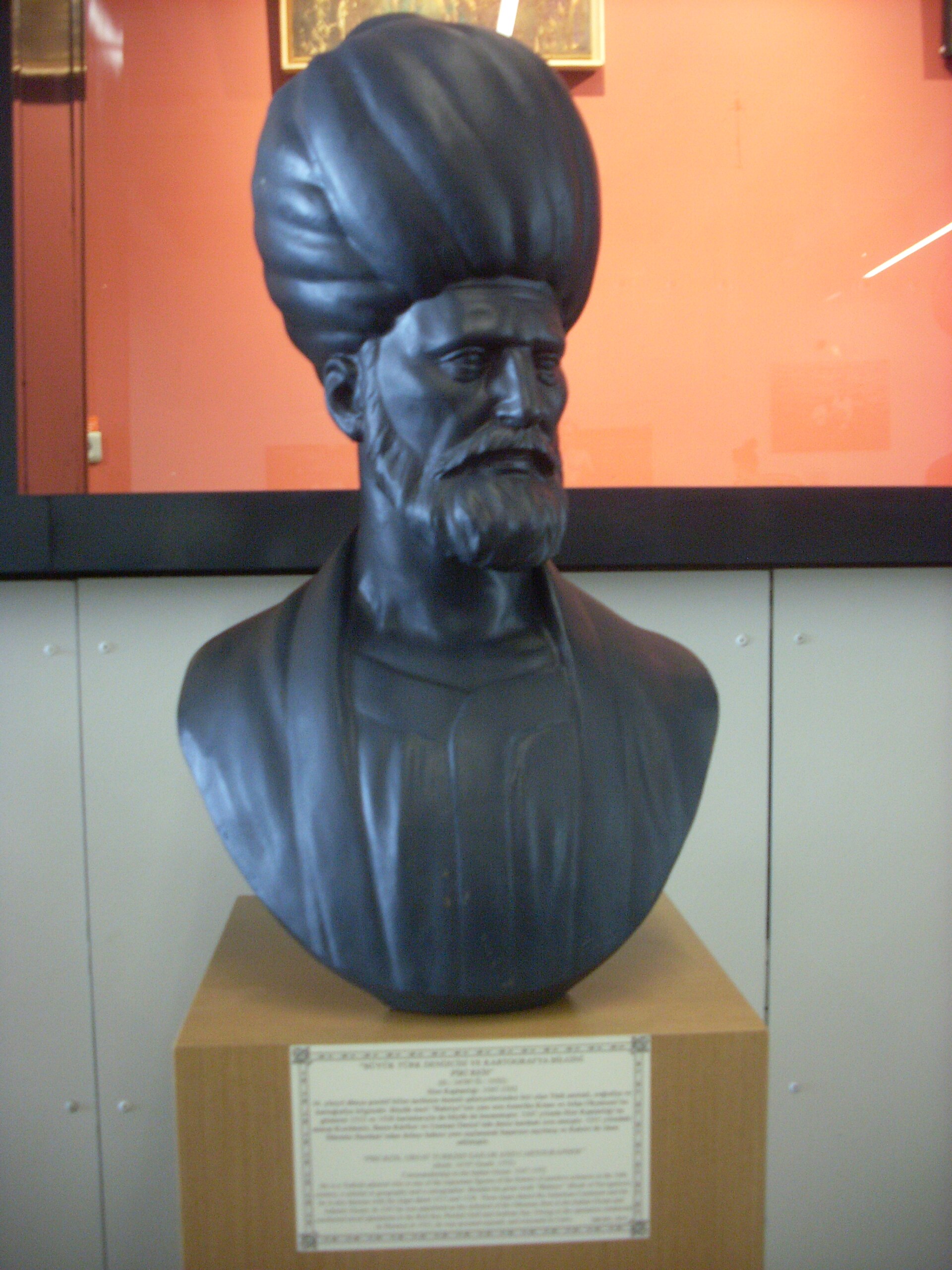
Piri Reis spent the first half of his working life as a corsair and the second half as a cartographer, naval writer and eventually admiral, and he died by execution rather than in either role. He is the maker of the earliest surviving map to carry any New World geography drawn from a Columbus source, and, by his own account, learned of Columbus's voyages at one remove, through a man who said he had sailed with Columbus himself. No contemporary portrait of him survives.
Related works
| Work | Relation | Where it is |
|---|---|---|
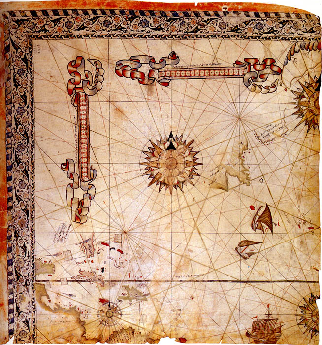
| Second Piri Reis map (1528) Piri Reis | The maker's other surviving world map fragment, a separate and later object This is NOT the object described in this record. It is a distinct, later (1528) surviving fragment by the same maker, showing Greenland and the northwest Atlantic and Caribbean, and is markedly more accurate than the 1513 sheet because it does not rely on the Columbus source material. Do not conflate the two objects. | Topkapi Palace Museum Library, Istanbul |
| Kitab-i Bahriye (Book of the Sea) Piri Reis | The maker's other major work, a portolan atlas of the Mediterranean, first version 1521, expanded version 1526 The copy most widely reproduced online (Walters MS W.658) is a scribal copy of roughly 1600-1700, not Piri Reis's own hand. | No autograph survives; over forty later scribal copies are known, including Walters Art Museum MS W.658, Baltimore |
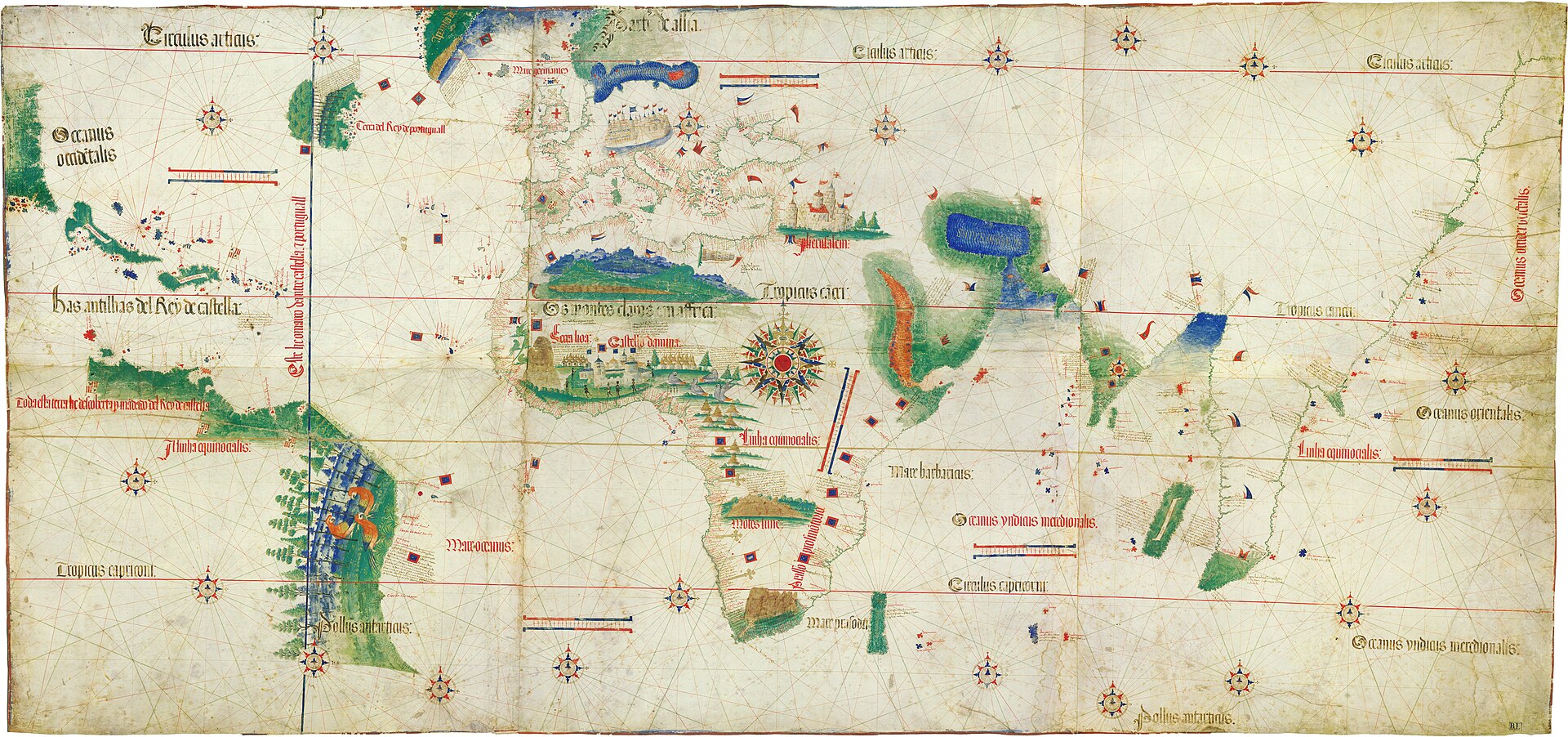
| Cantino planisphere Anonymous Portuguese cartographer | Comparandum: an earlier (1502) Portuguese chart representative of the tradition behind the Portuguese-derived sections of Piri Reis's map Smuggled out of Portugal in 1502 by Alberto Cantino; the earliest surviving map to show Portuguese discoveries in both east and west. | Biblioteca Estense Universitaria, Modena |
| Map of Juan de la Cosa Juan de la Cosa | Comparandum: the earliest surviving map to show the New World at all, made by a Basque pilot who sailed with Columbus Dated to around 1500, roughly contemporary with the lost Columbus-circle chart Piri Reis says he used. | Museo Naval, Madrid |
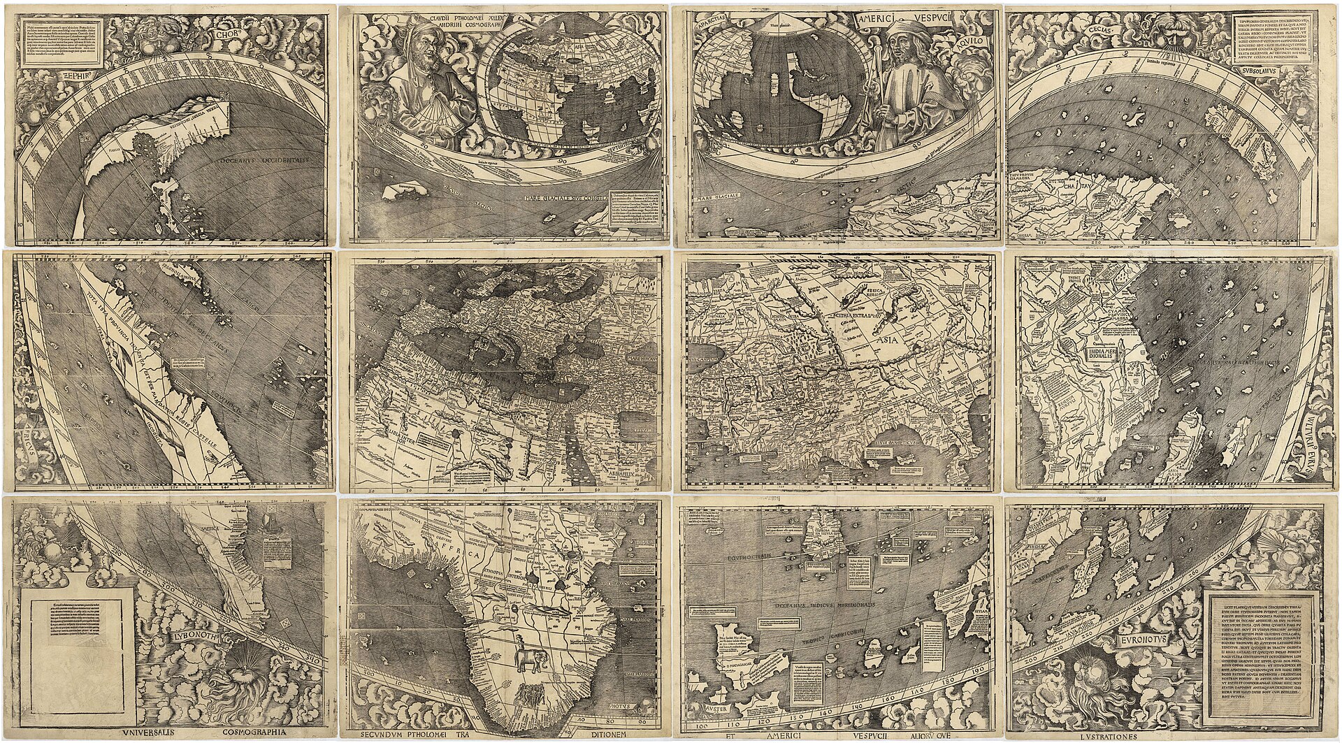
| Waldseemuller world map Martin Waldseemuller | Comparandum: a near-contemporary (1507) map from the same wave of Portuguese-derived New World data, transmitted via the Cantino and Caveri charts The first printed map to use the name America, showing how differently two cartographers working from related sources within a few years of each other could render the same new geography. | Library of Congress, Washington, D.C. |
Open questions
- What happened to the missing two thirds of the sheet, and when? Conservators attribute the loss to moisture, but no date or specific incident is documented.
- Did the map Piri Reis attributes to Columbus actually exist as he describes it, or is his account, at one remove through his uncle's associate, itself unverifiable? No independent copy or record of it survives.
- Where was the map, and in whose custody, between its presentation to Selim I in 1517 and its rediscovery in 1929? Four centuries are undocumented.
- Did Selim I or any later sultan ever consult or make use of the map? No record of its reception or use after 1517 survives.
- Which inventory number is correct: Revan Kosku no. 1633, as given in Turkey's own 2016 UNESCO nomination for this object, or H. 1824, as given in several secondary sources? Not resolved in the sources consulted.
- Has any independent scientific technical report (pigment analysis, radiocarbon dating of the parchment, multispectral imaging) ever been published on the sheet? None was found in the sources consulted for this record.
Questions about this object
What is The Piri Reis World Map of 1513?
The Piri Reis World Map of 1513 is a map, dated 1513 (Muharrem 919 AH, 9 March - 7 April 1513). Medium: Ink and pigment in eight colors on gazelle-skin parchment.
Who made The Piri Reis World Map of 1513, and is the attribution settled?
The attribution to Piri Reis (Haci Ahmed Muhiddin Piri) is recorded here as accepted. Piri Reis names himself as the maker in his own inscription on the sheet: drawn by Piri, son of Haci Mehmed, known as the nephew of Kemal Reis, at Gallipoli, in the month of Muharrem 919 AH (9 March - 7 April 1513 CE). Turkey's 2016 UNESCO Memory of the World nomination states plainly that there has been no scholarly opposition to the map's authenticity since Paul Kahle confirmed it in 1929-31.
Where is The Piri Reis World Map of 1513 now?
Topkapi Palace Museum Library, Istanbul (Sultan Ahmed III / Enderun Library, Third Courtyard). Inventory number Revan Kosku Collection, no. 1633, per Turkey's own 2016 UNESCO Memory of the World nomination form; several secondary sources instead give the number H. 1824 for this map, a discrepancy not resolved in the sources consulted for this record. Last confirmed 13 August 2026. Continuous Ottoman and then Turkish state custody since Piri Reis presented the sheet to Sultan Selim I in 1517; owned today by the General Directorate of Cultural Heritage and Museums, Republic of Turkey, custodian the Directorate of the Topkapi Palace Museum.
What is still unknown about The Piri Reis World Map of 1513?
What happened to the missing two thirds of the sheet, and when? Conservators attribute the loss to moisture, but no date or specific incident is documented.
Sources
- 1Republic of Turkey, General Directorate of Cultural Heritage and Museums, and the Turkish National Commission for UNESCO, nomination form for the International Memory of the World Register: 'Turkey - The Piri Reis World Map (1513) in the Topkapi Palace Museum Library', ID 2016-34. media.unesco.org/sites/...
- 2UNESCO, 'The Piri Reis World Map (1513)', Memory of the World register entry. unesco.org/en/...
- 3Wikipedia, 'Piri Reis map'. en.wikipedia.org/wiki/...
- 4Wikipedia, 'Piri Reis'. en.wikipedia.org/wiki/...
- 5Wikipedia, 'Second Piri Reis map (1528)'. en.wikipedia.org/wiki/...
- 6Wikipedia, 'Kitab-i Bahriye'. en.wikipedia.org/wiki/...
- 7Wikisource, 'Piri Reis' Map', translated inscriptions and colophon. en.wikisource.org/wiki/...
- 8Gregory C. McIntosh, with a foreword by Norman J. W. Thrower, The Piri Reis Map of 1513 (Athens: University of Georgia Press, 2000). archive.org/details/...
- 9Diego Cuoghi, summary and excerpts of Gregory McIntosh's analysis of the Columbus source and the Hapgood Antarctica claim. diegocuoghi.com/Piri_Reis/...
- 10Paul F. Hoye and Paul Lunde, 'Piri Reis and the Hapgood Hypotheses', Aramco World, January-February 1980. diegocuoghi.com/Piri_Reis/...
- 11Paul V. Heinrich, geological critique of Charles Hapgood's and Harold Ohlmeyer's Antarctica identification on the Piri Reis map, addressing the isostatic-rebound error. hallofmaat.com/wsog/...
- 12Marco Masseti and Cecilia Veracini, 'The zoomorphic representations of the Piri Reis map (1513)', Anthropozoologica 51(1) (2016), pp. 41-54. sciencepress.mnhn.fr/en/...
- 13Hurriyet Daily News, 'Piri Reis' world map on display at Topkapi Palace'. hurriyetdailynews.com/piri-reis-world-map-on-display-at-t...
- 14Hurriyet Daily News, 'Topkapi Palace Museum features Piri Reis collection', quoting museum director Haluk Dursun on the 1966-1988 overseas loans. hurriyetdailynews.com/topkapi-palace-museum-features-piri...
- 15Daily Sabah, '500-year-old map by Piri Reis on display at Topkapi Palace', 24 January 2013. dailysabah.com/arts-culture/...
- 16Daily Sabah, 'World map of Piri Reis back to display at Istanbul's Topkapi Palace', 19 November 2021. dailysabah.com/arts/...
- 17Wikimedia Commons, file description and metadata for File:Piri reis world map 01.jpg, sourced to Topkapi Palace Museum Library. commons.wikimedia.org/wiki/...

Last verified · Published
Change log
13 August 2026 - Record created at the house standard: researched narrative, technical evidence, maker dossier, graded provenance chain, prices with hammer and premium separated, related works, open questions and sources.