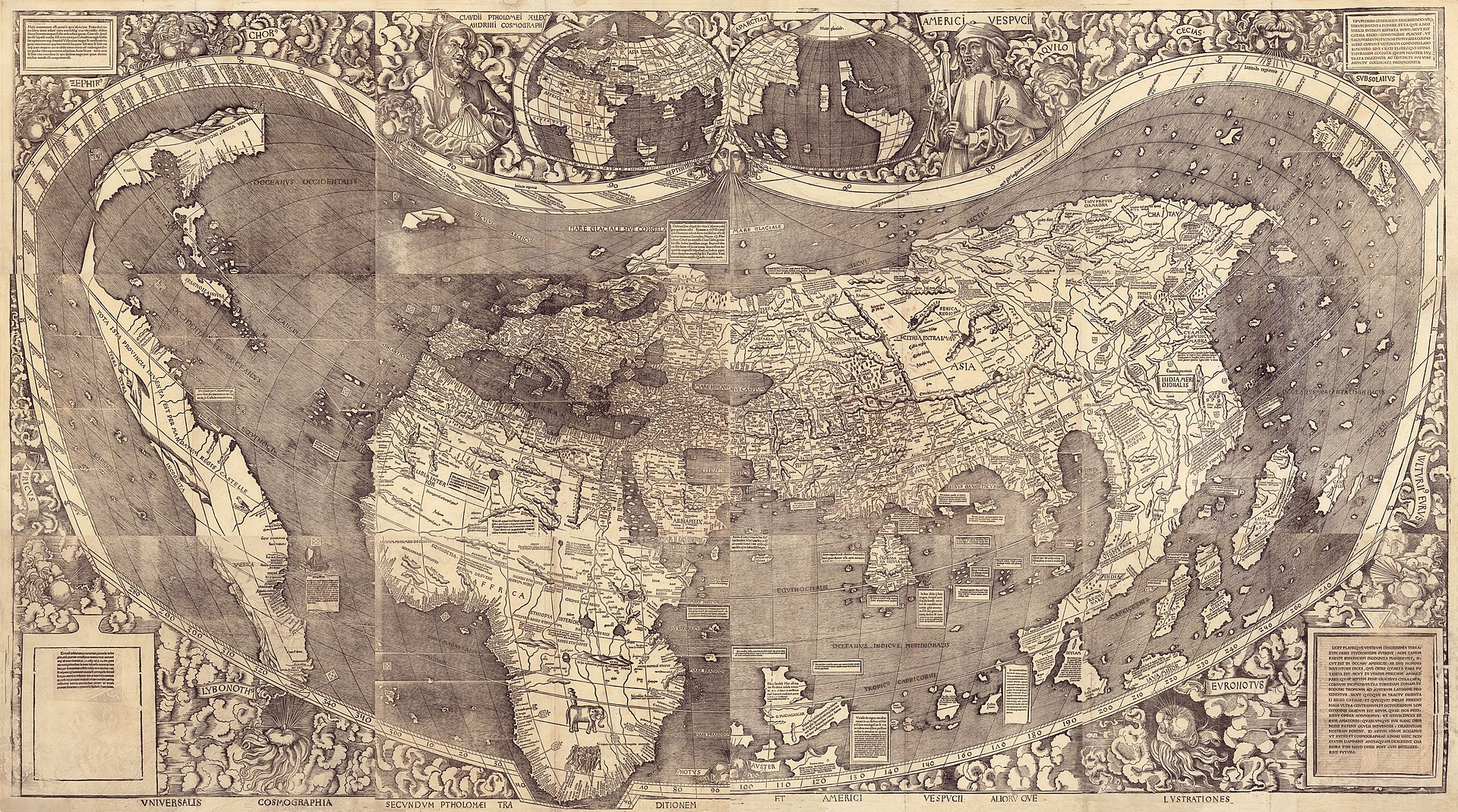
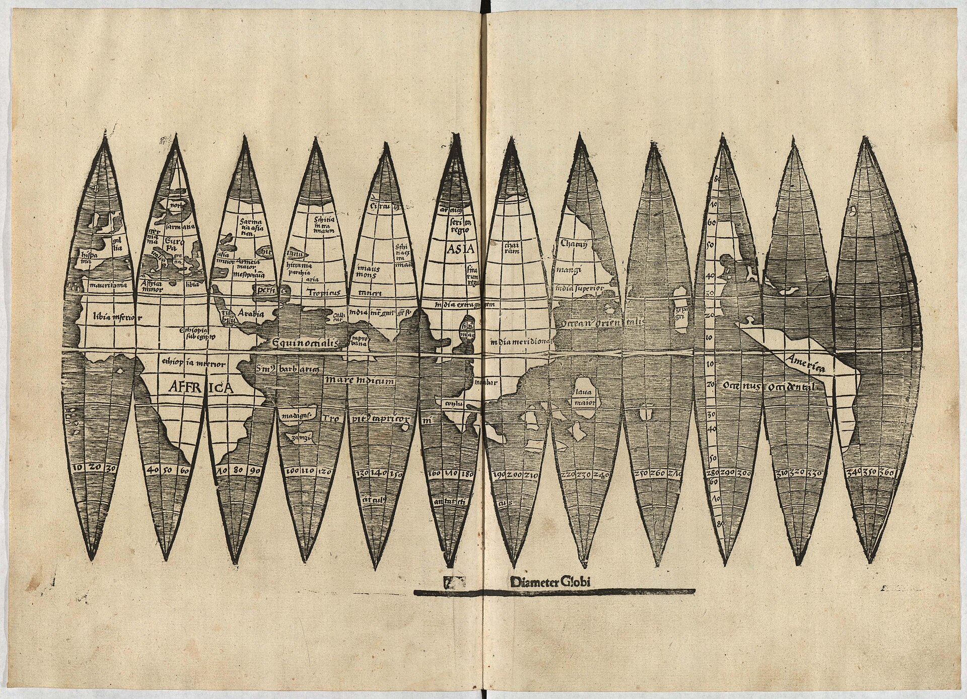
Universalis Cosmographia secundum Ptholomaei Traditionem et Americi Vespucii aliorumque Lustrationes
1507, in a printing of the sheets whose date is disputed · Woodcut with letterpress text on twelve...
 German, working in Lorraine · 1470-1520
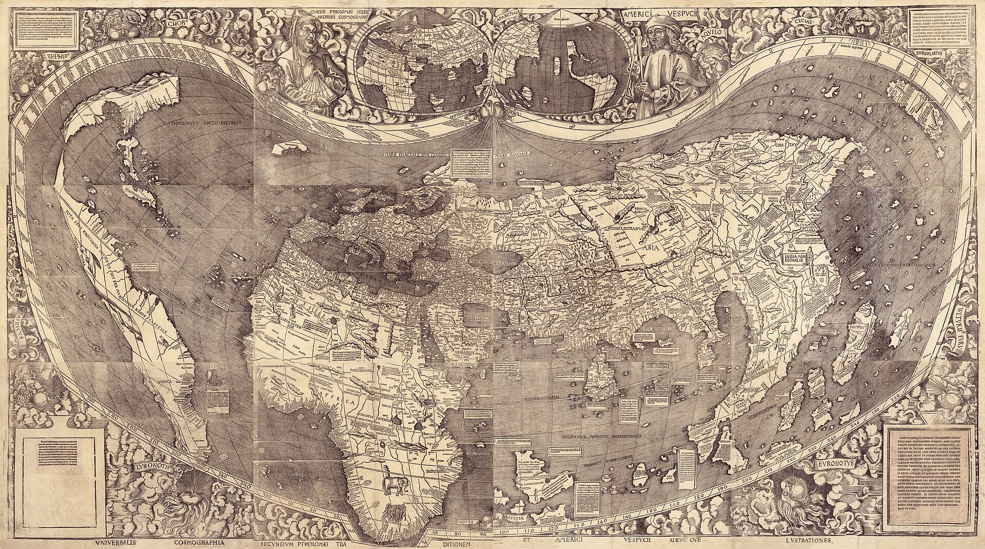
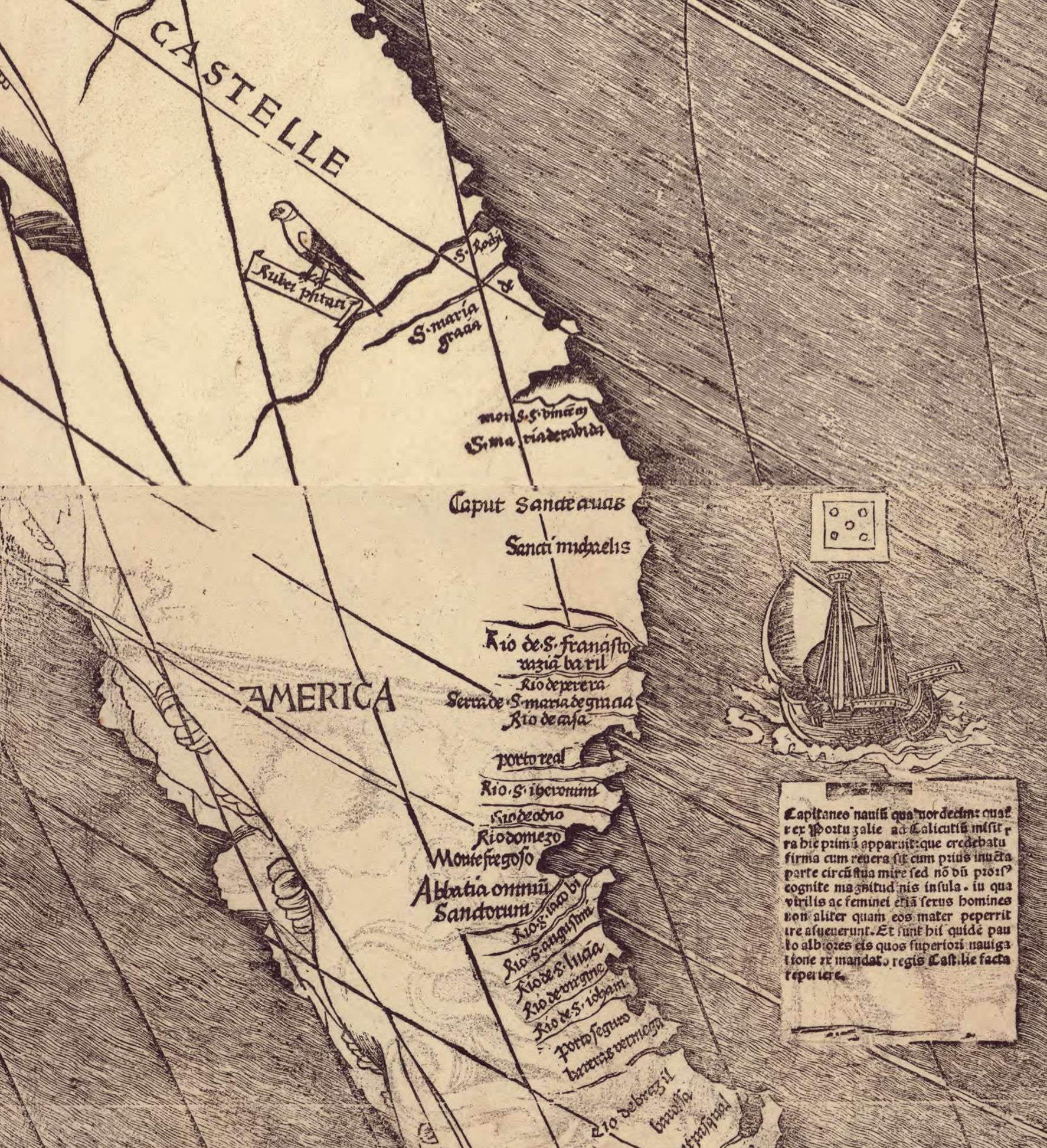
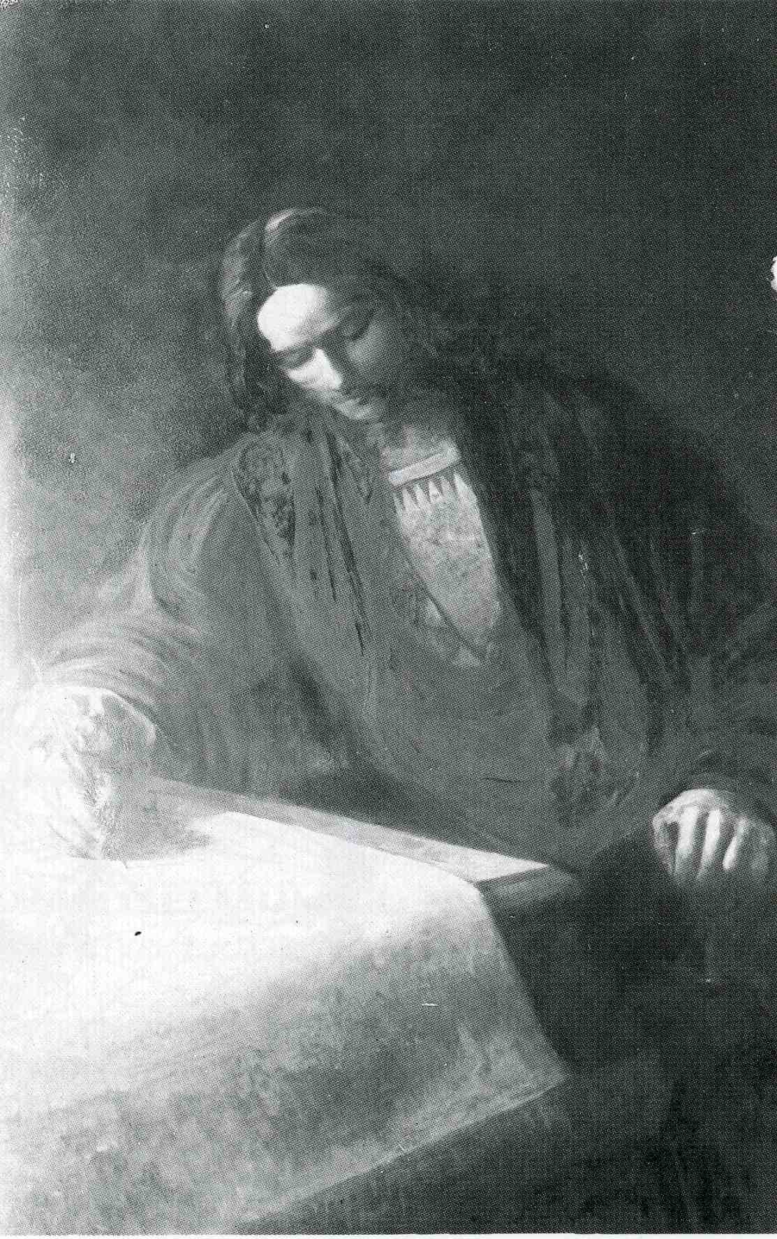
Universalis Cosmographia, 1507, composite of the twelve sheets The 1507 world map, the sole surviving copy, composite of the twelve woodcut sheets. Already the subject of its own record in this archive (waldseemuller-1507-world-map); shown here as the central object of Waldseemuller's career. No verified portrait. No securely identified likeness of this maker is known under a free licence. We do not publish a face we cannot verify.
Library of Congress, Geography and Map Division| Full name | Martin Waldseemuller (Latinised Martinus Ilacomilus or Hylacomylus |
|---|---|
| Worked as | Cartographer, Cosmographer, Cleric, Editor |
| Born | c. 1470 · Near Freiburg im Breisgau, Holy Roman Empire. |
| Died | 16 March 1520 (the date argued by Chet Van Duzer and Benoit... · Saint-Die (now Saint-Die-des-Vosges), Lorraine |
| Nationality | German, working in Lorraine |
| Movement | Renaissance humanism |
| In this archive | 3 artworks |
| Sources | 26 cited |
| Last verified | 17 September 2026 |
About this page 3 artworks in the archive · Last verified 17 September 2026 · 26 sources cited
Martin Waldseemuller was a Rhineland-trained theologian who spent most of his working life as a canon of a small collegiate church in Lorraine and, alongside that post, ran the cartographic output of a reading group of perhaps half a dozen humanist scholars for a little under a decade. The reason his name is remembered at all is one single decision made by that group in the spring of 1507: to print, on the lower left sheet of a twelve-sheet wall map, the word America.
The thing most readers do not know is that he took it back. By 1513 his own new edition of Ptolemy's Geographiae calls the same region Terra Incognita rather than America, and his second and last wall map, the 1516 Carta Marina, drops the name entirely and reverts to a broadly Columbian reading of the New World as adjoining Asia. Whether the naming argument was even his own idea in the first place is a live, citable scholarly dispute rather than a settled fact repeated in tourist copy. This record treats the reversal, and the argument over authorship, as the two central facts of his career, not as footnotes to a triumphant naming story.
What actually survives of his working output is almost nothing. Two wall maps exist in exactly one confirmed copy each. A handful of globe-gore sheets survive from at least two separate print runs, and two further sheets once counted among them have since been shown to be twentieth-century fakes. The one part of the 1507 project that was never scarce is the booklet that carried the naming argument in prose, which is why the argument survived a near-total loss of the maps that were supposed to illustrate it.
1507, in a printing of the sheets whose date is disputed · Woodcut with letterpress text on twelve...
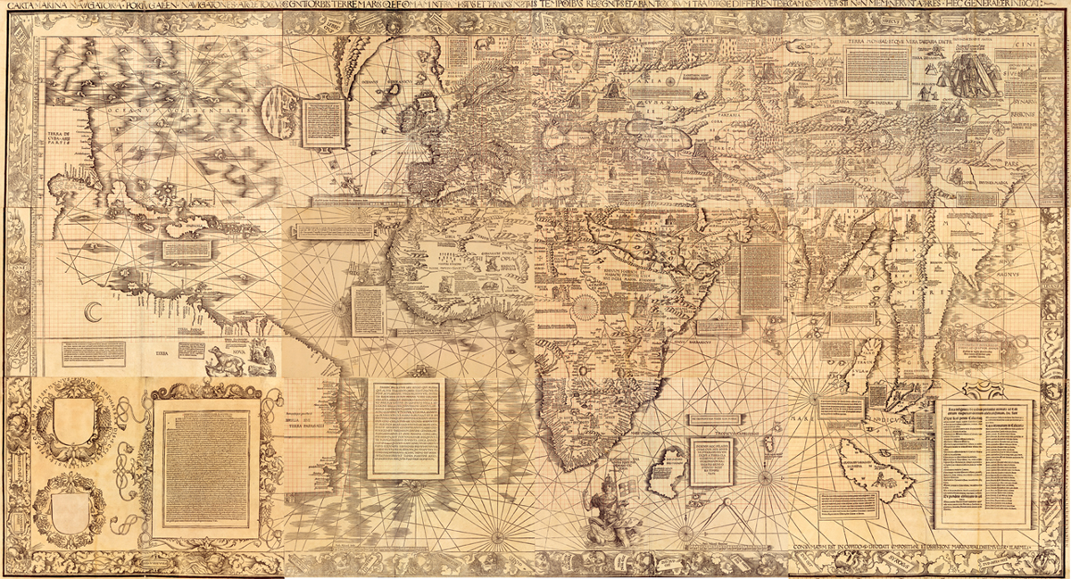
1516 · Woodcut with letterpress text on twelve...
Library of Congress, Geography and Map Division, Jay I.
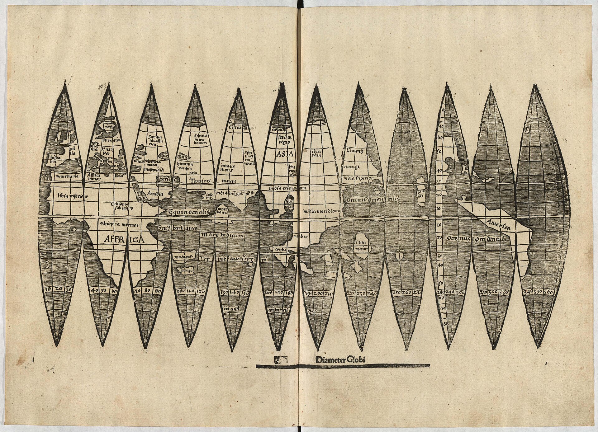
After 1507, most likely before 1513 · Woodcut with letterpress text on a single...
Universitatsbibliothek der Ludwig-Maximilians-Universitat...
Born near Freiburg im Breisgau; the precise village is disputed.141619
Matriculates at the University of Freiburg im Breisgau on 7 December.1614
Joins the Gymnasium Vosagense, the humanist circle convened at Saint-Die by Gauthier Lud, secretary to Duke Rene II of Lorraine.314
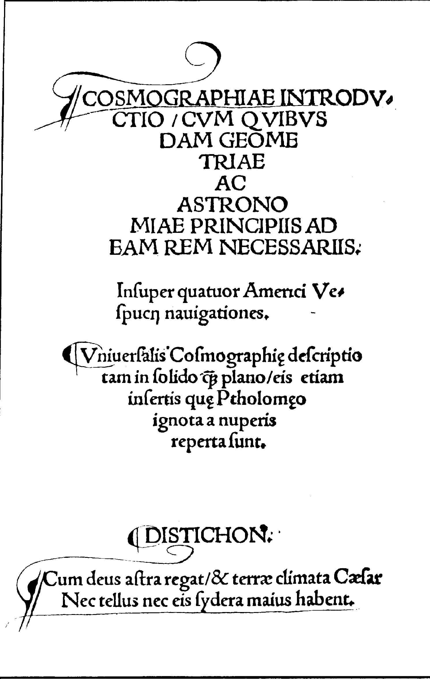
The Cosmographiae Introductio, the twelve-sheet wall map, and the first edition of the globe gores are issued together, reportedly in an edition of about 1,000 sets; this printing carries the first recorded use of the name America.134
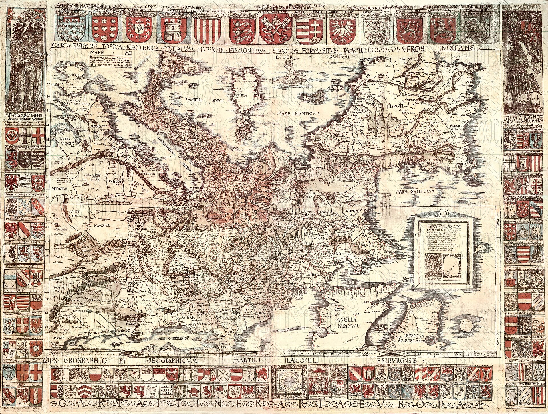
The Carta itineraria Europae, the first printed wall map of Europe, is produced; no copy of this first printing survives. Matthias Ringmann, credited by Franz Laubenberger as the true author of the 1507 naming argument, dies the same year.61321
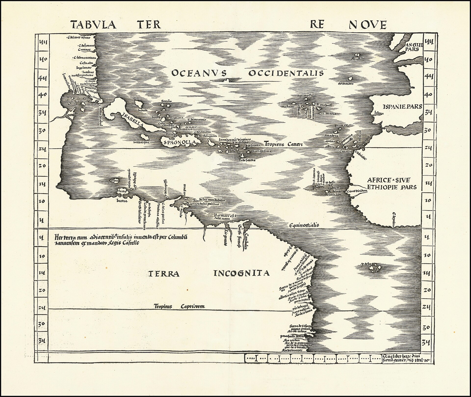
The Strasbourg edition of Ptolemy's Geographiae is published with Waldseemuller's modern maps added; the region earlier named America is now labelled Terra Incognita.35
Admitted, on his own application, as a canon of the collegiate church of Saint-Die, a position he holds until his death.1514
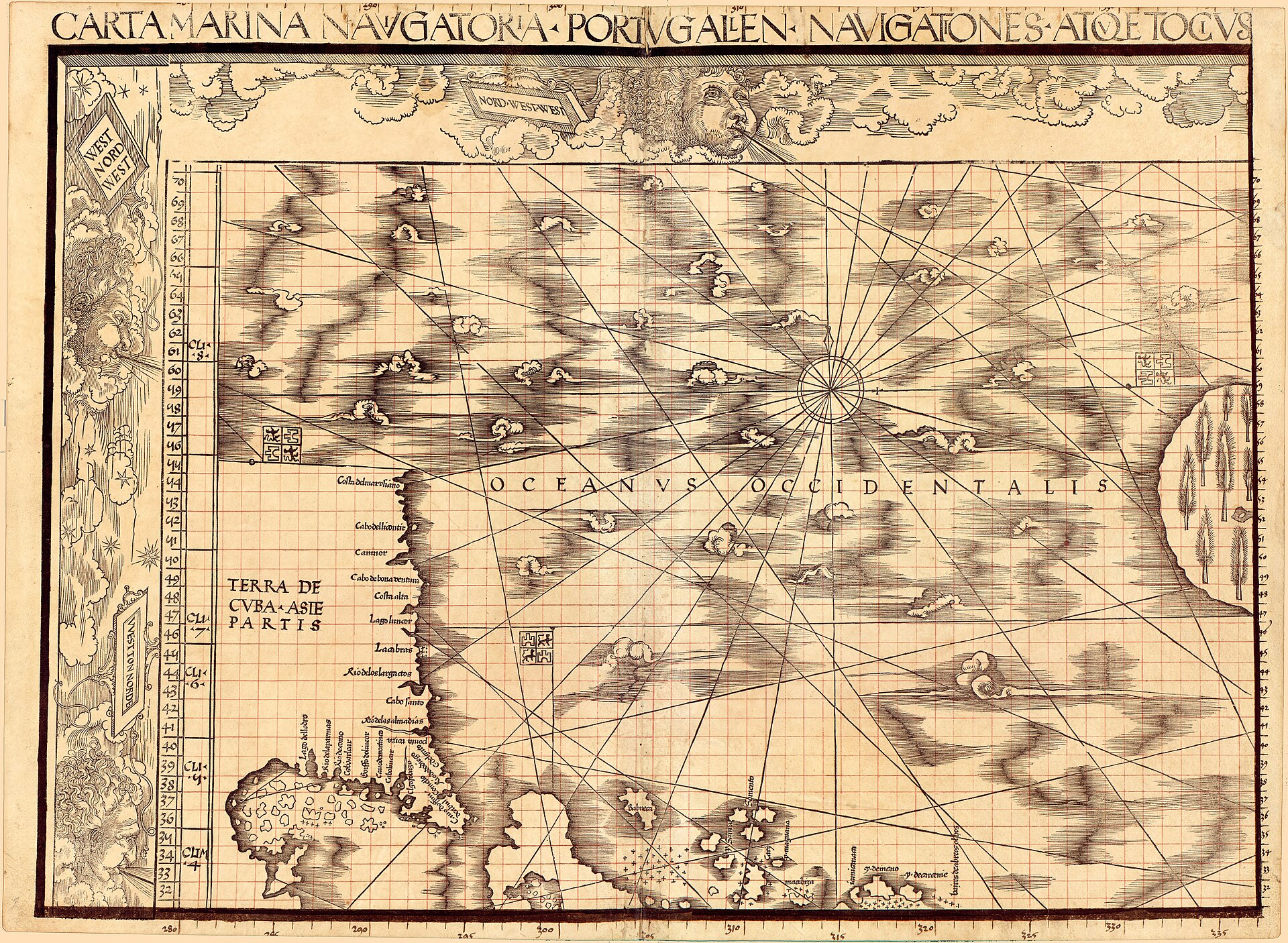
The Carta Marina, Waldseemuller's second and final wall map, is published; it drops the name America entirely and adopts a broadly Columbian reading of the New World. Exactly one copy is known.56
Johann Schoner binds the 1507 map, the Carta Marina, his own globe gores, and (from 1515) Albrecht Durer's star chart into the portfolio later called the Schoner Sammelband, at Nuremberg.16
Dies at Saint-Die, per Van Duzer and Larger's dedicated 2011 study of the question; older institutional sources give 1518, 1519 or 1522.26
The Jesuit historian Josef Fischer opens the Schoner Sammelband in the library of Schloss Wolfegg and identifies its contents, ending roughly 350 years in which the portfolio had sat unexamined.13
The Library of Congress negotiates and completes the purchase of the 1507 world map from Prince Johannes Waldburg-Wolfegg for USD 10 million, agreed June 2001 and completed May 2003.12
Chet Van Duzer and Benoit Larger publish a dedicated study correcting Waldseemuller's death date.26
A previously unrecorded, later edition of the 1507 globe gores is identified in the University Library of the Ludwig-Maximilians-Universitat, Munich, found sewn into a bound volume of optics texts.89
The collector Jay I. Kislak buys and gives the Carta Marina, Johann Schoner's own globe gores, and the Schoner Sammelband portfolio to the Library of Congress; the Library separately buys Durer's 1515 star chart in late 2015, completing the reassembly of the original portfolio.67
There is barely a market at all. Neither wall map has ever been offered at public auction, because each survives in a single confirmed copy and both changed hands as negotiated institutional transactions rather than saleroom lots. The 1507 world map went to the Library of Congress for USD 10 million, agreed in principle in late June 2001 and completed in May 2003, in a private treaty sale with Prince Johannes Waldburg-Wolfegg; there is no hammer price and no buyer's premium, because there was no auction. The Carta Marina, Johann Schoner's own globe gores, and the Schoner Sammelband portfolio passed to the Library the same way in 2014-2015, bought and given by the collector Jay I. Kislak; the price he paid has never been published.
The only class of Waldseemuller-attributed object that has ever reached an auction house at all is the globe gores, precisely because they were printed in numbers rather than surviving as unique sheets, and that market has been compromised by forgery. A set withdrawn from a Christie's, London sale scheduled for December 2017 (lot 97, estimated EUR 690,000 to 1,000,000) was later found identical in every physical detail to the Bayerische Staatsbibliothek's own long-held sheet; ink analysis in 2018 confirmed both as twentieth-century work pulled from a shared, non-original printing template. Whatever that lot achieved, if it sold, was not a price for a genuine Waldseemuller object. On the evidence available, no confirmed genuine work by Waldseemuller has ever achieved a published hammer price at public auction, and this record lists no market results for that reason: every real transaction on record was a private treaty or gift, not a sale with a hammer and a premium to separate.
| Institution | City | Holdings | Note |
|---|---|---|---|
| Library of Congress, Geography and Map Division | Washington, DC | The sole surviving 1507 world map, on permanent display in the Thomas Jefferson Building; the sole surviving 1516 Carta Marina and the reassembled Schoner Sammelband portfolio, Jay I. Kislak Collection. | The only public collection holding both of Waldseemuller's unique wall maps, acquired eleven years apart by two separate transactions. |
| Universitatsbibliothek der Ludwig-Maximilians-Universitat | Munich | A previously unrecorded, undated later edition of the 1507 globe gores, identified in 2012, shelfmark Cim. 107#2. | A different institution from the Bayerische Staatsbibliothek below; the two are frequently and wrongly conflated. |
| James Ford Bell Library, University of Minnesota | Minneapolis | A genuine surviving set of the 1507 globe gores. | Bought in 1954 from Prince Johann II von und zu Liechtenstein. |
| Historical Library, Offenburg (displayed at the Museum im Ritterhaus) | Offenburg | A genuine surviving set of the 1507 globe gores. | Found in 1993 sewn into a 1541 edition of Aristotle's Ethica Nicomachea. |
| Bayerische Staatsbibliothek | Munich | A set of globe gores once catalogued as genuine, confirmed in 2018 to be a twentieth-century forgery. | Retained for the institutional record; not displayed as an authentic Waldseemuller object. |
| Tiroler Landesmuseum Ferdinandeum | Innsbruck | A later surviving state (1520) of the Carta itineraria Europae, 1511. | No copy of the 1511 first printing of this map is known to survive anywhere. |
| Multiple rare-book and map collections worldwide | Copies of the Cosmographiae Introductio (1507) and the 1513 Strasbourg edition of Ptolemy's Geographiae. | Unlike the wall maps, both survive in institutional collections across Europe and North America and are not individually rare. |
Waldseemuller's own training was in theology, not geography.
Waldseemuller's own training was in theology, not geography. He matriculated at the University of Freiburg im Breisgau on 7 December 1490, and the standard secondary accounts describe him as ordained and later admitted, in 1514, as a canon of the collegiate church of Saint-Die, a post he held until his death. Cartography was not his career in the modern sense; it was what he did at the court of Duke Rene II of Lorraine, where the duke's secretary, Gauthier (Walter) Lud, had gathered a small circle of humanist scholars who called themselves the Gymnasium Vosagense. Their declared purpose was to prepare an updated edition of Ptolemy's Geographiae against the geographic news reaching Lorraine from the Atlantic voyages.
The known membership of that circle is small: Lud himself, his cousin Nicolas Lud, the Alsatian humanist and poet Matthias Ringmann, Johannes Basinus Sendacurius, and Waldseemuller. There is no record of the group ever having taught a student, despite the name Gymnasium; it functioned as a working editorial and production team, not a school. A canon's income and a duke's patronage, not any commercial print trade of his own, are what supported the years of work that produced the 1507 map.
The naming argument appears in chapter nine of the Cosmographiae Introductio, the booklet issued alongside the 1507 map and globe gores: since Europe and Asia had both received women's names, the...
The naming argument appears in chapter nine of the Cosmographiae Introductio, the booklet issued alongside the 1507 map and globe gores: since Europe and Asia had both received women's names, the authors saw no reason not to call the fourth part of the world Amerige, or America, after Amerigo Vespucci. Popular accounts credit this argument to Waldseemuller as a matter of course. The scholarship does not.
Franz Laubenberger's 1959 study in the journal Erdkunde examined the question directly, against an older consensus, dating to Alexander von Humboldt, that had simply assumed Waldseemuller wrote the booklet's text. Laubenberger's argument rests on a documentary pattern: of the texts that accompanied Waldseemuller's later cartographic projects, the 1511 map of Europe and the 1513 Ptolemy, Ringmann is named explicitly as author. Ringmann died in 1511; Waldseemuller's final work, the 1516 Carta Marina, appeared with no separate accompanying text at all. Laubenberger's conclusion is that Ringmann wrote the Cosmographiae Introductio in every instance, and is therefore the actual author of the naming argument, while Waldseemuller's contribution was to put the name on a map and a globe that then circulated widely enough for the word to stick. Not every later writer has accepted the full weight of that division, and some general accounts still credit the two men jointly or default to Waldseemuller alone; this record follows Laubenberger's documented case rather than the popular shorthand, and grades the question open where the literature itself is not unanimous.
Waldseemuller's whole surviving cartographic output was produced in a single stretch between 1507 and 1516.
Waldseemuller's whole surviving cartographic output was produced in a single stretch between 1507 and 1516. In the spring of 1507 the Saint-Die group issued three things together: the twelve-sheet wall map, a set of globe gores for a small globe, and the Cosmographiae Introductio. In 1511 Waldseemuller produced the Carta itineraria Europae, the first printed wall map of Europe; no copy of that first printing is known to survive, and what can be seen of the map today comes from later states, including a 1520 example now at the Tiroler Landesmuseum Ferdinandeum in Innsbruck. In 1513 came his most widely disseminated work, the Strasbourg edition of Ptolemy's Geographiae, which added twenty modern maps to the classical Ptolemaic set and is described in the literature as the first modern atlas; unlike the wall maps, it survives in institutional collections worldwide, because it was a proper printed book rather than a single oversized sheet. In 1516 the Carta Marina, his second and final wall map, appeared; like its 1507 predecessor, exactly one copy is known.
The pattern across those four projects is consistent: whatever survived in numbers was a book, and whatever was printed as a giant single sheet came within a hair of vanishing entirely.
By the 1513 Ptolemy the region labelled America on the 1507 map is called Terra Incognita.
By the 1513 Ptolemy the region labelled America on the 1507 map is called Terra Incognita. The 1516 Carta Marina goes further: it does not use the name at all, ranks Columbus above Vespucci among the discoverers of the New World in its own text, and labels the northern landmass Cuba, part of Asia, adopting the belief Columbus himself had held to his death. Laubenberger reads this reversal as personal as well as intellectual: Ringmann, who had pressed the naming argument, was dead by 1511, and Waldseemuller, on this reading, had never been fully persuaded and was by his final years unable, or unwilling, to correct what he had come to see as his late friend's error about who deserved credit as discoverer.
None of that stopped the name from spreading. Other cartographers kept using it after Waldseemuller himself had moved away from it: Johann Schoner on his globe of 1515, and Peter Apian in 1520. The word that now names two continents survived its own inventor's second thoughts because other people simply kept saying it.
The 1507 map shows the New World as a separate landmass with an ocean, the future Pacific, on its western side, years before any European is documented as having reached that coast; Vasco Nunez de...
The 1507 map shows the New World as a separate landmass with an ocean, the future Pacific, on its western side, years before any European is documented as having reached that coast; Vasco Nunez de Balboa's sighting of the Pacific from Panama is usually dated to 1513. How Waldseemuller's circle arrived at that shape is a genuinely open question in the scholarship, not a puzzle this record can close. One reading holds that Vespucci's own account of the lands he had seen could not be reconciled with what was already known of Asia, so the Saint-Die group reasoned the new coast had to belong to a separate continent with its own far shore. A second reading, argued by Chet Van Duzer, starts instead from Marco Polo's report that Japan was an island lying well off the coast of Asia, which requires open sea between Asia and any newly discovered land to its east. A third reading has been proposed by George E. Nunn. None of the three is a documentary proof, and this record keeps all three at the grade the evidence supports: argued, not settled.
No evidence has been found that Waldseemuller himself could cut a woodblock.
No evidence has been found that Waldseemuller himself could cut a woodblock. The large, finely made figures on his maps, the Great Khan seated in his tent on the Carta Marina, King Manuel of Portugal riding a sea monster on the same sheet, were almost certainly executed by specialist block cutters working from his and his collaborators' instructions, and their names are not recorded. The Carta Marina's own physical evidence shows more than one cutter at work with little coordination between them: wind-heads rendered in inconsistent styles from sheet to sheet, compass roses that vary in size, a decorative border on sheet nine that is cut off awkwardly by the edge of the paper, and rivers that fail to line up across at least one join between sheets. A note of thanks on the map to Hugues des Hazards, Bishop of Toul, presumably for financial support, hints at a project that ran into money trouble at some point in its production.
The men whose actual hands cut the wood that made Waldseemuller famous are, on the evidence available, anonymous. That is worth stating plainly rather than passing over: the credit line on this whole body of work names the editor and compiler, not the craftsmen who executed it.
The Saint-Die group's own dedicatory material describes the 1507 map and globe as printed and disseminated across the world, and a print run of roughly 1,000 copies of the whole 1507 package has been...
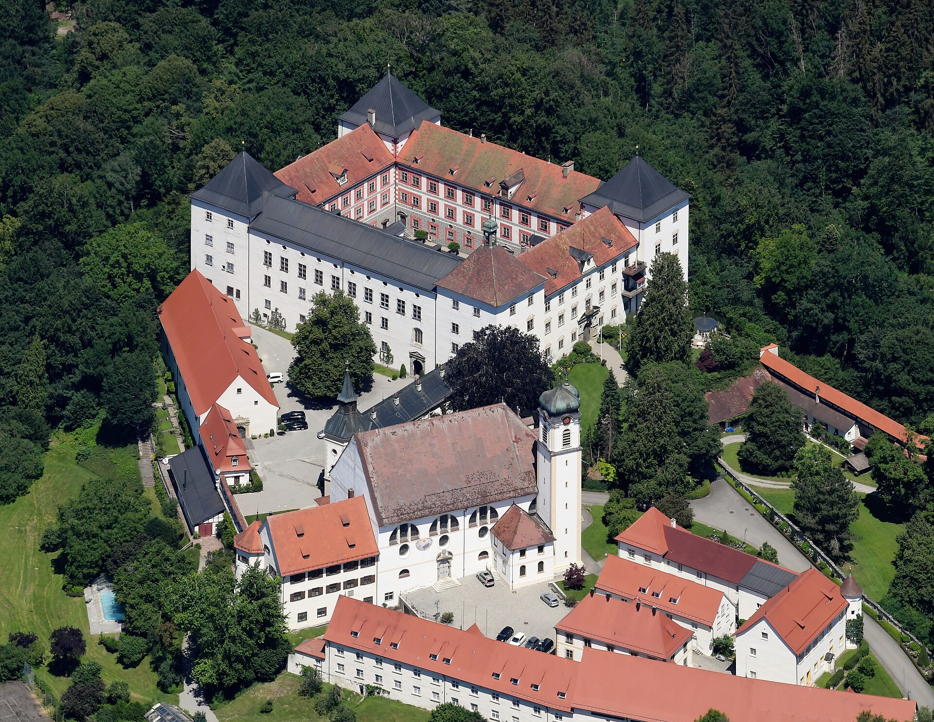
The Saint-Die group's own dedicatory material describes the 1507 map and globe as printed and disseminated across the world, and a print run of roughly 1,000 copies of the whole 1507 package has been reported. Exactly one wall map survives. It escaped destruction only because the Nuremberg globe maker Johann Schoner acquired it as working material and, in 1517, bound it flat into a portfolio, the Schoner Sammelband, together with globe gores of his own and, from 1515, Albrecht Durer's printed star chart. Bound and stored rather than hung, the sheets sat unread in the library of the Waldburg-Wolfegg family at Schloss Wolfegg in Upper Swabia for more than 350 years, until the Jesuit historian Josef Fischer opened the portfolio in 1901.
The 1516 Carta Marina, also bound into the same Sammelband by the same man, survives in exactly the same way and in exactly one copy, but it did not follow the 1507 map to Washington on the same schedule. The Library of Congress bought only the 1507 map from the Waldburg-Wolfegg family in 2003. The Carta Marina, the globe gores in the Sammelband, and the portfolio itself passed instead through the collector Jay I. Kislak, who bought them and gave them to the Library in 2014, eleven years later and by an entirely separate transaction whose price has not been published.
In the spring of 2012 a librarian at the University Library of the Ludwig-Maximilians-Universitat in Munich, doing routine cataloguing work on a nineteenth-century binding of two editions of a...
In the spring of 2012 a librarian at the University Library of the Ludwig-Maximilians-Universitat in Munich, doing routine cataloguing work on a nineteenth-century binding of two editions of a medieval textbook on optics, found a folded sheet of globe gores sewn between them. Comparison with the four sets of Waldseemuller's globe gores already known at the time showed it had been pulled from an entirely different woodblock, with the coastline of Cuba more carefully drawn and the island of Madagascar redrawn to match a newer nautical chart. The sheet still carries the name America, which places its printing before 1513, when Waldseemuller's next project dropped the name for good, but a watermark datable to after 1507 rules it out as part of the original first edition. It is best described as a previously unrecorded, undated later printing from within Waldseemuller's own circle.
That a whole distinct edition of a printed object this famous could sit uncatalogued in a major university library for close to two centuries, through a wartime evacuation and back, says something about how little of this corpus has actually been accounted for. Nobody has since systematically repeated the search that found it.
Neither of Waldseemuller's two wall maps has ever been offered at public auction, and for the obvious reason: each survives in exactly one confirmed copy, so there is no market in the ordinary sense...
Neither of Waldseemuller's two wall maps has ever been offered at public auction, and for the obvious reason: each survives in exactly one confirmed copy, so there is no market in the ordinary sense, only a small number of negotiated institutional transactions. The 1507 map changed hands in 2001-2003 for USD 10 million, agreed by private treaty between Prince Johannes Waldburg-Wolfegg and the Library of Congress, not a hammer price. What Jay I. Kislak paid for the Carta Marina, the globe gores, and the Sammelband portfolio in 2014 has never been published.
The one part of Waldseemuller's output that has reached the open market at all is the class of globe-gore sheets, precisely because they were printed in numbers rather than surviving as unique objects, and that market has been compromised by forgery. A sheet withdrawn from a Christie's, London sale scheduled for December 2017, lot 97, estimated at EUR 690,000 to 1,000,000, was found on comparison to be identical in every physical detail to the Bavarian State Library's own long-held sheet, implying both were pulled from a shared, non-original printing template. Ink analysis by the Bavarian library's own conservation institute found iron and titanium, almost certainly iron titanate, a pigment not manufactured before the first half of the twentieth century; the library confirmed in 2018 that its own sheet was a modern forgery, probably made by the same hand and process as the Christie's lot. Whatever, if anything, that lot achieved at sale was not a price for a genuine Waldseemuller object. The practical result is that essentially no confirmed genuine work by Waldseemuller has ever achieved a real, published hammer price at public auction.
The Gymnasium Vosagense's whole project rests on treating several kinds of authority as compatible on the same sheet: the revived classical science of Ptolemy, fresh empirical report from Vespucci's...
The Gymnasium Vosagense's whole project rests on treating several kinds of authority as compatible on the same sheet: the revived classical science of Ptolemy, fresh empirical report from Vespucci's voyages, and an inherited Christian and medieval frame for reading unfamiliar geography. None of this is hidden or coded; it is simply what a trained theologian and his humanist collaborators took for granted when they sat down to update a map of the world, and it shows up as plain content rather than as anything requiring decoding.
On the Carta Marina, a legend identifies Hispaniola with Ophir, the biblical source of King Solomon's gold, repeating a claim Columbus himself had made in his own writing; the same map groups several of the monstrous races of medieval travel literature, dog-headed men, Cyclopes, men with faces set in their chests, in northern India, drawn from the medieval writers John of Plano Carpini and Pierre d'Ailly. And south of the Cape of Good Hope, King Manuel of Portugal is shown riding a sea monster and holding the royal sceptre and banner, an image Chet Van Duzer traces to Jacopo de' Barbari's view of Venice showing Neptune doing the same thing in the city's lagoon; Van Duzer argues, as a reading rather than a certainty, that Waldseemuller's workshop replaced the pagan god with a living Catholic king to proclaim Portuguese mastery of the sea route to India, close to an apotheosis of Manuel rather than a decorative flourish. None of these choices required the map's makers to resolve any tension between a Ptolemaic grid, a biblical genealogy of place names, and a king shown in a god's pose; on the evidence available, they simply used whatever authority fitted the space on the sheet. That is a documented, argued fact about how this specific circle of humanist churchmen actually thought, not a hidden programme uncovered by later readers, and it deserves to be stated as plainly as the naming dispute.
The Carta Marina survives in exactly one copy, but its images did not stay confined to that copy.
The Carta Marina survives in exactly one copy, but its images did not stay confined to that copy. In 1525 the cartographer Lorenz Fries and the publisher Johann Gruninger issued a reduced-scale version of the map at Strasbourg, with a German-language booklet explaining what would not fit on the smaller sheet; no copy of that 1525 printing survives, but single copies of Fries's 1530 and 1531 re-editions do, and their images match Waldseemuller's own closely enough to prove Fries worked from a now-lost exemplar of the Carta Marina distinct from the one Johann Schoner kept. A manuscript atlas made around 1547 by the Dieppe school of French cartographers, the Vallard Atlas, carries an image of Mecca close enough to Waldseemuller's own version, not to Fries's simplified copy, to prove its maker had independent access to a copy of the Carta Marina itself, not merely to Fries's derivative. In 1570 the Antwerp cartographer Abraham Ortelius listed both a map of Europe by 'Martin Ilacomilus of Freiburg' and, separately, a 'Martinus Waldseemuller universal nautical chart, commonly called Marina', adding that he believed the two names described the same man, proof that the Carta Marina had reached a major European cartographic centre two generations after its printing, still circulating under a name its own maker had stopped using for it decades earlier.
The reputation, in other words, outran the object by more than a century before the object itself was ever seen again. Copies of copies of Waldseemuller's images moved among working cartographers while the actual printed sheets he made sat bound and forgotten in a Swabian castle library.
For roughly four centuries after Waldseemuller's death almost nobody outside the Waldburg-Wolfegg household knew his 1507 and 1516 maps still existed.
For roughly four centuries after Waldseemuller's death almost nobody outside the Waldburg-Wolfegg household knew his 1507 and 1516 maps still existed. Fischer's 1901 rediscovery began a slow process that turned an obscure canon's editorial work into a national relic: the Library of Congress bought facsimiles within two years of the find, spent a century trying to acquire the originals, and on completing the purchase in 2003 promoted the map publicly as 'America's birth certificate.' Germany inscribed the 1507 map on the UNESCO Memory of the World register in 2005 while it was already in Washington, listing it as German documentary heritage held at a foreign address; the 2007 ceremony at which the map itself was formally handed over to library officials was framed by the German chancellor of the day as a gesture of transatlantic affinity rather than a commercial transaction.
The scholarship has not caught up with the fame. A tertiary reference source consulted for this record states plainly that there is no biography of Waldseemuller in English, and the two dedicated modern monographs that do exist, Van Duzer's studies of the Carta Marina and of the Munich globe gores, are both narrowly focused technical studies of single objects rather than an account of the man. The map is a celebrity. Its maker, on the evidence of what has actually been published about him, is still barely known.
Cartographer; Cosmographer; Cleric; Editor. c. 1470-1520.
Born c. 1470, Near Freiburg im Breisgau, Holy Roman Empire. The precise village is disputed: a house at Wolfenweiler (now part of Schallstadt, just south of Freiburg) is locally commemorated as his birthplace, while at least one tertiary reference work gives Radolfzell instead. This record follows the Library of Congress's own 'near Freiburg' and does not resolve the conflict; died 16 March 1520 (the date argued by Chet Van Duzer and Benoit Larger's dedicated 2011 study; older institutional sources give 1518, 1519 or 1522, and not every catalogue page has been corrected to match), Saint-Die (now Saint-Die-des-Vosges), Lorraine.
The 1507-type globe gores: two sheets exposed as twentieth-century work. A sheet acquired by the Bayerische Staatsbibliothek in Munich in 1990, bound into a genuine 1486 Ptolemy incunable with an apparently impeccable seventeenth-century provenance, and a separate sheet withdrawn from a Christie's, London sale scheduled for December 2017 (lot 97, estimated EUR 690,000 to 1,000,000) were compared and found identical in every physical detail, implying both were pulled from a single, non-original printing template rather than surviving as two independent period impressions.
Library of Congress, Geography and Map Division (Washington, DC); Universitatsbibliothek der Ludwig-Maximilians-Universitat (Munich); James Ford Bell Library, University of Minnesota (Minneapolis); Historical Library, Offenburg (displayed at the Museum im Ritterhaus) (Offenburg); Bayerische Staatsbibliothek (Munich); Tiroler Landesmuseum Ferdinandeum (Innsbruck).
There is barely a market at all. Neither wall map has ever been offered at public auction, because each survives in a single confirmed copy and both changed hands as negotiated institutional transactions rather than saleroom lots.
How much of the naming argument for America belongs to Waldseemuller personally rather than to Matthias Ringmann is not settled across the literature. Franz Laubenberger's 1959 study assigns authorship of the Cosmographiae Introductio's text, and so the naming argument itself, to Ringmann; some general accounts still credit the two men jointly or default to Waldseemuller alone, and this record has not found a later study that overturns Laubenberger's documentary case.
Of 35 objects this archive has researched but does not publish, 27 already carry licensed photographs.
9 min read
16 of the 18 manuscripts and printed books in this archive wear a binding a later owner paid for.
10 min read
Nine evacuations in this archive: three objects never returned to the building they left, one came back unrecognised and title...
9 min read
Last verified 17 September 2026
One artwork and its story every Tuesday, with the picture: who owned it, what it made, and what closes soon in the exhibition calendar. No promotion, and nothing we cannot cite.
We send one email to confirm the address and keep nothing else. Every letter carries a one-click unsubscribe. How we handle your data.


