Universalis Cosmographia secundum Ptholomaei Traditionem et Americi Vespucii aliorumque Lustrationes
Martin Waldseemuller · 1507, in a printing of the sheets whose date is disputed
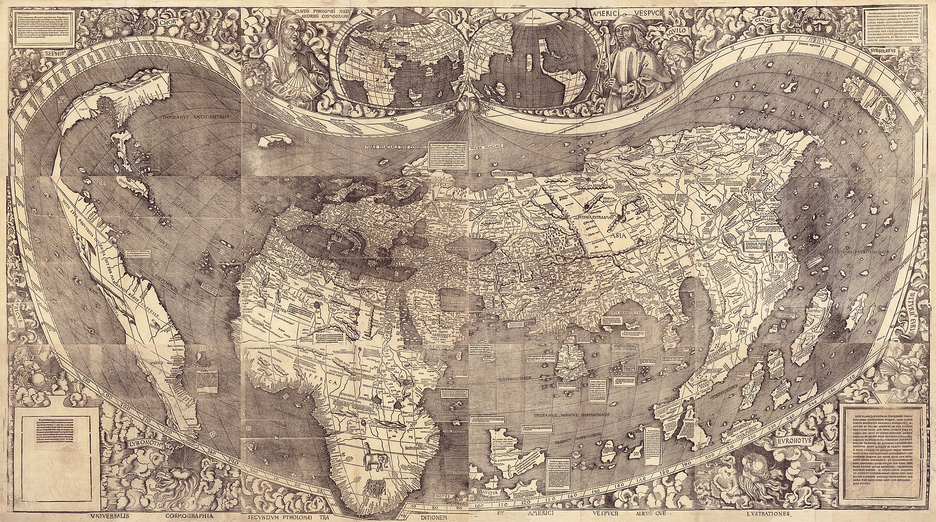
The Library of Congress composite scan of its own copy, built from the twelve separate sheets held under call number G3200 1507 .W3. This is the object described in this record and the only surviving impression of the map. Which printing it is remains disputed: the Library catalogues it as the 1507 first edition, Elizabeth Harris argued in 1985 that these sheets were pulled after 1516.
| Artist | Martin Waldseemuller |
|---|---|
| Date | 1507, in a printing of the sheets whose date is disputed |
| Medium | Woodcut with letterpress text on twelve sheets of laid paper, watermarked with a triple pointed crown |
| Dimensions | 128 x 233 cm assembled; sheets 46 x 63 cm or smaller |
| Where it is now | Library of Congress, Geography and Map Division, Washington DC, on permanent display in the Thomas Jefferson Buildinglast confirmed 4 August 2026 |
| Inventory number | G3200 1507 .W3 (LCCN 2003626426) |
| Attribution | AcceptedAttributed to Martin Waldseemuller and the Gymnasium Vosagense at Saint-Die by the map's own title and by the accompanying Cosmographiae Introductio of 1507. Full note |
| Object type | Map |
| Period | German and Lorraine, early sixteenth century |
| Cases | Has a provenance gap · Rediscovered |
| Inscriptions | Two collection stamps on the verso of the upper left sheet: Fuerstl. Waldburg Wolfegg'sches Kupferstichkabinett, and Furstl. Waldbg. Wolf. Bibliothek. Manuscript annotations in the margin of one sheet. |
| Owners on record | 6 links5 documented, 1 unknown |
| Sources | 13 cited |
About this record Last verified 27 August 2026 · 13 sources cited · Change log
On this page 10 sections
ContentsClose
Twelve woodcut sheets, never pasted together, printed at Strasbourg and dated 1507, carrying the first recorded use of the name America and the first depiction of a separate Western Hemisphere with the Pacific as a separate ocean. A thousand copies were reported printed. This is the only one known to survive, and the survival is an accident of storage: the Nuremberg globe maker Johannes Schoner bound it into a portfolio in 1517 with three other objects and it stayed flat and unhung for four centuries.
It was found in the library of Schloss Wolfegg in 1901 by the Jesuit Josef Fischer, and bought by the Library of Congress for USD 10 million, agreed in June 2001 and completed in May 2003. That was a private treaty sale, not an auction: there is no hammer price and no buyer's premium. Congress appropriated half the money. The other half came from Discovery Communications, Jerry Lenfest, David Koch, and two matching donors. The permit to export it from Germany, where the map was on the register of nationally valuable cultural property, was granted in 1999, two years before the price was agreed, and was publicly criticised at home.
Two things in this record are not in the standard account. Elizabeth Harris argued in 1985 that the surviving sheets are a later pull rather than the 1507 printing, and the holding library has never adjudicated the point. And the market next door has failed: the Bavarian State Library has established that its own set of Waldseemuller globe gores, bought in 1990 inside an incunable with a seventeenth-century provenance, is a twentieth-century forgery.
Provenance
Each link is graded. Documented: a cited source supports it. Disputed: the identification is argued but not established. Unknown: no owner for that span, and the gap is not smoothed into a narrative. The grades in the glossary.
- 1507 - by 1517Martin Waldseemuller and the Gymnasium Vosagense, Saint-Diedocumented
The Library of Congress catalogues the sheets as the only known surviving copy of the 1507 edition. Elizabeth Harris argued in 1985 that the surviving sheets are a later pull, after 1516, in which case no copy of the 1507 printing survives. The dispute is unresolved.138
- by 1517 - 1547Johannes Schoner, Nurembergdocumented
Schoner was a globe maker, astronomer and geographer. The Library states the map originally belonged to him. He died in 1547; the Library's press releases give 1557 in error.146
- 1547 - mid-seventeenth centuryNot establishedunknown
Roughly a century separates Schoner's death from the portfolio's presence at Schloss Wolfegg. No transfer is recorded in the sources consulted. The Wolfegg print room was assembled in the seventeenth century by Maximilian Willibald von Waldburg-Wolfegg, which is a plausible route and not a documented one.
- mid-seventeenth century - June 2001The princely house of Waldburg-Wolfegg, Schloss Wolfegg, Upper Swabiadocumented
Two Wolfegg collection stamps on the verso of the upper left sheet are the physical record of this ownership. The Library of Congress bought facsimiles of the 1507 and 1516 maps in 1903.134
- 1999 - 2001Prince Johannes Waldburg-Wolfegg (title), Library of Congress (custody from June 2001)documented
The map was on the German register of nationally valuable cultural property and could not leave without a permit. The licence was granted in 1999, two years before the sale was agreed. Public criticism in Germany accompanied the decision.1410
- May 2003 - presentLibrary of Congress, Geography and Map Division, Washington DCdocumented
USD 5 million appropriated by Congress; the balance from Discovery Communications, Jerry Lenfest, David Koch, George Tobolowsky and Virginia Gray. Inscribed on the UNESCO Memory of the World register in 2005, where Germany still lists it as German documentary heritage held in Washington.2411
Prices realised
This object has never been offered at auction. The figure of USD 10 million is a negotiated private treaty price between Prince Johannes Waldburg-Wolfegg and the Library of Congress, agreed in late June 2001 and settled in May 2003. There is no hammer price and no buyer's premium, and any source that reports one is wrong. The prices given in the narrative for the 1507 globe gores belong to a different object and two of those sheets are now established as twentieth-century forgeries.
Technical evidence
| Attribution note | Attributed to Martin Waldseemuller and the Gymnasium Vosagense at Saint-Die by the map's own title and by the accompanying Cosmographiae Introductio of 1507. The attribution of authorship is not in dispute. What is disputed is the date of the surviving impression: Elizabeth Harris argued in Imago Mundi in 1985 that these sheets were pulled after 1516. |
|---|---|
| Format | One map on twelve woodcut sheets, never joined. Overall 128 x 233 cm; sheets 46 x 63 cm or smaller. The Library's bulletin gives the sheets as 18 by 24 inches and the assembled map as more than four feet by eight feet.34 |
| Process | Woodcut, printed from wood block plates, with letterpress text. Described by the Library as the earliest multi-sheet printed wall map.14 |
| Paper and watermark | All sheets bear a watermark of a triple pointed crown. The watermark is physical evidence in the dispute over when the surviving sheets were printed.38 |
| Added work on the sheets | Red ink grid on two sheets. Text applied over blank areas on two sheets. Manuscript annotations in the margin of one sheet.3 |
| Ownership marks | Two stamps on the verso of the upper left sheet: Fuerstl. Waldburg Wolfegg'sches Kupferstichkabinett, and Furstl. Waldbg. Wolf. Bibliothek.3 |
| Original housing | Originally bound in the Schoner Sammelband, assembled by Johannes Schoner at Nuremberg in 1517 with the 1516 Carta Marina, Schoner's globe gores and Durer's 1515 star chart.36 |
| Imprint | Catalogued as [Strasbourg, France? : s.n., 1507]. The place of printing carries a question mark in the Library's own record.3 |
| Call number | G3200 1507 .W3, Geography and Map Division, Library of Congress. LCCN 2003626426.3 |
| Present housing | Sealed microclimate case with an argon atmosphere, Thomas Jefferson Building, on permanent display since 2007. A printed surrogate is kept in the vault for reference.312 |
| Imaging | Hyperspectral imaging with an LED camera and illumination system before encasement. The Library publishes a composite digital image built from the twelve sheets, up to a 1.4 GB TIFF, with a IIIF manifest.312 |
Images
The record in full
Chapter 1Twelve sheets that were never joined, which is why they survive
The object is not a map in the sense of a single sheet of paper.
The object is not a map in the sense of a single sheet of paper. It is twelve woodcut sheets, each about 46 by 63 cm, which assemble into a wall map roughly 128 by 233 cm, or four and a half feet by eight feet. The Library of Congress records that the sheets were never pasted up. Its own bulletin makes the point that the sheets of both the 1507 map and the 1516 Carta Marina were kept separate rather than joined, and that this is probably why they survived at all. A wall map that is hung is a wall map that is exposed; loose sheets in a portfolio are stored flat and forgotten.
Every sheet carries a watermark of a triple pointed crown. Two of the sheets have a red ink grid; on two more, text has been applied over blank areas; one sheet carries manuscript annotations in the margin. The verso of the upper left sheet has two ownership stamps, reading Fuerstl. Waldburg Wolfegg'sches Kupferstichkabinett and Furstl. Waldbg. Wolf. Bibliothek. The catalogue also notes that the map was originally bound in the Schoner Sammelband. Those three facts, the watermark, the stamps and the binding, carry most of the weight of everything that follows: the watermark is the evidence in the argument about when the sheets were printed, the stamps are the physical proof of the only long ownership the object has, and the Sammelband is the reason there is anything to own.
Chapter 2The word is on the lower left sheet, and the man who put it there took it back
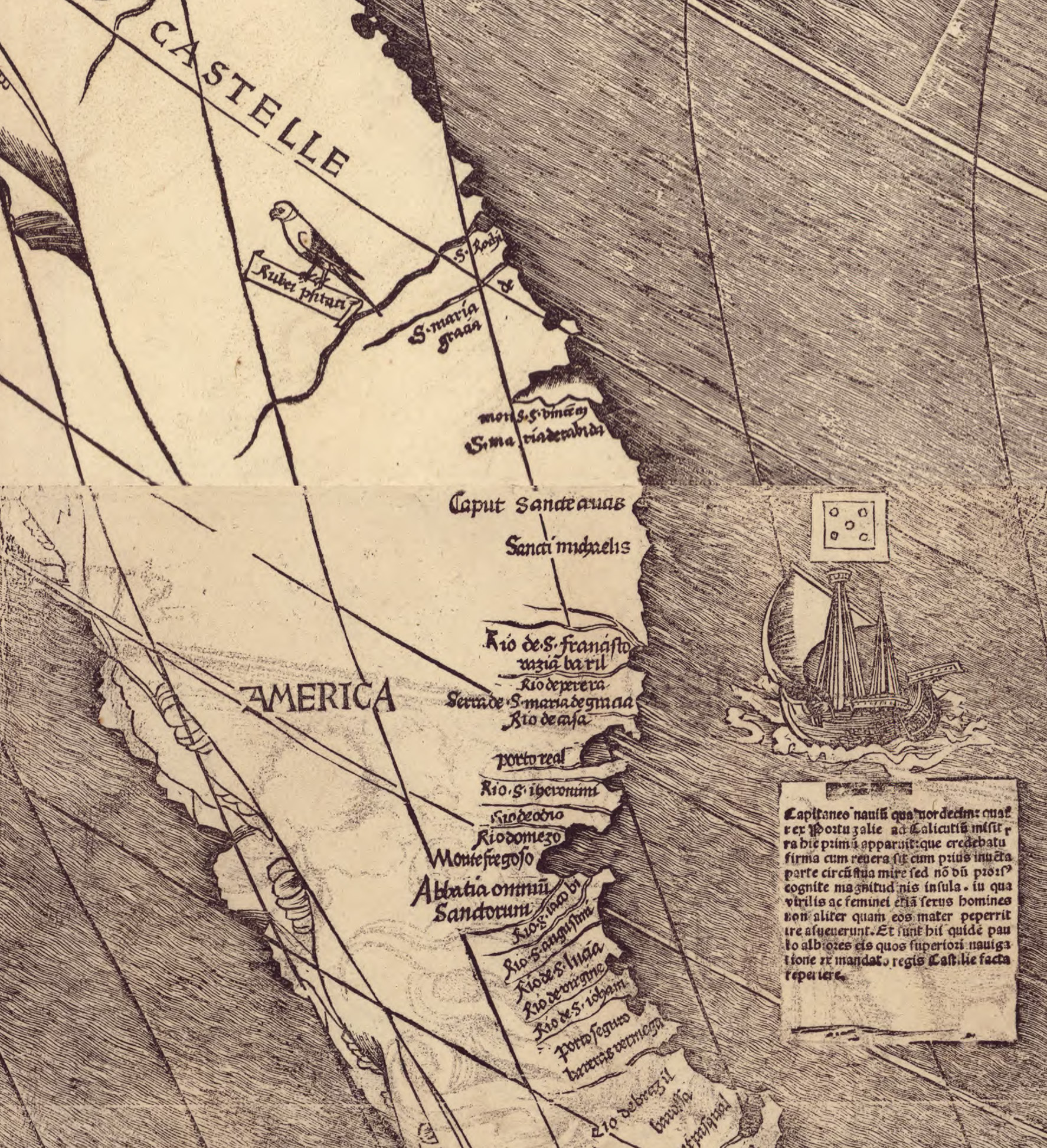
The name America appears on the lower left panel, applied to the southern landmass.
The name America appears on the lower left panel, applied to the southern landmass. The Library of Congress calls the map the first document known to name America, the first map to depict a separate Western Hemisphere, and the first to show the Pacific as a separate ocean. The name honours Amerigo Vespucci, who was alive when it was applied and did not die until 1512.
What the popular account leaves out is that Waldseemuller withdrew it. In the 1513 edition of Ptolemy's Geographiae the area named America on the 1507 map is called Terra Incognita. On the 1516 Carta Marina South America is Terra Nova, and the northern landmass is named Cuba and shown as part of Asia. Neither work uses the name America at all. The name survived because other people kept using it: Johannes Schoner in 1515 and Peter Apian in 1520 adopted it, and it passed into ordinary usage from there. The object in Washington is therefore the record of a decision its own maker reversed within six years.
Chapter 3Saint-Die, and what a small group of scholars in Lorraine actually had to work with
The map came out of the Gymnasium Vosagense, the scholarly circle at Saint-Die in Lorraine, then part of the Holy Roman Empire.
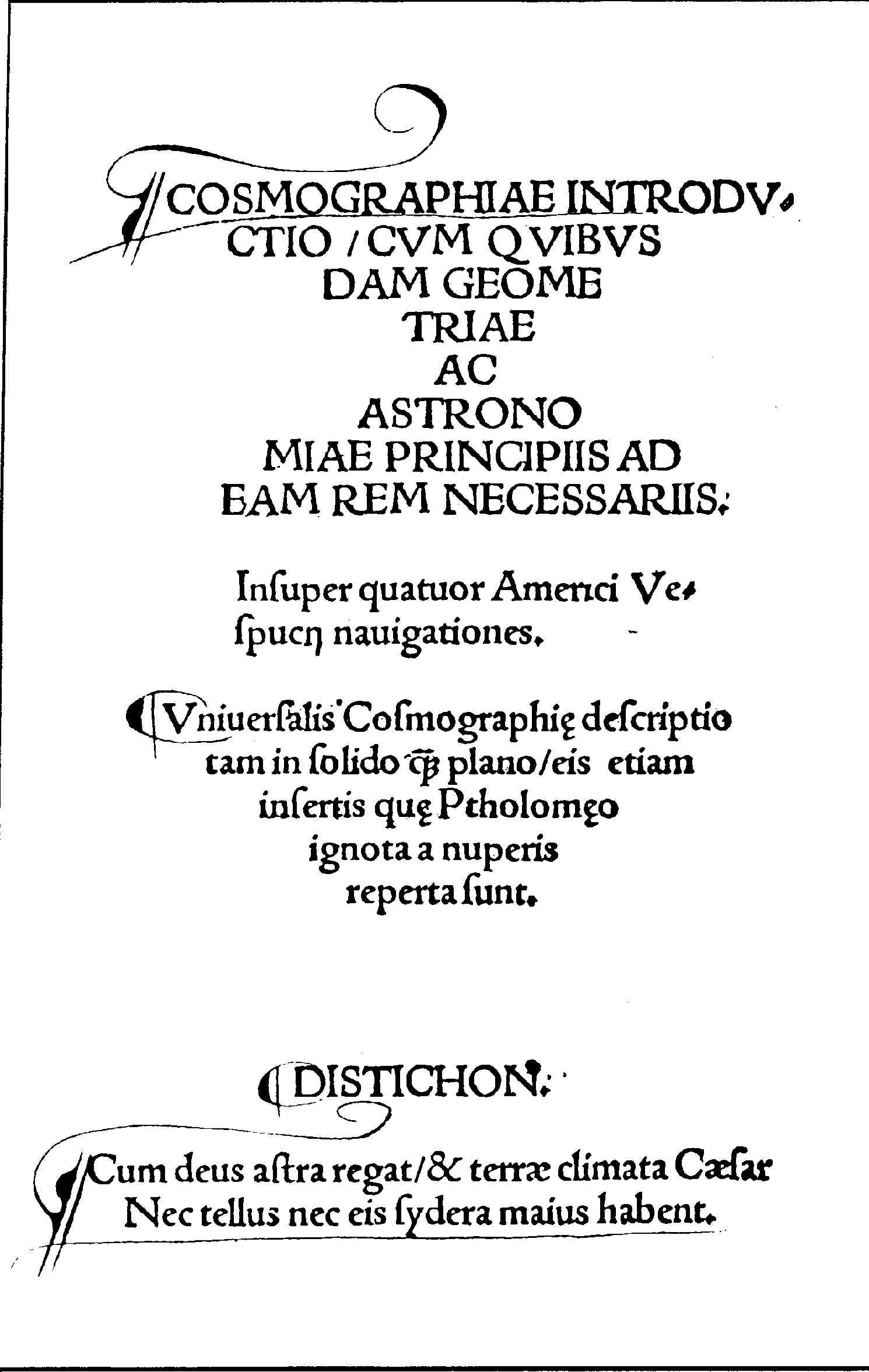
The map came out of the Gymnasium Vosagense, the scholarly circle at Saint-Die in Lorraine, then part of the Holy Roman Empire. The project was to update Ptolemy against the news arriving from the Atlantic and the African coast. In the spring of 1507 the group produced three things together: the wall map, a set of globe gores for a globe of about three inches diameter, and the Cosmographiae Introductio, the book written to accompany the map.
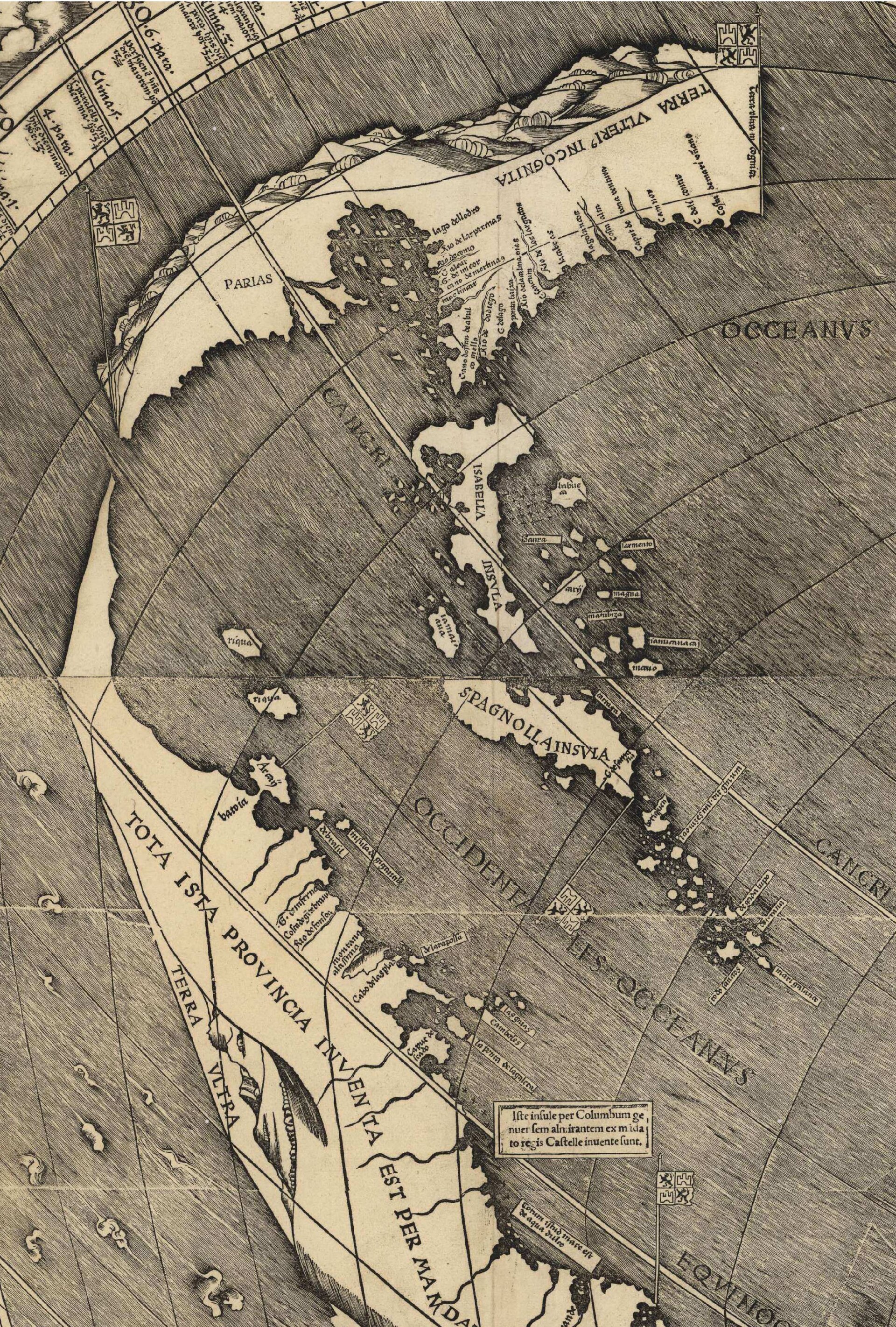
The evidence they used included a French translation of Mundus Novus, the letter attributed to Vespucci describing four Atlantic voyages between 1497 and 1504, in which the lands Columbus reached are argued to be a separate continent. The Library's own account is careful on the point usually got wrong: the Saint-Die group knew perfectly well what Columbus had done, and the 1507 map marks his West Indies voyages and their Spanish sponsorship. They named the continent for Vespucci because Vespucci had published the conclusion, not because they had not heard of Columbus.
How the map came to show a Pacific at all, years before any European is documented as having seen it, is genuinely unresolved. Peter Whitfield has argued that Vespucci's descriptions could not be reconciled with what was known of Asia, so Waldseemuller reasoned the new lands must be separate. Chet Van Duzer has argued instead that Marco Polo's statement that Japan was an island required sea between it and America. George E. Nunn proposed a third reading. These are arguments, not documents, and the record keeps them at that grade.
Chapter 4Whether the surviving sheets were printed in 1507 is a live scholarly dispute
The Library of Congress catalogues the object as the only known surviving copy of the first edition, printed at Strasbourg in 1507 in an edition reported at 1,000 copies.
The Library of Congress catalogues the object as the only known surviving copy of the first edition, printed at Strasbourg in 1507 in an edition reported at 1,000 copies. That is the description under which it was bought, displayed and inscribed by UNESCO.
Elizabeth Harris argued otherwise. In a typographic appraisal published in Imago Mundi in 1985 she examined the printing itself and concluded that the surviving sheets are a later pull, a printer's proof from after 1516 rather than a 1507 impression, which would mean that no example of the 1507 printing survives. The argument rests on the physical evidence of the sheets, and the paper is part of it, which is why the triple crown watermark recorded in the catalogue matters. The dispute has not been settled by the institution that owns the object, and this record does not settle it either. A new study, Domenico Bertoloni Meli's 'Printing the Waldseemuller 1507 and 1516 World Maps', appeared in The Papers of the Bibliographical Society of America in June 2026; the publisher's site refuses automated readers, and this desk has not read the text, only the bibliographic record.
The distinction is not pedantry. If Harris is right, the most famous single sheet of paper in the history of American cartography is not the 1507 edition but a survivor of a later print run kept as a proof, and the phrase 'America's birth certificate' is describing a copy of the certificate.
Chapter 5A Nuremberg globe maker bound it into a portfolio in 1517, and that is the whole reason it exists
The map belonged to Johannes Schoner, the Nuremberg astronomer, geographer and globe maker, who almost certainly acquired it as working material for his own cartography.
The map belonged to Johannes Schoner, the Nuremberg astronomer, geographer and globe maker, who almost certainly acquired it as working material for his own cartography. Schoner bound the contents of what is now called the Schoner Sammelband together at Nuremberg in 1517. The portfolio held the 1507 wall map, the 1516 Carta Marina, globe gores by Schoner himself, and the earliest printed star chart, Albrecht Durer's of 1515.
Nothing about that is a preservation decision in the modern sense. It is a working scholar keeping his sources in one place. The consequence is that four objects, each of which would now be a headline acquisition on its own, went into a single portfolio and stayed there while every other copy of the wall map, all thousand of them if the report is right, was hung, cut up, worn out or thrown away.
Chapter 6Wolfegg, 1901: a Jesuit finds it in a castle library
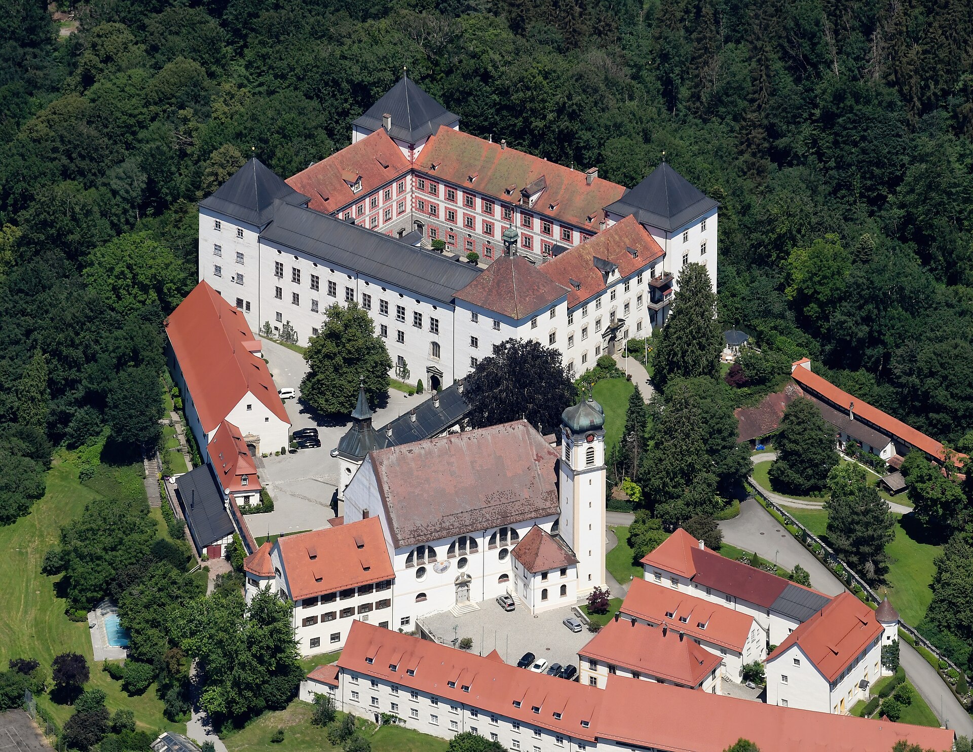
By the middle of the seventeenth century the Sammelband was in the collections of the Waldburg-Wolfegg family at Schloss Wolfegg in Upper Swabia.
By the middle of the seventeenth century the Sammelband was in the collections of the Waldburg-Wolfegg family at Schloss Wolfegg in Upper Swabia. The Library of Congress puts the map in that castle for more than 350 years. How it travelled from Schoner, who died in 1547, into a south German princely collection is not documented in the sources consulted here. The Wolfegg print room was built up in the seventeenth century by Maximilian Willibald von Waldburg-Wolfegg, who also acquired the Medieval Housebook from an owner nobody has identified; the family's acquisition habits of that period are the likeliest route, and that is an inference, not a record.
The portfolio was opened to scholarship in 1901 by the Jesuit historian and cartographer Josef Fischer, who was working in the Waldburg collection. Fischer and Franz von Wieser published the find, and in 1903 the Library of Congress bought facsimiles of the 1507 and 1516 maps. That is the beginning of the Library's interest: it had photographic copies within two years of the discovery and spent the following century trying to acquire the objects.
Chapter 7A hundred years of asking, and the conversation in 1992 that started the sale
The Library of Congress describes the 2003 purchase as concluding a nearly century-long effort.
The Library of Congress describes the 2003 purchase as concluding a nearly century-long effort. The decisive moment came in 1992, when Prince Johannes Waldburg-Wolfegg told the Librarian of Congress James H. Billington, the Associate Librarian Winston Tabb and the chief of the Geography and Map Division Ralph Ehrenberg, in a conversation in Washington, that he was willing to negotiate a sale. Ehrenberg and Margrit Krewson, the Library's German and Dutch area specialist, were told to pursue it.
What followed was not a negotiation about money first. It was a negotiation about permission.
Chapter 8The export licence Germany did not have to grant
The map was entered on the German register of nationally valuable cultural property, which means it could not lawfully leave the country without a permit.
The map was entered on the German register of nationally valuable cultural property, which means it could not lawfully leave the country without a permit. In 1999 the Prince notified the Library that the federal government and the state government of Baden-Wuerttemberg had granted a limited export licence, negotiated with Krewson's involvement. Only after the licence existed did the sale itself proceed to agreement.
In Germany this was not received quietly. German reporting on the later sale of the Wolfegg Medieval Housebook treats the Waldseemuller transfer as the precedent, notes that it went abroad with the permission of the federal government's authorised representative, and records that the export protection for nationally valuable cultural property was lifted for it by special permission. Public criticism accompanied that decision. The federal chancellor at the time of the handover ceremony, Angela Merkel, framed the transfer in 2007 as a gesture of transatlantic affinity rather than a commercial transaction.
The bureaucratic afterlife is the part nobody mentions. The German UNESCO commission still lists the map among Germany's documentary heritage, inscribed on the Memory of the World register in 2005, and gives its location as the Library of Congress, Geography and Map Division, Washington. The object is German heritage at a Washington address, by agreement of both governments.
Chapter 9Ten million dollars, and exactly who paid it
The price was USD 10 million, agreed in late June 2001.
The price was USD 10 million, agreed in late June 2001. This was a private treaty sale between one owner and one institution. There was no auction, no hammer price and no buyer's premium, and any published figure describing the transaction in those terms is describing something that did not happen.
The Library took custody in late June 2001 against an initial down payment, and completed the purchase in late May 2003, announcing it on 18 June 2003. The funding, as set out by the chief of the Geography and Map Division, was: USD 5 million appropriated by the Congress of the United States, substantial contributions from Discovery Communications, Jerry Lenfest and David Koch, and matching funds from George Tobolowsky and Virginia Gray, who also gave for preservation, exhibition and study. The House Appropriations Committee endorsed the acquisition in its report on the fiscal year 2001 supplemental appropriations, House Report 107-102 of 20 June 2001.
So half the price of the map was public money voted by the legislature of the country the map named, and the other half was raised from a cable television company and three private donors. Part of the terms was not financial at all: under the agreement, the map goes on display in the Thomas Jefferson Building. The seller sold access as well as ownership.
Chapter 10The rest of the portfolio followed it to Washington
The purchase broke up the Schoner Sammelband, and then the Library spent eleven years putting it back together.
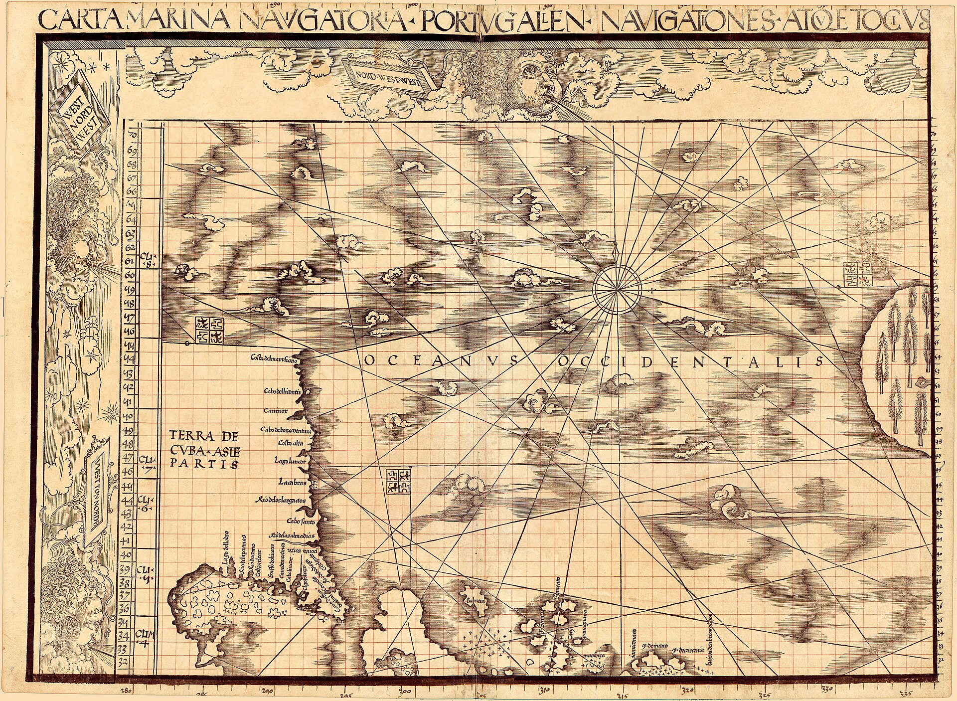
The purchase broke up the Schoner Sammelband, and then the Library spent eleven years putting it back together. Jay I. Kislak, a member of the Library's Madison Council, bought the Carta Marina, the globe gores and the Sammelband portfolio itself and gave them to the Library in 2014. The Library bought the last component, Durer's 1515 star chart, in late 2015. The 1516 Carta Marina in the Kislak Collection is the only surviving example of that map.
Wolfegg therefore no longer holds any part of the portfolio, and the whole of it is in one division of one library in Washington, reassembled at four separate transactions across fifteen years. What Kislak paid in 2014, and what the Library paid for the Durer chart in 2015, are not published in the sources consulted.
Chapter 11The market this object sits in has produced at least two forgeries
The wall map is unique, which removes the usual danger.
The wall map is unique, which removes the usual danger. The companion object, the 1507 globe gores, is not, and that market has failed badly.
In 1990 the Bayerische Staatsbibliothek in Munich bought, for DM 2,000,000 raised largely from third-party funding, a 1486 Ptolemy Cosmographia incunable from the estate of the dealer H. P. Kraus, with a set of globe gores bound in. The provenance of the incunable ran back through the collector Sergej A. Sobolevskij to Count Christian Ernst zu Stolberg-Wernigerode, with matching bookplates inside the front cover, and was reviewed again in 2005. Nobody doubted the gores.
Doubt arrived only when a sixth known copy of the gores was catalogued for sale at Christie's as lot 97, estimated at EUR 690,000 to 1,000,000. Christie's compared it with the Munich sheet and found the two identical in every detail, which implies a common printing template. Experts questioned the authenticity of the lot; comparison with the University of Minnesota copy strengthened the suspicion; and the Munich library then examined its own sheet. Its Institute of Conservation and Restoration analysed the printing ink without sampling and found iron and titanium, probably iron titanate. A titanium-bearing black pigment indicates manufacture in the first half of the twentieth century. Carbon black, the pigment used from Waldseemuller's time to the beginning of the twentieth century, was present in the text of the Cosmographia and absent from the gores. Munich's conclusion is unambiguous: its map, too, is a forgery, probably made at the same time and by the same process as the one at Christie's, and it is considering what legal claims it can bring.
The lesson for anyone reading a provenance is exact. The forged sheet had an impeccable pedigree, because the pedigree belonged to the genuine book it had been bound into. A chain of ownership can be true in every link and still be attached to the wrong object.
Chapter 12Argon, and the map a visitor actually sees
Since 2007 the map has been on permanent display in the Thomas Jefferson Building in a specially built microclimate case filled with argon, an anoxic environment intended to arrest oxidation of the...
Since 2007 the map has been on permanent display in the Thomas Jefferson Building in a specially built microclimate case filled with argon, an anoxic environment intended to arrest oxidation of the paper. Before it went into the case the Library carried out a hyperspectral imaging study with an LED camera and illumination system, undertaken to answer preservation and display questions rather than curatorial ones. The composite digital image is published by the Library at high resolution and can be downloaded, up to a 1.4 GB TIFF of the entire map, alongside a IIIF manifest.
A printed surrogate is held in the vault for reference use, which is the honest institutional answer to the problem that the object cannot be handled.
Chapter 13The catalogue cannot agree with itself about the man who made it
The Library of Congress catalogue record gives the maker as 'Waldseemueller, Martin, 1470-1519'.
The Library of Congress catalogue record gives the maker as 'Waldseemueller, Martin, 1470-1519'. The Library's own bulletin, written by the chief of its Geography and Map Division, says he was born near Freiburg sometime in the 1470s and died in the canon house at Saint-Die in 1522. The Library's exhibition page gives 'ca. 1470-ca. 1522'. The 2001 and 2003 press releases both date Johannes Schoner 1477-1557, while the exhibition page and the standard literature give 1477-1547.
None of this affects the object. It is recorded here because a reader checking a date against an institutional page is entitled to know that the institution holds four pages that do not match, and because the sequence of catalogue descriptions is itself part of an object's history. The 1547 date for Schoner is the one to use.
The artist
Martin Waldseemuller
A cleric, humanist and cartographer of the small scholarly circle at Saint-Die in Lorraine, the Gymnasium Vosagense, working under the patronage of the court of Lorraine. He is known for four cartographic projects across nine years, of which the 1507 wall map is the first and the 1516 Carta Marina the last. He is also the man who applied the name America and then stopped using it.
Related works
| Work | Relation | Where it is |
|---|---|---|
| Carta Marina navigatoria Portugallensium navigationes Martin Waldseemuller | The other wall map from the same portfolio, printed 1516; sole surviving example Bought by Jay I. Kislak and given to the Library in 2014. Sheet 6 of the Library's copy appears to be a proof laid in after the Sammelband was bound. | Jay I. Kislak Collection, Geography and Map Division, Library of Congress |
| Globe gores of 1507 Martin Waldseemuller | The companion object, issued in the same spring for a globe of about three inches diameter Six copies were known by 2017. The Bayerische Staatsbibliothek sheet and the sheet offered at Christie's as lot 97 are both established or strongly suspected as twentieth-century forgeries. CORRECTION 2026-08-30: this entry previously located a set in the Jay I. Kislak Collection at the Library of Congress; the Library's own catalogue records identify the globe gores bound into the Kislak Collection's Schoner Sammelband (both the celestial gores and the fragmentary terrestrial gores found in the binding in 1905) as the work of Johann Schoner, dated 1515-1517, not Waldseemuller's 1507 design. The Sammelband does hold Waldseemuller's 1507 wall map and 1516 Carta Marina, both already covered elsewhere in this record and in waldseemuller-1516-carta-marina, but not a Waldseemuller globe-gore set. The false claim is removed rather than left standing. | Several collections, including the University of Minnesota (ex-Liechtenstein) and the University Library of the Ludwig-Maximilians-Universitat, Munich (Cim. 107#2) |
| Star chart of the southern hemisphere, 1515 Albrecht Durer | The fourth component of the Schoner Sammelband; the earliest printed star chart Bought by the Library in late 2015, completing the reassembly of the portfolio. | Geography and Map Division, Library of Congress |
| Cosmographiae Introductio Gymnasium Vosagense, Saint-Die | The treatise printed in 1507 to accompany the wall map The book and the map were issued as one project. The book survives in numbers; the map does not. | Multiple copies survive in institutional collections |
| The Medieval Housebook of Wolfegg Anonymous, Middle Rhine | The other great object sold out of Schloss Wolfegg, and the closest market comparable Sold in 2008 through the dealer Christoph Graf Douglas, with a figure of about EUR 20 million reported, roughly double what the Waldseemuller map raised. German reporting states that the transfer breached the notification requirement of the federal cultural property act. | Private collection, Switzerland |
Open questions
- Were the surviving twelve sheets printed in 1507, or after 1516? The Library of Congress catalogues them as the only known copy of the first edition; Elizabeth Harris argued in Imago Mundi in 1985 that they are a later pull kept as a proof. No institution has adjudicated it.
- Where was the map between Johannes Schoner's death in 1547 and its appearance in the Waldburg-Wolfegg collections in the seventeenth century? No owner is documented for roughly a century.
- How and when did the Waldburg-Wolfegg family acquire the Schoner Sammelband? The Library states only that it was in the castle for more than 350 years.
- What conditions were attached to the limited export licence granted in 1999 by the federal government and Baden-Wuerttemberg? The terms have not been published in the sources consulted, and 'limited' is the Library's own word.
- What did Jay I. Kislak pay for the Carta Marina, the globe gores and the Sammelband portfolio in 2014, and what did the Library pay for the Durer star chart in 2015? Neither figure is published.
- How many of the six recorded copies of the 1507 globe gores are genuine? Two are now discredited, and the Bavarian State Library has said it is considering legal claims.
- Did any German institution attempt to acquire or retain the map before the export licence was granted? No competing bid or public appeal is recorded in the sources consulted.
Questions about this object
What is Universalis Cosmographia secundum Ptholomaei Traditionem et Americi Vespucii aliorumque Lustrationes?
Universalis Cosmographia secundum Ptholomaei Traditionem et Americi Vespucii aliorumque Lustrationes is a map, dated 1507, in a printing of the sheets whose date is disputed. Medium: Woodcut with letterpress text on twelve sheets of laid paper, watermarked with a triple pointed crown.
Who made Universalis Cosmographia secundum Ptholomaei Traditionem et Americi Vespucii aliorumque Lustrationes, and is the attribution settled?
The attribution to Martin Waldseemuller is recorded here as accepted. Attributed to Martin Waldseemuller and the Gymnasium Vosagense at Saint-Die by the map's own title and by the accompanying Cosmographiae Introductio of 1507. The attribution of authorship is not in dispute. What is disputed is the date of the surviving impression: Elizabeth Harris argued in Imago Mundi in 1985 that these sheets were pulled after 1516.
Where is Universalis Cosmographia secundum Ptholomaei Traditionem et Americi Vespucii aliorumque Lustrationes now?
Library of Congress, Geography and Map Division, Washington DC, on permanent display in the Thomas Jefferson Building. Inventory number G3200 1507 .W3 (LCCN 2003626426). Last confirmed 4 August 2026. Purchased from Prince Johannes Waldburg-Wolfegg; agreement June 2001, purchase completed May 2003.
What is still unknown about Universalis Cosmographia secundum Ptholomaei Traditionem et Americi Vespucii aliorumque Lustrationes?
Were the surviving twelve sheets printed in 1507, or after 1516? The Library of Congress catalogues them as the only known copy of the first edition; Elizabeth Harris argued in Imago Mundi in 1985 that they are a later pull kept as a proof. No institution has adjudicated it.
Sources
- 1Library of Congress, press release PR 01-093, 'Library of Congress Acquires Only Known Copy of 1507 World Map Compiled by Martin Waldseemuller', 23 July 2001. loc.gov/item/...
- 2Library of Congress, press release PR 03-110, 'Library of Congress Completes Purchase of Waldseemuller Map', 18 June 2003. loc.gov/item/...
- 3Library of Congress catalogue record, 'Universalis cosmographia secundum Ptholomaei traditionem et Americi Vespucii alioru[m]que lustrationes', LCCN 2003626426, call number G3200 1507 .W3, Geography and Map Division. loc.gov/item/...
- 4John R. Hebert, 'The Map That Named America: Library Acquires 1507 Waldseemuller Map of the World', Library of Congress Information Bulletin, September 2003. Hebert was chief of the Geography and Map Division. loc.gov/loc/...
- 5Library of Congress exhibition, 'Waldseemuller Maps', in 'Exploring the Early Americas'. loc.gov/exhibits/...
- 6John Hessler, 'Celebrating Waldseemuller's Carta Marina at 500: A Conference at the Library of Congress', Worlds Revealed: Geography and Maps at the Library of Congress, 7 September 2016. blogs.loc.gov/maps/...
- 7Bayerische Staatsbibliothek, press statement, 'Bavarian State Library confirms that its own Waldseemueller globe gores map is a forgery', Munich. bsb-muenchen.de/en/...
- 8Museo Galileo, Florence, bibliography for the Waldseemuller online exhibition, recording Elizabeth Harris, 'The Waldseemuller World Map: a Typographic Appraisal', Imago Mundi 37 (1985), 1, pp. 30-53. exhibits.museogalileo.it/waldseemuller/...
- 9Crossref metadata record for Domenico Bertoloni Meli, 'Printing the Waldseemuller 1507 and 1516 World Maps', The Papers of the Bibliographical Society of America 120:2 (June 2026), pp. 165-192, doi 10.1086/741326. The publisher's page returned HTTP 403 to this desk; the bibliographic data here is Crossref's, and the article text has not been read. api.crossref.org/works/...
- 10Raimund Weible and Bettina Wieselmann, Suedwest Presse, on the Wolfegg sales and the German cultural property rules, reproduced at Archivalia, 'Wolfegger Verkauf: Wirtschaftsministerium wusste Bescheid'. Secondary; the underlying newspaper page was not reachable from this desk. archivalia.hypotheses.org/25979
- 11Deutsche UNESCO-Kommission, 'Waldseemuellerkarte von 1507', Weltdokumentenerbe Deutschland, giving the year of inscription as 2005 and the location as the Library of Congress. unesco.de/kultur-und-natur/...
- 12Wikipedia, 'Waldseemuller map'. Tertiary, used only to locate the Harris and Bertoloni Meli references and George E. Nunn's analysis. Flagged for replacement with the printed literature. en.wikipedia.org/wiki/...
- 13Library of Congress, Geography and Map Division, item records for the Schoner Sammelband's '[Celestial globe gores]' (2016586439/2016586440) and '[Fragmentary terrestrial globe gores]' (2016586441), both catalogued as the work of Johann Schoner, 1515-1517 - the basis for the 2026-08-30 correction to the Globe gores of 1507 related-work entry above, which had wrongly attributed these to Waldseemuller. loc.gov/item/...
Last verified 27 August 2026 · Published 4 August 2026
Change log
2 August 2026 - Record deepened to the house standard: narrative sections, technical evidence, artist dossier, related works and open questions added; provenance chain and auction results replaced with the researched versions; sources rebuilt.
4 August 2026 - Record created at the house standard: researched narrative, technical evidence, maker dossier, graded provenance chain, prices with hammer and premium separated, related works, open questions and sources.
27 August 2026 - Re-verified: location (Library of Congress, Jefferson Building, argon case), the Harris 1985 dating dispute, and the globe-gores forgery status all confirmed unchanged; 8 of 12 cited sources spot-checked live (loc.gov sources now sit behind a Cloudflare bot-check for automated fetches but are confirmed current via Wayback Machine mirrors). No substantive change.
30 August 2026 - Correction, found during research for a separate new record (waldseemuller-1507-globe-gores): the 'Globe gores of 1507' related-work entry wrongly located a Waldseemuller set in the Jay I. Kislak Collection at the Library of Congress. The Library's own catalogue identifies the globe gores bound into that collection's Schoner Sammelband as Johann Schoner's own work of 1515-1517, not Waldseemuller's. Corrected; the Sammelband's genuine Waldseemuller holdings (the 1507 wall map and the 1516 Carta Marina) are unaffected and remain correctly stated elsewhere in this record. last_verified not bumped - this is a targeted correction, not the scheduled re-verification pass.
30 August 2026 - House-rule fix, found alongside the globe-gores correction above: seven gallery/hero 'author' fields carried the accented spelling 'Waldseemuller' with u-umlaut, in violation of the plain-ASCII rule (commons_title is the only exempt field). Transliterated to the ASCII form already used consistently elsewhere in this record (artist.name). No commons_title field touched - those must keep the exact Commons spelling to resolve.