Waldseemuller's Globe Gores
Martin Waldseemuller · After 1507, most likely before 1513; a distinct, previously unrecorded edition, not the original 1507 printing
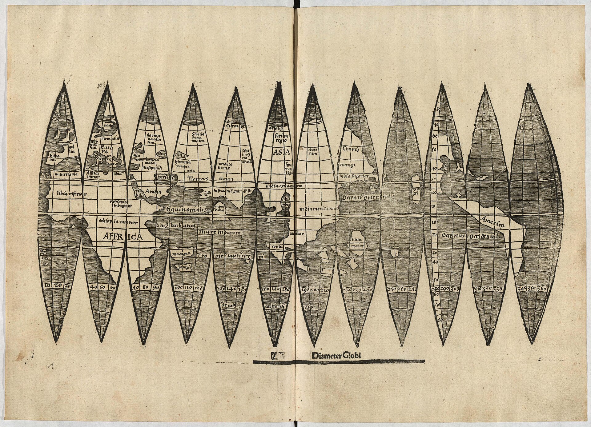
The object described in this record: the previously unrecorded set of Waldseemuller's globe gores identified in 2012 at the University Library of the Ludwig-Maximilians-Universitat, Munich, shelfmark Cim. 107#2. Printed from a different woodblock than any other known set.
| Artist | Martin Waldseemuller |
|---|---|
| Date | After 1507, most likely before 1513; a distinct, previously unrecorded edition, not the original 1507 printing |
| Medium | Woodcut with letterpress text on a single sheet of paper, printed as twelve tapering gores meant to be cut out and pasted onto a sphere |
| Dimensions | Sheet approximately 18 x 35 cm, printed across two conjoined leaves; the twelve gores form a globe of about 11 cm in diameter when cut out and assembled. Other genuine surviving sets, pulled from different woodblocks, vary slightly in scale and finish. |
| Where it is now | Universitatsbibliothek der Ludwig-Maximilians-Universitat, Munich (LMU Munich University Library), Rare Books and Manuscripts Departmentlast confirmed |
| Inventory number | Cim. 107#2 (also cited as 2 Math. 499#2) |
| Attribution | AcceptedThe design is accepted as belonging to Martin Waldseemuller's project at Saint-Die, on typeface and content grounds: the lettering used for the phrase Diameter Globi at the foot of the sheet matches the typeface Waldseemuller used in the Cosmographiae Introductio and on his 1507 and 1516 wall maps. Full note |
| Object type | Map |
| Period | German and Lorraine, early sixteenth century |
| Cases | Has a provenance gap · Rediscovered |
| Inscriptions | A ruled line reading Diameter Globi at the foot of the sheet, set from the same movable type used elsewhere for Waldseemuller's text blocks, added to help a buyer determine the correct sphere diameter without measuring the gores directly. Two watermarks in the paper: the letter P surmounted by a four-lobed flower ornament, matching paper documented elsewhere in a bound book of 1518. |
| Owners on record | 5 links4 documented, 1 unknown |
| Sources | 13 cited |
About this record Last verified · 13 sources cited · Change log
On this page 10 sections
ContentsClose
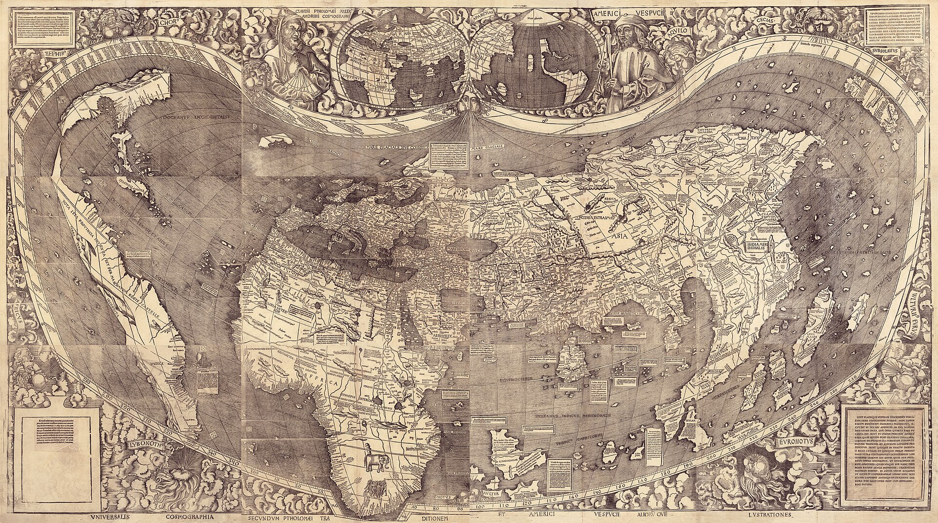
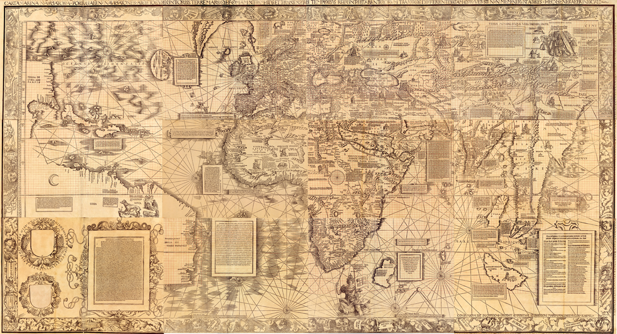
This is not the map. It is the other object the same Saint-Die workshop printed in 1507: a single sheet of twelve tapering woodcut gores, meant to be cut out with scissors and pasted around a small wooden or plaster ball to make a globe about the size of an orange. It is a separate physical artefact from both the great wall map now in the Library of Congress and the 1516 Carta Marina beside it, and it has its own, stranger story.
The copy described here is not even an example of the famous first printing. It surfaced by accident in 2012, when a librarian at the University Library of the Ludwig-Maximilians-Universitat in Munich, cataloguing a nineteenth-century binding of two editions of a medieval optics textbook, found a set of globe gores sewn between them. Comparison against the four sets already known showed it was pulled from a completely different woodblock, with the island of Madagascar redrawn to match a more accurate chart and the port of Calicut moved to a different segment. The paper's watermark places the printing after 1507, probably before 1513. Munich had never seen this edition before, because nobody had known it existed.
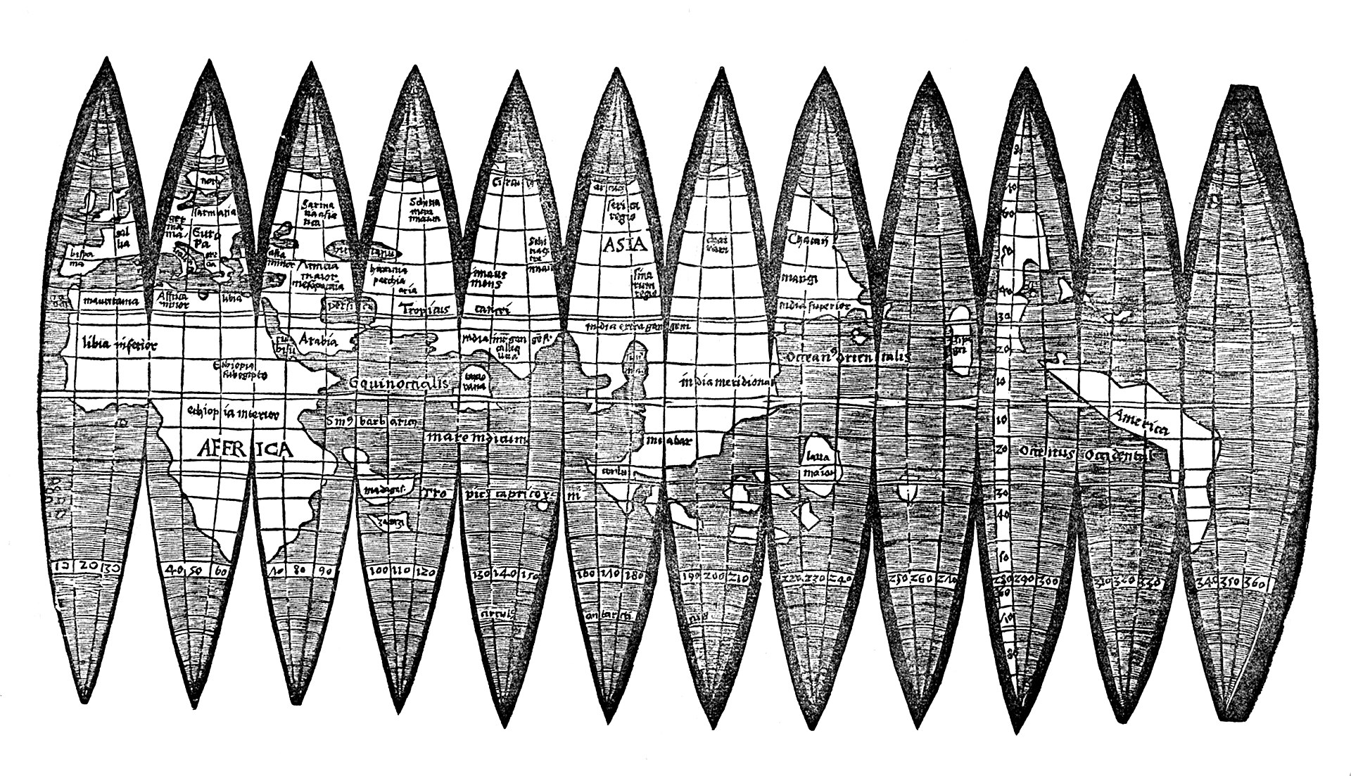
The find also landed in the middle of a market failure. Of the four sets of gores known before 2012, one, at the Bavarian State Library across town, was confirmed in 2018 to be a twentieth-century forgery, and a second, offered at Christie's in 2005, was shown to have come from the same fake printing template. That leaves, by the best current count, three genuine surviving sets of Waldseemuller's globe gores anywhere: the University of Minnesota, the Historical Library at Offenburg, and this one, an edition nobody else has.
Provenance
Each link is graded. Documented: a cited source supports it. Disputed: the identification is argued but not established. Unknown: no owner for that span, and the gap is not smoothed into a narrative. The grades in the glossary.
- after 1507 - before 1513Martin Waldseemuller's circle at Saint-Die, printed probably in or near Strasbourgdocumented
The typeface used for the Diameter Globi line matches type used elsewhere by Waldseemuller's workshop, and the watermark and the cartographic content (a revised Madagascar following a nautical chart, and a shifted position for Calicut) date the printing after the 1507 first edition and before 1513, when Waldseemuller's next map dropped the name America entirely. No printer's name or place of printing survives on the sheet itself; the attribution to Waldseemuller's circle rests on typography and content, not a colophon.12
- unknown - unknownUnrecordedunknown
Nothing is recorded about who owned the sheet, or where, between its printing and its appearance bound into a library volume. How and when it was sewn between two editions of Johannes Peckham's Perspectiva communis is not documented.1
- first half of the 19th century - 1826A bound volume containing two editions of Johannes Peckham's Perspectiva communis, with the gores inserted between themdocumented
The volume that now carries the shelfmark Cim. 107 passed out of the Benedictine monastery of Oberalteich in Bavaria at the secularisation of the Bavarian monasteries around 1803, into the library of the University of Landshut. The university, and its library, moved to Munich in 1826. Whether the loose gore sheet was already part of the Oberalteich monastery's holdings before 1803, or was bound in afterward at Landshut or Munich, is not established in the sources consulted.23
- 1826 - 1955University Library of the Ludwig-Maximilians-Universitat, Munichdocumented
The volume was held among the library's rare books, unidentified, through more than a century that included evacuation and relocation of the collection during and after the Second World War, documented at the library as a 1942 to 1955 wartime dispersal and return. The globe gores travelled with the volume through this period without being noticed for what they were.3
- 2012 - presentUniversity Library of the Ludwig-Maximilians-Universitat, Munichdocumented
Found during cataloguing work in the spring of 2012 by the library's own staff; the librarian credited with the find is Elke Humml. Sven Kuttner, the library's rare book specialist, identified the cartographic and typographic differences from the four previously known sets. Library director Klaus-Rainer Brintzinger announced the find publicly on 3 July 2012, calling it a sensation. The library has held it, catalogued and digitised, since.13456
Prices realised
This specific sheet has never been offered at auction; it was found in a library's own holdings, not bought. A different set of Waldseemuller's globe gores was offered at Christie's, London, on 8 June 2005, estimated at EUR 690,000 to 1,000,000 as lot 97 in a sale of the Charles Frodsham and Co. collection. That sheet, and the Bavarian State Library's own long-held set, were subsequently shown by ink and pigment analysis to be twentieth-century forgeries pulled from a shared fake printing template. Those figures and that market history belong to a different, discredited object, not to the Munich sheet described in this record.
Technical evidence
| Attribution note | The design is accepted as belonging to Martin Waldseemuller's project at Saint-Die, on typeface and content grounds: the lettering used for the phrase Diameter Globi at the foot of the sheet matches the typeface Waldseemuller used in the Cosmographiae Introductio and on his 1507 and 1516 wall maps. But this particular printed sheet, held at the University Library of the Ludwig-Maximilians-Universitat in Munich, is not from the 1507 printing. It was pulled from an entirely different woodblock than the one used for the four other genuine sets known before it was found, and the printer's name does not survive on it. It is best described as an unrecorded, later edition of the gores produced within Waldseemuller's own circle, not as a copy of the first edition. |
|---|---|
| Format | A single printed sheet of twelve tapering gores, designed to be cut out and pasted around a sphere to form a globe of about 11 cm diameter. Sheet approximately 18 x 35 cm.12 |
| Woodblock | Printed from a woodblock entirely different from the one used for the four previously known sets of the gores. Segment borders, the hatching style used for water, and the shapes of individual letters all differ from the earlier block.1 |
| Diameter Globi line | A ruled measurement line at the foot of the sheet, labelled Diameter Globi, set in movable type matching the typeface used elsewhere in Waldseemuller's Cosmographiae Introductio and on his 1507 and 1516 maps. The type was overinked when this sheet was printed, causing ink to bleed around the letters.1 |
| Watermark | Two examples in the sheet of a watermark showing the letter P surmounted by a four-lobed flower ornament, matched to paper documented in a bound book of 1518, indicating a printing after 1507 and probably in the Alsace region.12 |
| Cartographic revisions | Cuba redrawn with a more articulated coastline, closer to its shape on the 1507 wall map. Madagascar's northern portion, above the Tropic of Capricorn, cut from the woodblock and replaced with open-water hatching, moving the island south to match the nautical chart of Nicolo de Caverio rather than the earlier Martellus-derived outline used on the four previously known sets. Calicut relocated from the fifth gore segment to the fourth.1 |
| Binding | Bound within a nineteenth-century library binding, shelfmark Cim. 107 (= 2 Math. 499#2), together with two separate editions of Johannes Peckham's Perspectiva communis, one of 1504 and one of about 1510.123 |
Images
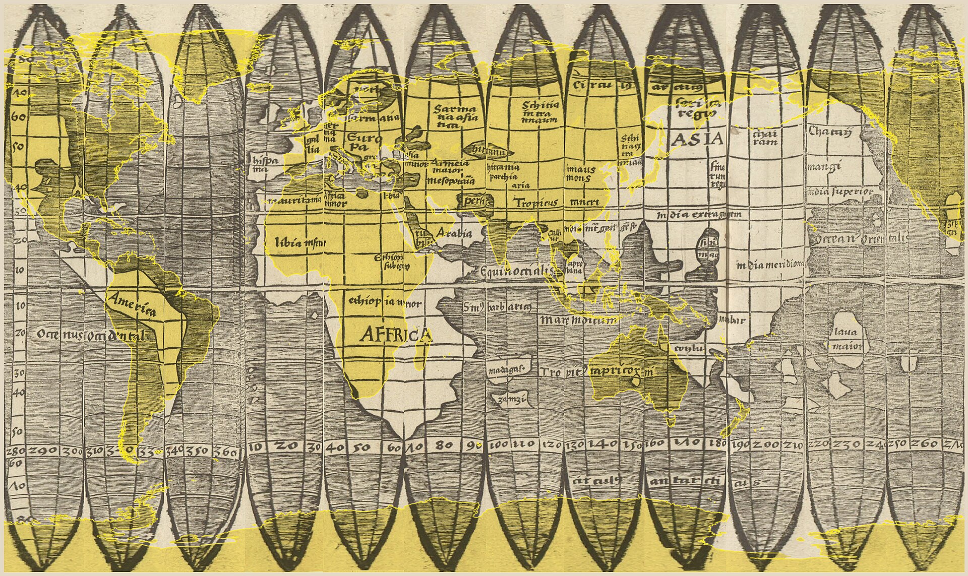
The record in full
Chapter 1A globe you were meant to cut up
The object described in this record is not the famous wall map.
The object described in this record is not the famous wall map. It is a different, smaller, and much odder thing that came out of the same workshop in the same year: a single printed sheet showing twelve narrow, tapering wedges of the world, called gores, arranged so that a buyer could cut them out with scissors and paste them, edge to edge, around a small wooden or plaster ball. Glued down correctly, the twelve gores make a globe roughly the size of an orange, about 11 centimetres across. It is, so far as the surviving evidence shows, the earliest printed globe to carry the name America.
Almost nobody did this. Of the small number of genuine printed sheets that survive today, not one is known to have actually been cut up and assembled into a globe. Every surviving example, including the one this record is about, exists because it was kept flat, unused, and eventually forgotten in a library. The object's usual fate, being cut to pieces and pasted onto a sphere, is exactly the fate none of the survivors met. That is why there is anything left to look at.
Chapter 2Found in a book about optics, not about maps
The copy this record describes surfaced by chance in the spring of 2012.
The copy this record describes surfaced by chance in the spring of 2012. A librarian at the University Library of the Ludwig-Maximilians-Universitat in Munich, Elke Humml, was working through a routine cataloguing correction on a nineteenth-century bound volume when she found a folded sheet of globe gores sewn between two separate printed editions of Johannes Peckham's Perspectiva communis, a standard medieval textbook on optics that had nothing to do with cartography. The gores had been sitting there, misfiled by content and unread by anyone who understood what they were, for the better part of two centuries.
Sven Kuttner, the library's specialist in early printed books, compared the new find against the four sets of Waldseemuller's globe gores that were known to exist at the time. He found enough differences to call it, in his own words, unique. The library's director, Klaus-Rainer Brintzinger, announced the discovery publicly on 3 July 2012, describing it as a sensational find, and it drew international press coverage within days.
Chapter 3Not the 1507 edition: a separate woodblock
The Munich sheet is not a copy of the famous first printing.
The Munich sheet is not a copy of the famous first printing. Chet Van Duzer, a historian of cartography who examined the find soon after it surfaced, established that it was cut from an entirely different woodblock than the one used for all four previously known sets. The evidence is both typographic and cartographic. On the other four sets, most of the gore segments carry a thick black border; on the Munich sheet they do not. The style used to render open water differs. The shapes of individual letters differ. And the paper's watermark, a letter P surmounted by a four-lobed flower ornament, matches watermarks documented in a book of 1518, which places the paper, and so the printing, later than 1507.
Two further, apparently deliberate changes confirm the later date. On the four previously known sets, the coastline of Cuba is only loosely drawn; on the Munich sheet it is more carefully articulated, closer to the shape Waldseemuller gave it on his large 1507 map. And the island of Madagascar, which on every other known set of the gores carries a distinctive L-shaped outline borrowed indirectly from the cartographer Henricus Martellus, has been redrawn on the Munich woodblock: the portion of the island north of the Tropic of Capricorn has been cut away and replaced with plain hatching for open water, moving the whole island south to match a different and more current source, the nautical chart of Nicolo de Caverio of about 1504.
Chapter 4Dating a sheet with no date on it
Nothing on the Munich sheet states when or where it was printed.
Nothing on the Munich sheet states when or where it was printed. The date has to be argued from the evidence, and the argument brackets it fairly tightly. The Madagascar revision and the watermark both indicate a printing after the first edition of 1507. The upper bound comes from the name America itself: it appears on the Munich gores, exactly as it does on the 1507 map and the other four known sets, but it disappears entirely from Waldseemuller's next cartographic project, the world map he prepared for the 1513 edition of Ptolemy's Geography, and it never reappears on his 1516 Carta Marina either. Since the Munich gores still carry the name, they must have been printed before that change of mind, which places them most likely before 1513, and certainly before 1516.
There is a smaller, harder puzzle inside that bracket. On all four previously known sets, the trading city of Calicut sits in the fifth gore segment, northeast of the island of Taprobana. On the Munich sheet it has moved to the fourth segment, northwest of Taprobana. Van Duzer noted that this position matches, more closely than any of the other known gores do, the position of Calicut on the terrestrial globe built by Johann Schoner in 1515, a globe that otherwise followed Waldseemuller's 1507 map closely. That is suggestive rather than conclusive. It raises the possibility that the Munich edition of the gores, not the wall map, is the source Schoner actually consulted for that one detail, but it does not prove it.
Chapter 5How this differs from the wall map's story
The 1507 wall map's fame rests on a single, unrepeatable fact: exactly one copy of the first edition survives, and it is the physical object on which the word America first appears in print.
The 1507 wall map's fame rests on a single, unrepeatable fact: exactly one copy of the first edition survives, and it is the physical object on which the word America first appears in print. The globe gores are a genuinely different kind of survival problem. They were never unique. A thousand copies of the map, the gores, and the accompanying book were reportedly printed together at Saint-Die in 1507, and at least one further, separate edition of the gores, the Munich sheet, was produced afterward within the same workshop tradition. The gores were not one irreplaceable object under threat of loss; they were a mass-produced accessory, sold to help a buyer understand the projection used on the map and to let him build a working model of it at home.
That difference in kind produces a different kind of danger. Because the wall map is unique, nobody can plausibly manufacture a second one and pass it off as the original. Because the gores were printed in numbers, from more than one edition, and because so few genuine sets survive to compare against, they are exactly the kind of object a forger can imitate convincingly, and that is precisely what happened to two of the four sets that were known before the Munich sheet surfaced. The wall map's danger is loss. The gores' danger is substitution.
Chapter 6Three genuine sets, and a market that failed twice
Before 2012, four sets of Waldseemuller's globe gores were known to scholarship: one at the University of Minnesota's James Ford Bell Library, one at the Bavarian State Library in Munich, one at the...
Before 2012, four sets of Waldseemuller's globe gores were known to scholarship: one at the University of Minnesota's James Ford Bell Library, one at the Bavarian State Library in Munich, one at the Historical Library in Offenburg, and one that had passed through the London dealers Charles Frodsham and Co. and was offered at Christie's on 8 June 2005 as lot 97, estimated at EUR 690,000 to 1,000,000.
The market did not hold. Comparison of the Christie's lot against the Bavarian State Library's own long-held sheet found the two identical in every physical detail, which pointed to a shared printing template rather than two independent period impressions. The Bavarian State Library then examined its own sheet's ink under its Institute of Conservation and Restoration and found iron and titanium, almost certainly iron titanate, a pigment that was not manufactured before the first half of the twentieth century. The library confirmed in 2018 that its own long-accepted set was a modern forgery, made, it believes, by the same hand and process as the sheet offered at Christie's. The forged sheet had arrived at the library in 1990 bound into a genuine 1486 Ptolemy incunable with an impeccable seventeenth-century provenance; the fraud rode in on the book's real pedigree, not its own.
That leaves, on the best current count, three sets of Waldseemuller's globe gores whose authenticity is not in question: the University of Minnesota's, the Historical Library at Offenburg's, found in 1993 by the librarian Vera Sack sewn into a 1541 edition of Aristotle's Ethica Nicomachea, and the one described in this record, the previously unrecorded edition held at the University Library in Munich. None of the three has ever been assembled into a physical globe.
Chapter 7From a Bavarian monastery to a Munich rare book room
The volume that carries the Munich gores, now catalogued as Cim.
The volume that carries the Munich gores, now catalogued as Cim. 107, is built around two separate printed editions of Johannes Peckham's Perspectiva communis, one from 1504 and one from about 1510, with the gore sheet inserted between them and the whole bound together sometime in the first half of the nineteenth century. That binding volume descends from the library of the Benedictine monastery of Oberalteich in Bavaria, which was broken up at the secularisation of the Bavarian monasteries around 1803 and transferred into the library of the University of Landshut. The university and its library moved to Munich in 1826, and the volume has been part of the Munich university library's holdings ever since.
Whether the gore sheet was already part of the Oberalteich monastery's own collection before 1803, or was added to the binding afterward at Landshut or in Munich, is not established in the sources consulted for this record. What is documented is that the volume, wherever the gores joined it, survived the collection's evacuation and dispersal during the Second World War, a period the library itself records as running from 1942 to 1955, and came back into the university's rare book holdings intact. It sat there, uncatalogued as anything more than a bound optics textbook, until 2012.
Chapter 8What the discovery is not evidence of
It would be easy to read the Bavarian State Library's 2018 forgery confirmation and the Munich university library's 2012 discovery as parts of the same story, since both involve a Waldseemuller globe...
It would be easy to read the Bavarian State Library's 2018 forgery confirmation and the Munich university library's 2012 discovery as parts of the same story, since both involve a Waldseemuller globe gore sheet in the city of Munich. They are not connected. The two objects are held by two different institutions, the Bavarian State Library and the university library of the Ludwig-Maximilians-Universitat, which are separate organisations with separate collections. The university library's sheet was identified as a previously unrecorded genuine edition through typographic and watermark analysis in 2012, six years before the state library's sheet was shown to be a modern fake. The two findings do not corroborate or undermine each other; they simply happened, by coincidence of geography, in the same city.
It is also worth being precise about what does and does not belong to this object's own family. The Schoner Sammelband, the portfolio assembled by the Nuremberg globe maker Johann Schoner in 1517 that is now split between the Library of Congress and, formerly, the Waldburg-Wolfegg family, contained the unique 1507 wall map, the unique 1516 Carta Marina, and Durer's 1515 star chart. It also contained a set of globe gores, but the Library of Congress's own catalogue identifies those specifically as Johann Schoner's own celestial and terrestrial globe gores of 1515 and 1517, a different maker's work, not Martin Waldseemuller's 1507 design. A reader moving between this archive's record for the 1507 wall map and this one should not conclude that the Library of Congress holds a set of Waldseemuller's globe gores; on the evidence available, it does not.
Chapter 9What the gores add to the naming story
The Cosmographiae Introductio, the short book Waldseemuller and his collaborator Matthias Ringmann issued alongside the map and the gores in 1507, makes the naming argument explicit: since Europe and...
The Cosmographiae Introductio, the short book Waldseemuller and his collaborator Matthias Ringmann issued alongside the map and the gores in 1507, makes the naming argument explicit: since Europe and Asia were both named for women, the authors saw no reason not to name the fourth part of the world for Amerigo Vespucci, the man credited with recognising it as a separate continent, calling it Amerige, or America. The gores were sold as part of that same package, a three-piece release, map, gores, and book, aimed at anyone who wanted to understand and literally hold the new geography Vespucci's voyages had forced onto European cosmography.
The Munich sheet's evidence adds something the wall map's own record cannot: proof that Waldseemuller's workshop went back to the gores specifically, revised their geography against newer sources, and printed them again, still carrying the name America, at some point in the years between the 1507 map and the 1513 Ptolemy that dropped the name entirely. The gores, not the wall map, are the object that shows the naming decision still circulating and still being reprinted after 1507. That the name eventually stuck came from other people entirely, Johann Schoner in 1515 and Peter Apian in 1520 among them, who kept using it after Waldseemuller himself had moved on. But for the years immediately after 1507, before that adoption by others took hold, this edition of the gores is direct physical evidence that Waldseemuller's own circle had not yet abandoned the word.
The artist
Martin Waldseemuller (also Latinised as Martinus Ilacomilus or Hylacomylus)
Waldseemuller worked in a small scholarly circle at Saint-Die in Lorraine, producing, in the space of one year, three complementary printed objects meant to be sold and used together: a wall map, a short explanatory book, and a set of globe gores. The object in this record is one of those three, and specifically a later reprinting of it that nobody knew existed until 2012. The facts below concentrate on what is documented about the gores and the workshop that produced them, rather than repeating the wall map's own biography in full.
Related works
| Work | Relation | Where it is |
|---|---|---|
| Universalis Cosmographia (the 1507 wall map) Martin Waldseemuller | The wall map issued as part of the same 1507 project; a different, unique physical object Already recorded separately in this archive as waldseemuller-1507-world-map. Not the object described in this record. | Library of Congress, Washington DC |
| Carta Marina Martin Waldseemuller | Waldseemuller's second wall map, 1516; drops the name America entirely Already recorded separately in this archive as waldseemuller-1516-carta-marina. Not the object described in this record. | Jay I. Kislak Collection, Library of Congress |
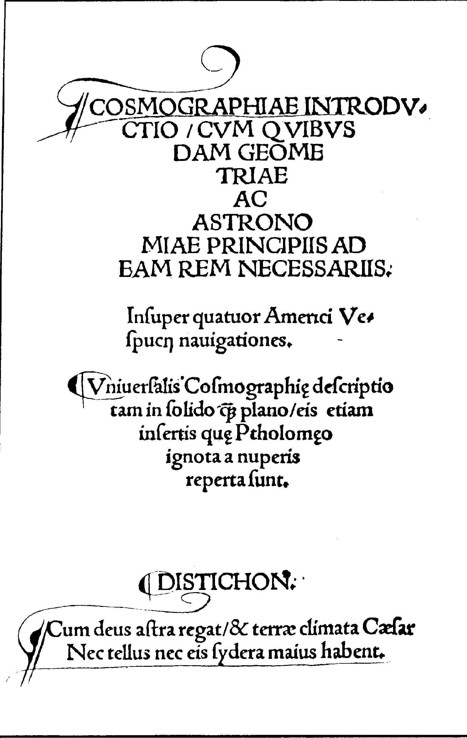
| Cosmographiae Introductio Matthias Ringmann and Martin Waldseemuller, Gymnasium Vosagense, Saint-Die | The companion book issued with the map and the gores in 1507; contains the naming argument for America Part of the same three-piece 1507 release as the gores. | Multiple copies survive in institutional collections, including one at the University Library, Munich (Cim. 74) |
| Globe gores, University of Minnesota exemplar Martin Waldseemuller | A genuine sibling set of the gores, from the earlier printing tradition Bought by James Ford Bell in 1954 from Prince Johann II von und zu Liechtenstein, whose family had acquired it in 1883 with the estate of Field Marshal Lieutenant Franz Ritter von Hauslab. | James Ford Bell Library, University of Minnesota |
| Globe gores, Offenburg exemplar Martin Waldseemuller | A genuine sibling set of the gores, from the earlier printing tradition Found in 1993 by the librarian Vera Sack, sewn into an edition of Aristotle's Ethica Nicomachea printed at Freiburg in 1541. Reported to have survived a city fire of 1689 and two world wars. | Historical Library, Offenburg (displayed at the Museum im Ritterhaus) |
| Globe gores, Bavarian State Library sheet Attributed to Waldseemuller; now discredited | Once counted as a genuine sibling set; confirmed a twentieth-century forgery in 2018 Acquired in 1990 bound into a genuine 1486 Ptolemy incunable. Ink analysis found a titanium-bearing pigment not manufactured before the twentieth century. A different institution from the University Library of the Ludwig-Maximilians-Universitat, which holds the object in this record. | Bayerische Staatsbibliothek, Munich |
| Globe gores, Christie's / Charles Frodsham sheet Attributed to Waldseemuller; strongly suspected forgery | Offered at auction in 2005; found identical in every detail to the discredited Bavarian State Library sheet Estimated EUR 690,000 to 1,000,000. The comparison between this lot and the Bavarian sheet triggered the forgery investigation. | Formerly Charles Frodsham and Co. Ltd.; offered at Christie's, London, 8 June 2005, lot 97 |
| Celestial and terrestrial globe gores of 1515 and 1517 Johann Schoner | A different cartographer's globe gores, bound into the same Schoner Sammelband portfolio as Waldseemuller's wall maps Not Waldseemuller's work. Listed here specifically to prevent the two from being confused, since they were bound together historically and both involve the word globe gores. | Jay I. Kislak Collection, Library of Congress |
Open questions
- When did this particular sheet enter the binding it now sits in, and was it already part of the Oberalteich monastery's collection before the 1803 secularisation, or added later at Landshut or in Munich? No source consulted establishes this.
- Who printed this edition of the gores, and where exactly? Typeface and watermark point to Waldseemuller's circle and the Alsace region, but no printer's name or place of printing survives on the sheet.
- How many genuine sets of Waldseemuller's globe gores survive today? This record counts three (Minnesota, Offenburg, Munich) after excluding two now discredited sheets, but this archive's own record for the 1507 wall map cites a higher figure that appears to date from before the 2018 forgery confirmation and may also conflate Johann Schoner's separate globe gores with Waldseemuller's.
- Was this sheet, or either of the other two genuine surviving sets, ever cut out and pasted onto a sphere? No assembled globe made from any surviving printed sheet is known to exist.
- Does the Wikimedia Commons file credited to the Badische Landesbibliothek and used for comparison in this record in fact depict the Offenburg exemplar? The file's own description page does not name the holding institution directly, and this record has not independently confirmed the identification.
- What was Waldseemuller's exact reasoning for revising Madagascar's outline on this edition while apparently leaving other geography from the earlier gores largely unchanged? The change is documented; the workshop's decision-making behind it is not.
Questions about this object
What is Waldseemuller's Globe Gores?
Waldseemuller's Globe Gores is a map, dated after 1507, most likely before 1513; a distinct, previously unrecorded edition, not the original 1507 printing. Medium: Woodcut with letterpress text on a single sheet of paper, printed as twelve tapering gores meant to be cut out and pasted onto a sphere.
Who made Waldseemuller's Globe Gores, and is the attribution settled?
The attribution to Martin Waldseemuller is recorded here as accepted. The design is accepted as belonging to Martin Waldseemuller's project at Saint-Die, on typeface and content grounds: the lettering used for the phrase Diameter Globi at the foot of the sheet matches the typeface Waldseemuller used in the Cosmographiae Introductio and on his 1507 and 1516 wall maps. But this particular printed sheet, held at the University Library of the Ludwig-Maximilians-Universitat in Munich, is not from the 1507 printing. It was pulled from an entirely different woodblock than the one used for the four other genuine sets known before it was found, and the printer's name does not survive on it. It is best described as an unrecorded, later edition of the gores produced within Waldseemuller's own circle, not as a copy of the first edition.
Where is Waldseemuller's Globe Gores now?
Universitatsbibliothek der Ludwig-Maximilians-Universitat, Munich (LMU Munich University Library), Rare Books and Manuscripts Department. Inventory number Cim. 107#2 (also cited as 2 Math. 499#2). Last confirmed 30 August 2026. Held in the library's early holdings; recognised as a genuine, previously unrecorded set of Waldseemuller's globe gores in 2012 during routine cataloguing of a bound volume of geometrical texts. The library has held the physical volume for close to two centuries without anyone identifying its contents.
What is still unknown about Waldseemuller's Globe Gores?
When did this particular sheet enter the binding it now sits in, and was it already part of the Oberalteich monastery's collection before the 1803 secularisation, or added later at Landshut or in Munich? No source consulted establishes this.
Sources
- 1Chet Van Duzer, 'Details, Date, and Significance of the Fifth Set of Waldseemuller's Globe Gores Recently Discovered in the Munich University Library' (2012). razoncartografica.com/wp-content/...
- 2Irmela von der Osten, 'Cim. 107-2 (= 2 Math. 499#2): Globussegmentkarte von Martin Waldseemuller nach 1507,' prepared for the Munich Historikertag 2021, Universitatsbibliothek der LMU Munchen. historikertag.de/Muenchen2021/...
- 3Universitatsbibliothek der LMU Munchen, digitised catalogue record for '[Globensegmente],' Cim. 107#2, urn:nbn:de:bvb:19-epub-13138-6. epub.ub.uni-muenchen.de/13138
- 4science.ORF.at, 'Wertvolle Waldseemueller-Karte entdeckt' (3 July 2012). sciencev2.orf.at/stories/...
- 5Medievalists.net, '500 year old map of America discovered in Munich' (2012). medievalists.net/2012/...
- 6International League of Antiquarian Booksellers (ILAB), '500 year old Waldseemuller map found at the Munich University Library.' ilab.org/article/...
- 7Bayerische Staatsbibliothek, press statement, 'Bavarian State Library confirms that its own Waldseemueller globe gores map is a forgery,' Munich. bsb-muenchen.de/en/...
- 8Stadtanzeiger Ortenau, 'Christie's stoppt Auktion historischer Weltkarte: Die Eine-Million-Euro-Karte,' on the 2005 Christie's lot and its later exposure as a forgery. stadtanzeiger-ortenau.de/offenburg-stadt/...
- 9Stadtanzeiger Ortenau, on the Offenburg exemplar of the globe gores, found in 1993 by the librarian Vera Sack sewn into an edition of Aristotle's Ethica Nicomachea printed at Freiburg in 1541. stadtanzeiger-ortenau.de/offenburg-stadt/...
- 10James Ford Bell Library, University of Minnesota, 'At the Bell,' on the Bell Library's set of the gores and its provenance through the princely House of Liechtenstein. apps.lib.umn.edu/bell/...
- 11Library of Congress, 'Schoner Sammelband,' Exploring the Early Americas exhibition, and the Library's catalogue entries for Johann Schoner's own celestial and terrestrial globe gores of 1515 and 1517 in the Jay I. Kislak Collection. Automated fetch of loc.gov is blocked by a Cloudflare bot-check; content confirmed through search-engine caching and secondary citation, not read directly by this desk. loc.gov/exhibits/...
- 12Wikimedia Commons, file information for 'Waldseemuller Globensegmente Cim107-2.jpg,' source Universitatsbibliothek Munchen. commons.wikimedia.org/wiki/...
- 13Wikimedia Commons, file information for 'Waldseemuller-Globus.jpg,' source Badische Landesbibliothek. commons.wikimedia.org/wiki/...


Last verified · Published
Change log
30 August 2026 - Record created at the house standard: researched narrative, technical evidence, maker dossier, graded provenance chain, prices with hammer and premium separated, related works, open questions and sources.