The Vinland Map
Unidentified maker (probable modern forger) · Uncertain. The parchment itself radiocarbon-dates to circa 1411-1468 and is genuinely medieval. The ink and drawing on it were added later: they copy specific errors found only in an 18th-century (1782 or 1783, sources differ) facsimile reprint of Andrea Bianco's 1436 world map, which sets a firm earliest possible date, and the ink's titanium dioxide pigment (anatase) was not manufactured in its synthetic rounded form before roughly the 1920s. A chemical wash or coating applied to the parchment has also been read as bearing trace fallout markers that would place that treatment no earlier than the early 1950s. Yale's working position since 2021 is that the map was drawn in the 20th century on a genuine but unrelated piece of 15th-century parchment.
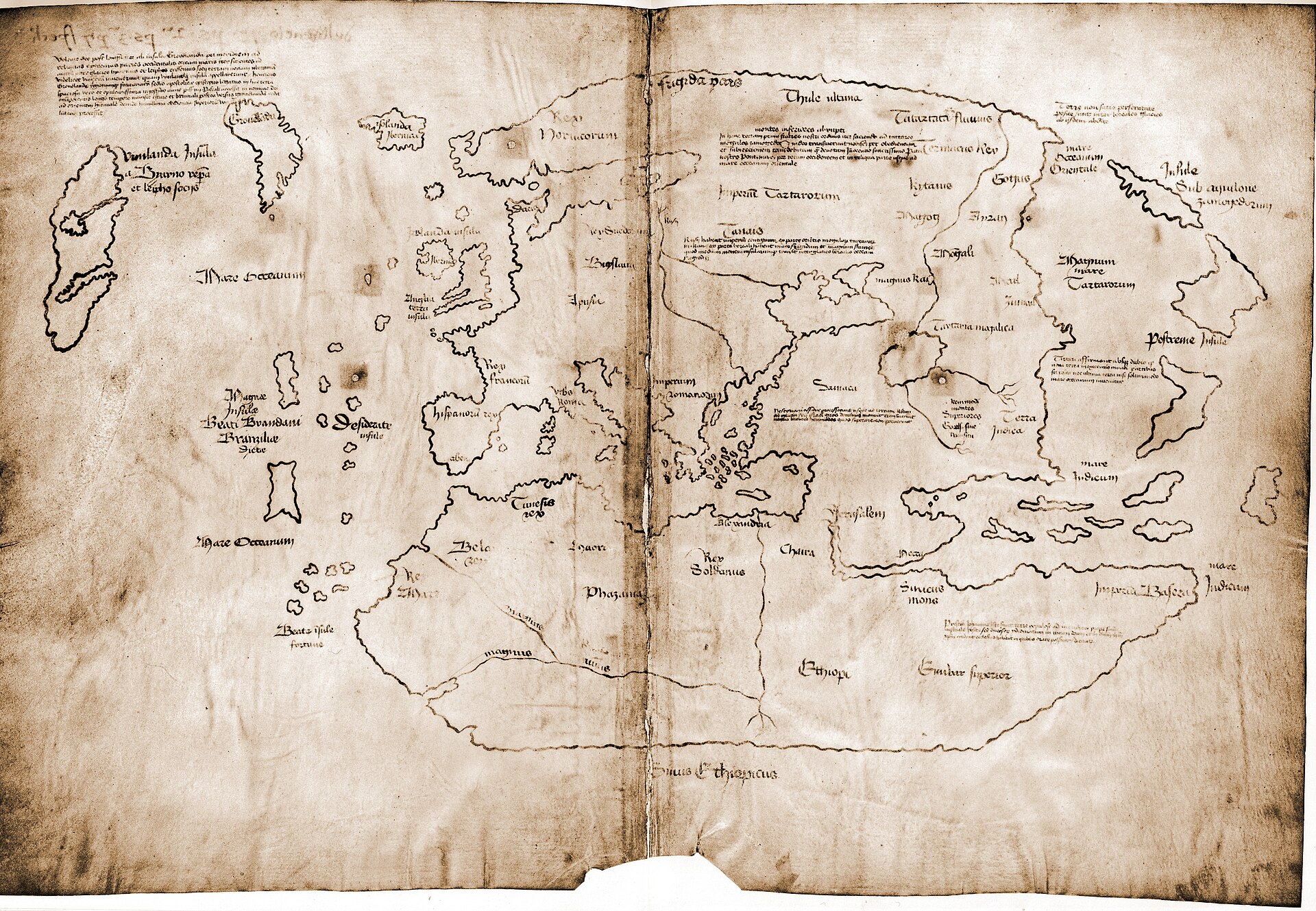
The full map as bound, showing Europe, Africa, Asia and, in the lower left, the landmass labelled Vinlanda Insula. Yale's own 2021 analysis found this ink pervaded throughout with a titanium compound not manufactured before the 1920s.
| Artist | Unidentified maker (probable modern forger) |
|---|---|
| Date | Uncertain. The parchment itself radiocarbon-dates to circa 1411-1468 and is genuinely medieval. The ink and drawing on it were added later: they copy specific errors found only in an 18th-century (1782 or 1783, sources differ) facsimile reprint of Andrea Bianco's 1436 world map, which sets a firm earliest possible date, and the ink's titanium dioxide pigment (anatase) was not manufactured in its synthetic rounded form before roughly the 1920s. A chemical wash or coating applied to the parchment has also been read as bearing trace fallout markers that would place that treatment no earlier than the early 1950s. Yale's working position since 2021 is that the map was drawn in the 20th century on a genuine but unrelated piece of 15th-century parchment. |
| Medium | Ink (a black carbon overlay on a yellow anatase-bearing line, bound in a collagen/gelatin medium) drawn onto a genuine 15th-century parchment bifolium |
| Dimensions | 27.8 x 41.0 cm parchment sheet, folded to form a bifolium of two conjoined leaves, each carrying half the map |
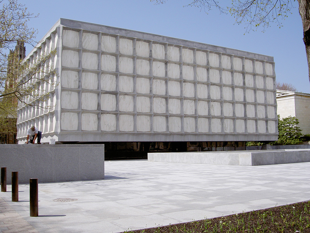
| Where it is now | Beinecke Rare Book and Manuscript Library, Yale University, New Haven, Connecticutlast confirmed |
| Inventory number | Beinecke MS 350A (the map, bound with the Tartar Relation / Hystoria Tartarorum); the companion Speculum Historiale fragment held separately as Beinecke MS 350 |
| Attribution | DisputedPresented at its unveiling in 1965 as a genuine circa-1440 Norse-era world map. Full note |
| Object type | Map |
| Period | Claimed at unveiling: International Gothic, circa 1440. Current assessment: 20th-century forgery on a genuine circa-1411-1468 parchment support. |
| Cases | Disputed attribution · Has a provenance gap |
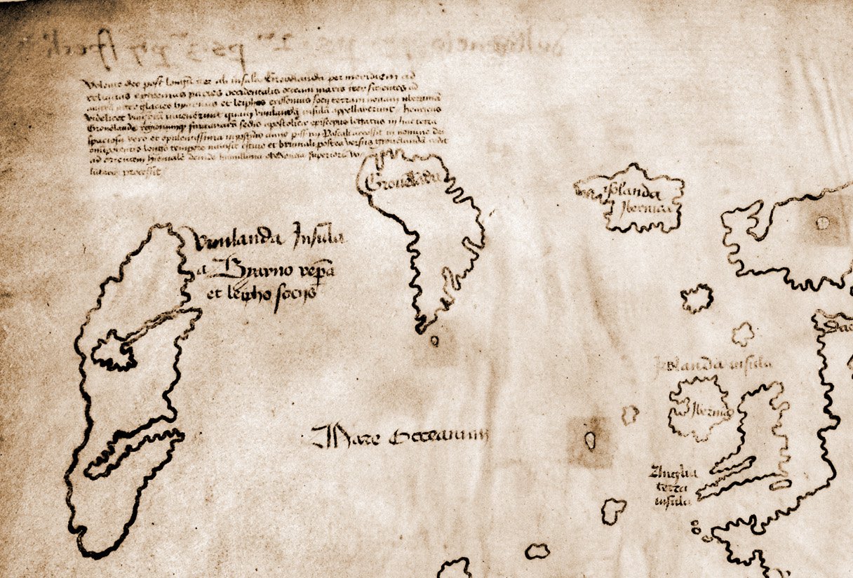
| Inscriptions | The map is captioned in Latin, including the label "Vinlanda Insula" over the landmass in the lower left and text describing the voyage of "Byarnus" (Bjarni) and "Leiphus Erissonius" (Leif Eriksson) in the company of Bishop Eirik Gnupsson. On the reverse (verso), a genuine medieval iron-gall-ink note reading approximately "the second part of the third part of the Speculum" (a binder's shelf note belonging to the authentic Speculum Historiale volume) has been partly overwritten in the same modern, anatase-bearing ink used on the map's front, altering it to read as though it were an instruction for binding the map itself into the volume. |
| Owners on record | 9 links7 documented, 1 disputed, 1 unknown |
| Sources | 25 cited |
About this record Last verified · 25 sources cited · Change log
On this page 9 sections
ContentsClose
A parchment bifolium, 27.8 by 41.0 centimetres, bound since 1957 with a genuine medieval manuscript called the Tartar Relation and drawn with a map that purports to show pre-Columbian Norse exploration of North America under the label Vinlanda Insula. It surfaced through an Italian dealer, Enzo Ferrajoli di Ry, later convicted of stealing manuscripts from a Spanish cathedral library, was bought by a New Haven bookseller, and was quietly financed into Yale's hands by the philanthropist Paul Mellon before its unveiling by Yale University Press on 11 October 1965, one day before Columbus Day, to immediate controversy.
Forgery allegations followed within a decade. Walter McCrone found a modern synthetic pigment, anatase, in the ink in 1974; a UC Davis team led by Thomas Cahill found far less of it in 1985-1987 and reopened the case for authenticity; the argument ran through Analytical Chemistry and other journals for the next twenty years without full resolution, complicated by a genuine 1411-1468 radiocarbon date for the parchment itself, which never settled the separate question of when the ink was applied.
Yale's own conservation science team closed the case, in the university's own view, in 2021: full-sheet elemental mapping found a titanium compound absent from genuine medieval ink pervading every line, and a genuine medieval note on the reverse had been partly overwritten in the same modern ink to fabricate a binding instruction. The map remains at the Beinecke Library, retained now as a documented forgery rather than as evidence of Vinland.
Provenance
Each link is graded. Documented: a cited source supports it. Disputed: the identification is argued but not established. Unknown: no owner for that span, and the gap is not smoothed into a narrative. The grades in the glossary.
- c. 1411 - c. 1468Unknown scriptorium or workshopdocumented
Radiocarbon date range (95 percent confidence) for the parchment sheet itself, established by accelerator mass spectrometry on a trimmed sliver. This dates the animal skin only, not the map drawn on it.12
- - 1892-1893Archdiocese / Cathedral Library of La Seo, Zaragozadocumented
A codex containing the Tartar Relation and a Speculum Historiale fragment was lent by the Archdiocese of Zaragoza to the Exposicion Historico-Europea in Madrid, per a contemporary exhibition catalogue identified by researcher John Paul Floyd. The catalogue makes no mention of a map bound into the volume.14
- c. 1780s at the earliest - 1957Unknownunknown
No documentary trace of the map itself exists before 1957. The map's cartographic model (a facsimile of Andrea Bianco's 1436 world map published in the 1780s) sets the earliest possible date of composition; when between then and 1957 it was drawn, and by whom, and when it was joined to the genuine Zaragoza manuscripts, is not established.14
- c. 1960 - 1965Enzo Ferrajoli di Ry (dealer)disputed
Ferrajoli was convicted 13 October 1964 by the Audiencia Territorial de Zaragoza and sentenced to eight years and one day for theft from La Seo. Published theft chronologies date the wave he was convicted for to approximately 1960-1965, which is difficult to reconcile with his having already sold the Vinland volume in 1957; at least one Spanish-language source instead places the thefts generally across the postwar period through the late 1950s. This record does not resolve the conflict.1517
- 1957 - 1957Enzo Ferrajoli di Ry, offered via the London dealer Irving Davisdocumented
Ferrajoli brought the bound Map-and-Tartar-Relation volume to London in summer 1957 and offered it to the British Museum, which declined to purchase it, partly on the grounds that the map's wormholes did not appear to align with those of the Tartar Relation.115
- 1957 - 1957Laurence C. Witten II (dealer)documented
Witten bought the bound volume from Ferrajoli for 3,500 dollars and brought it to New Haven, offering it to Yale, his alma mater, in October 1957. Witten later admitted (1974, published 1989) that he had misrepresented aspects of the acquisition and had never independently verified Ferrajoli's account of the volume's source.116
- 1958 - 1958Thomas E. Marston (Yale curator), acquiring the Speculum Historiale fragmentdocumented
Marston bought a damaged Speculum Historiale fragment (books 21-24) independently, then identified matching wormholes with the map and Tartar Relation, the basis for the three-volume claim. The price paid, and whether it was covered by the same Mellon funding as the map purchase, is not consistently reported in the sources consulted.1
- 1958 - 1965Paul Mellon (philanthropist, anonymous purchaser and prospective donor)documented
Mellon financed the purchase, reported at approximately 300,000 dollars, on condition the object's existence remain secret until a scholarly book vindicating it had been completed, a condition that limited outside expert consultation during the authentication process.1
- 1965 - presentYale University, Beinecke Rare Book and Manuscript Librarydocumented
Mellon's gift was announced 11 October 1965 with publication of The Vinland Map and the Tartar Relation (Skelton, Marston and Painter), one day before Columbus Day, producing immediate controversy including protest from Italian-American communities and reaction in Italy. Yale has held the object continuously since, including through McCrone's 1974 forgery finding, decades of contested countertesting, and its own 2021 conservation science determination that the map is a modern forgery. Its only documented exhibition outside New Haven was a loan to the Mystic Seaport Museum, Connecticut, May-October 2018.12320
Technical evidence
| Attribution note | Presented at its unveiling in 1965 as a genuine circa-1440 Norse-era world map. Yale's own conservation science department declared it a modern forgery in 2021 after decades of contested chemical testing, and this is now the holding institution's official position and the overwhelming consensus of the published literature. A minority of scientists (Thomas Cahill in the 1980s, Jacqueline Olin and Garman Harbottle into the 2000s) published peer-reviewed work arguing the ink evidence was consistent with a medieval origin. That minority position has not been withdrawn in print, which is why this record grades attribution disputed rather than simply closed, even though the weight of evidence and the institution's own current judgment fall entirely on the forgery side. |
|---|---|
| Support | Single parchment sheet, folded to a bifolium of two conjoined leaves, 27.8 x 41.0 cm overall.112 |
| Parchment radiocarbon date | AD 1434 plus or minus 11 years (95 percent confidence range approximately AD 1411-1468), by accelerator mass spectrometry on a sliver of the parchment itself. The parchment is genuinely medieval; this date says nothing about when the ink was applied.12 |
| Ink line structure | Each drawn line is built from two superimposed layers: an underlying yellowish line and a black line on top, rather than a single iron-gall stroke that has discoloured with age.1 |
| McCrone analysis, 1974 | Polarised light microscopy, electron microscopy and X-ray diffraction of nanogram ink flakes found the yellow line to contain rounded synthetic anatase (titanium dioxide) crystals approximately 0.3 microns across, estimated at 5-45 percent of the ink's inorganic content by weight. That crystalline form was not manufactured commercially before a 1917 patent.61 |
| Cahill PIXE analysis, 1985-1987 | 159 particle-induced X-ray emission analyses at UC Davis found titanium at a maximum of about 10 nanograms per square centimetre (roughly 0.006 percent by weight), argued by the team to be consistent with a natural trace impurity rather than deliberate pigment. Contested on sampling-method grounds by Kenneth Towe and by Walter McCrone.71 |
| Raman spectroscopy, 2002 | Brown and Clark (UCL) confirmed anatase present as rounded particles about 0.15 microns across, a morphology read as characteristic of synthetic manufacture from the 1920s onward, with the overlying black line identified as ordinary soot-type carbon.8 |
| Yale macro-XRF/Raman/FE-SEM analysis, 2021 | Full-sheet elemental mapping found titanium with smaller amounts of barium pervasive in every inked line, and iron, sulfur and copper (the expected iron-gall ink markers) essentially absent throughout.23 |
| Ink binder | Identified by McCrone's later analysis as a collagen/gelatin medium, consistent with an animal-skin-derived binder rather than the gum or plant binders typical of period iron-gall recipes.6 |
| Cartographic source | The map's outline reproduces errors specific to an 18th-century (1782 or 1783, sources differ) printed facsimile of Andrea Bianco's 1436 world map rather than to Bianco's original, identified by researcher John Paul Floyd. If correct, this sets the earliest possible date of composition in the 1780s.14 |
| Wormhole matching | Wormholes in the map, the Speculum Historiale fragment and the Tartar Relation were reported in 1958 to align, supporting a claim that all three were once bound as one volume. Disputed by a 1967 British Museum examination (uncertain the map's two parchment halves were ever one sheet) and a circa-2004 Danish study finding imprecise alignment between the map and the Tartar Relation specifically.1 |
| Verso inscription | A genuine medieval iron-gall-ink binder's note on the reverse, reading approximately "the second part of the third part of the Speculum," was partly overwritten in the same modern titanium-bearing ink used on the map, altering it to resemble a binding instruction referencing the map itself. Read by the 2021 Yale team as direct evidence of intent to deceive.23 |
| Shelfmarks | Beinecke MS 350A: the Vinland Map bound with the Tartar Relation (Hystoria Tartarorum). Beinecke MS 350: the separately catalogued Speculum Historiale fragment (books 21-24).19 |
Images
The record in full
Chapter 1What the object physically is
A single sheet of parchment, 27.8 by 41.0 centimetres, folded down the middle to form a bifolium of two conjoined leaves.
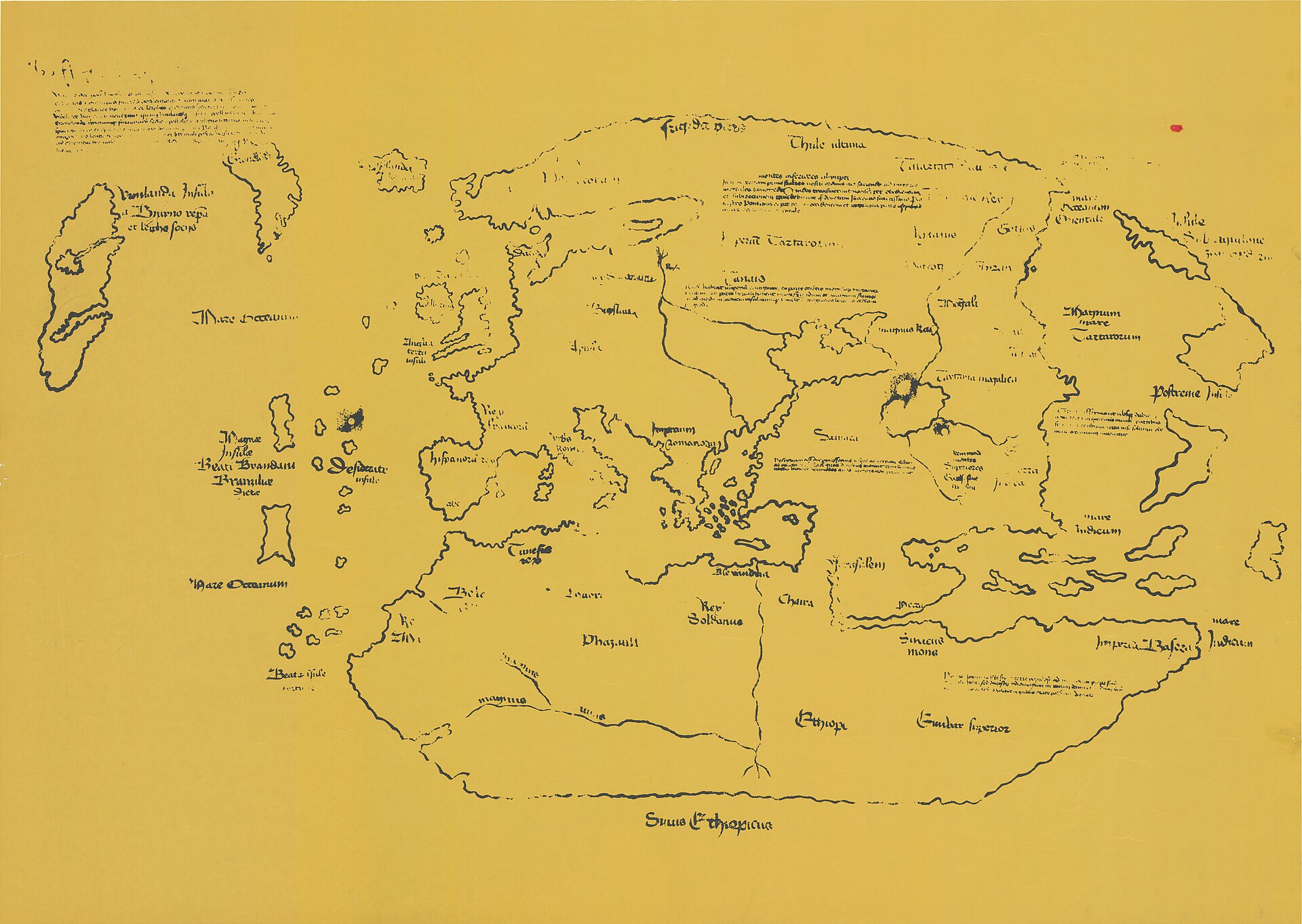
A single sheet of parchment, 27.8 by 41.0 centimetres, folded down the middle to form a bifolium of two conjoined leaves. Drawn across both leaves in a brownish-black ink is a world map: Europe, Africa and Asia in a recognisably late-medieval outline, and, isolated in the lower left beyond a stretch of open sea, a landmass labelled Vinlanda Insula, Island of Vinland, with a Latin caption crediting its discovery to Bjarni and Leif Eriksson travelling in company with a bishop.
The sheet is not a standalone object. It is bound, and has been since it first surfaced, with a genuine mid-15th-century paper manuscript called the Tartar Relation, a first-hand account of a 1245-1247 Franciscan mission into the Mongol Empire. That companion text is not in question; its authenticity has never been seriously disputed. What is in question is only the map drawn on the parchment bound in front of it.
Chapter 2How it surfaced, 1957
In the summer of 1957 an Italian-born dealer, Enzo Ferrajoli di Ry, brought the bound Map-and-Tartar-Relation volume to London and, through the London bookseller Irving Davis, offered it to the...
In the summer of 1957 an Italian-born dealer, Enzo Ferrajoli di Ry, brought the bound Map-and-Tartar-Relation volume to London and, through the London bookseller Irving Davis, offered it to the British Museum. The Museum's map department examined it and declined to buy, partly because the wormholes running through the map's parchment did not appear to line up with the wormholes in the Tartar Relation paper bound behind it, a mismatch that read, at the time, as evidence the two items had not always been bound together.
Ferrajoli then sold the volume, for 3,500 dollars, to the New Haven rare-book dealer Laurence C. Witten II, a Yale alumnus who had been buying aggressively in Europe while the dollar was strong. Witten brought it back to New Haven and, in October 1957, offered it to his own alma mater.
Chapter 3The Zaragoza connection, and what it does and does not corroborate
For decades, Ferrajoli's own account of where the volume had come from went essentially unverified: Witten later admitted he had never been shown documentation and had simply trusted a dealer who...
For decades, Ferrajoli's own account of where the volume had come from went essentially unverified: Witten later admitted he had never been shown documentation and had simply trusted a dealer who said he knew the source but had promised not to name it.
In the 2010s the researcher John Paul Floyd traced part of the answer. He located a catalogue from the 1892-1893 Exposicion Historico-Europea in Madrid recording that the Archdiocese of Zaragoza had lent a codex containing the Tartar Relation and a fragment of Vincent of Beauvais's Speculum Historiale for display. Separately, it is documented that between roughly 1960 and 1965 a series of thefts stripped some 583 books, codices and manuscripts from the library of La Seo cathedral in Zaragoza, and that Ferrajoli, convicted in October 1964 and sentenced to eight years and one day, was responsible for around 110 of them.
This corroborates a real, pre-1957 institutional home for the Tartar Relation and the Speculum fragment. It does not corroborate one for the map. Floyd's 1892-1893 exhibition catalogue describes the codex without any mention of a map bound into it. Whatever else is true, the map itself has no documented existence anywhere before the moment Ferrajoli produced it in 1957, and the published theft chronology for La Seo, if the 1960-1965 dating is accurate, does not obviously accommodate a 1957 sale in the first place. That contradiction has never been resolved in print and this record does not attempt to resolve it either; it is recorded honestly in the open questions below.
Chapter 4The Speculum Historiale and the three-volume claim
Suspicion cooled somewhat in early 1958, when the Yale curator Thomas Marston, working independently, bought from the same London dealer, Irving Davis, a separate and by itself unremarkable damaged...
Suspicion cooled somewhat in early 1958, when the Yale curator Thomas Marston, working independently, bought from the same London dealer, Irving Davis, a separate and by itself unremarkable damaged manuscript: books 21 to 24 of Vincent of Beauvais's Speculum Historiale, a standard medieval encyclopaedic history. Marston noticed that its wormholes matched those in the map and the Tartar Relation, and read this as proof that all three items had once been bound together as a single three-part volume, with the map at the front, the Speculum in the middle, and the Tartar Relation at the back.
That match became one of the central pillars of the case Yale eventually made for authenticity: a forger, the argument ran, would have had no reason to fabricate a matching, genuinely worm-eaten, genuinely medieval Speculum fragment and get it into circulation through an unconnected dealer. The pillar has not held up cleanly. A British Museum examination in 1967 could not confirm that the two halves of the map's own parchment sheet had ever in fact been a single piece rather than two sheets joined along a seam; a Danish study reported around 2004 found that the worm holes in the map and in the Tartar Relation did not align as precisely as the original claim required, suggesting the two had not spent as long stored together as claimed. A separate line of Danish analysis in 2005-2009 concluded the two halves of the map parchment were physically distinct pieces that may or may not once have been joined. None of this proves the three-volume claim false. It does mean the claim is disputed physical evidence, not settled physical evidence, and this record grades it accordingly.
A further, independent piece of evidence works against the Speculum's innocence rather than for it: a surviving photograph of folio 223r of the Speculum manuscript (Beinecke MS 350) shows what the Beinecke Library itself describes as a probable mid-20th-century attempt to remove an ownership stamp from the page before the volume was offered to Yale, a detail that says nothing about the map's ink but says a great deal about how carefully the paper trail around the whole bundle was scrubbed before 1957.
Chapter 5Secrecy, Mellon's money, and the writing of the 1965 book
Yale could not itself afford Witten's asking price.
Yale could not itself afford Witten's asking price. The philanthropist and Yale alumnus Paul Mellon agreed, anonymously, to buy the volume and give it to the university, for a price later reported at around 300,000 dollars, on the condition that its existence be kept secret until a scholarly book vindicating it had been written. Separately, whoever paid for the Speculum Historiale fragment once Marston had identified its connection is reported, in some accounts, to have paid a price in the high six figures approaching a further million dollars, though the sources consulted for this record do not agree on the figure and neither price has been published by Yale itself with full documentation.
The secrecy condition meant the authentication work leading to the 1965 book was conducted by a small, closed team, over roughly seven years, largely insulated from outside specialists who might have raised objections earlier. The book, The Vinland Map and the Tartar Relation, was written by three men: Raleigh Ashlin Skelton, superintendent of the British Museum's map room and the only one of the three with map-specific expertise; Thomas Marston, the Yale curator who had found the Speculum; and George Painter, an assistant keeper of printed books at the British Museum. Yale University Press published it on 11 October 1965, one day before Columbus Day.
Chapter 6The Columbus Day announcement and the backlash
The timing was not lost on anyone. A map purporting to prove Norse Europeans reached North America roughly five centuries before Columbus, released to the press the day before the holiday built...
The timing was not lost on anyone. A map purporting to prove Norse Europeans reached North America roughly five centuries before Columbus, released to the press the day before the holiday built around Columbus's own claim to that distinction, produced immediate and furious protest from Italian-American communities, particularly in New Haven itself, who read the announcement as a calculated diminishment of Columbus and, by extension, of Italian-American heritage. The controversy was not confined to the United States; it registered in the Italian press and in official Italian reaction as well, adding a live diplomatic irritant to what was already, among specialists, an open scholarly argument about whether the map was genuine at all.
Scholarly reviewers of the 1965 book were, from the start, considerably less convinced than its press rollout suggested. Objections to the handwriting, the Latin, and the map's cartographic sources were raised within the first year, well before any chemical testing had taken place.
Chapter 7McCrone and the first anatase finding, 1974
In 1972 Yale itself commissioned an independent chemical examination from Walter McCrone, a Chicago microanalytical chemist, and his wife and collaborator Lucy McCrone.
In 1972 Yale itself commissioned an independent chemical examination from Walter McCrone, a Chicago microanalytical chemist, and his wife and collaborator Lucy McCrone. Working from nanogram-scale flakes of the ink itself, without disturbing the parchment, the McCrones used polarised light microscopy, electron microscopy and X-ray diffraction and found that the map's characteristic yellow line was not iron-gall ink discolouration at all: it contained substantial titanium dioxide in the form of anatase, present as rounded crystals roughly 0.3 microns across and making up, by the McCrones' estimate, somewhere between 5 and 45 percent of the ink's inorganic content by weight. Anatase in that synthetically produced, uniformly rounded crystalline form was not commercially manufactured as a pigment until after a 1917 patent. On 26 January 1974 Yale announced publicly that the map might be a forgery, and the McCrones published their findings that year in the Geographical Journal under the title "The Vinland Map Ink."
The finding did not end the argument. It started the argument that would run, in the pages of Analytical Chemistry and elsewhere, for the next three decades.
Chapter 8The pendulum swings: Cahill's PIXE analysis and its critics, 1985-2008
In 1985-1987 a University of California, Davis team led by the physicist Thomas Cahill, working with Richard Schwab and Bruce Kusko, brought a very different instrument to the question...
In 1985-1987 a University of California, Davis team led by the physicist Thomas Cahill, working with Richard Schwab and Bruce Kusko, brought a very different instrument to the question: particle-induced X-ray emission (PIXE), a non-destructive proton-beam technique capable of detecting trace elements without removing any ink at all. Across 159 separate multielemental analyses, including 33 closely matched ink-and-parchment pairs and fine transects across individual inked lines, Cahill's team reported titanium at a maximum of only about 10 nanograms per square centimetre, on the order of 0.006 percent by weight, a level they argued was consistent with titanium occurring as an ordinary natural trace impurity in medieval iron-gall ink rather than as a deliberately applied modern pigment. Published in Analytical Chemistry in 1987, the result directly contradicted McCrone's figures and reopened the case for authenticity; it was seized on almost immediately by Yale's own George Painter as vindication.
The rebuttal came from several directions. McCrone pointed out that a titanium concentration as low as Cahill's could not physically produce the sharp, well-defined X-ray diffraction pattern McCrone's own team had recorded, which required something closer to 5 percent anatase by weight, not a fraction of one percent. A member of Cahill's own analytical group, Gregory Moller, separately examined loose ink particles recovered from the fold of the map using a different technique and found titanium concentrations far higher than the PIXE transects had reported; Cahill's team did not publish or publicise that finding. The Smithsonian geologist Kenneth Towe, who had begun studying the map's crystal morphology independently in the early 1980s, argued across a series of papers running from 1990 through 2008 that Cahill's non-random, surface-averaged sampling method was the likely source of the discrepancy, and, in a 2004 Analytical Chemistry paper titled "The Vinland Map Ink Is NOT Medieval," directly rebutted a subsequent paper by the Smithsonian's own Jacqueline Olin arguing for a natural, medieval explanation of the anatase (a proposed calcium-oxalate byproduct pathway). The chemist Garman Harbottle continued to argue the authenticity case into the mid-2000s; Towe, working now with Robin Clark and the historian Kirsten Seaver, published a direct point-by-point rebuttal of Harbottle's reasoning in Archaeometry in 2008, titled, pointedly, "Analysing the Vinland Map: A Critical Review of a Critical Review."
Chapter 9Raman spectroscopy and the parchment's own, genuine, date
Two further results in 2002 pulled the evidence in opposite directions at once, and both were real.
Two further results in 2002 pulled the evidence in opposite directions at once, and both were real. Katherine Brown and Robin Clark at University College London examined the ink with Raman microprobe spectroscopy, a technique that had not been available to McCrone or Cahill, and confirmed the presence of anatase in rounded particles about 0.15 microns across, a size and shape Clark judged characteristic of synthetic titanium dioxide manufacture from the 1920s onward rather than any known natural or medieval source; the black overlying line, they found, was ordinary soot-type carbon. Clark restated the forgery conclusion even more bluntly in a follow-up 2004 Analytical Chemistry piece titled "The Vinland Map, Still a 20th Century Forgery."
In the same year, a separate team, Douglas Donahue of the University of Arizona working with Jacqueline Olin and Garman Harbottle, used accelerator mass spectrometry on a sliver trimmed from the parchment itself, not the ink, and dated the skin to 1434 AD plus or minus 11 years, a 95 percent confidence range of roughly 1411 to 1468. That result, published in Radiocarbon in 2002, is not in dispute and never has been: the parchment is genuinely medieval. It simply answers a different question than the ink chemistry does. A map can be drawn in the 20th century on a real 15th-century skin, and the accumulating evidence increasingly suggested that was exactly what had happened.
Chapter 10What the map actually copied
Separately from any chemistry, John Paul Floyd made a cartographic discovery that, if it holds, is close to dispositive on its own.
Separately from any chemistry, John Paul Floyd made a cartographic discovery that, if it holds, is close to dispositive on its own. Comparing the Vinland Map's outline of Europe and the North Atlantic against known genuine 15th-century portolan charts, Floyd found the closest match was not to the 1436 world map of the Venetian cartographer Andrea Bianco itself, but specifically to a printed facsimile reproduction of Bianco's map published in the 1780s. The Vinland Map, Floyd showed, reproduces particular errors and idiosyncrasies that exist only in that 18th-century facsimile and not in Bianco's original. If the identification is correct, whoever drew the Vinland Map could not have done so before that facsimile existed, which places the earliest possible date of composition in the 1780s at best, and makes a genuine 1440s origin impossible regardless of what the ink chemistry shows.
Chapter 11Yale's 2021 verdict and the altered inscription
In 2018 Yale's own conservation science staff, led by the scientist Richard Hark, began a full non-destructive re-examination of the map, and by 2021 a team that included the conservators...
In 2018 Yale's own conservation science staff, led by the scientist Richard Hark, began a full non-destructive re-examination of the map, and by 2021 a team that included the conservators Marie-France Lemay and Paula Zyats, the Technical Studies Laboratory director Aniko Bezur, Hark, the conservation scientists Pablo Londero and Marcie Wiggins, and the curator Raymond Clemens had completed it, using macro X-ray fluorescence mapping, Raman microscopy, field-emission scanning electron microscopy and infrared imaging across the entire sheet rather than isolated sample points. Every inked line on the map, Yale announced, carried titanium along with smaller amounts of barium, and carried almost no iron, sulfur or copper, the elements that should dominate any genuine iron-gall ink and are essentially absent here.
The team's most consequential single finding was on the back of the sheet, not the front. A short, genuine, iron-gall-ink note in a medieval hand on the verso, reading approximately "the second part of the third part of the Speculum," a binder's shelf note that belongs to the authentic Speculum Historiale and would only make sense on a page that had once sat inside that book, had been partially overwritten in the same modern, titanium-bearing ink used to draw the map itself, altering the note so that it reads as an instruction for binding the map into the volume. Richard Hark called that "pretty strong evidence of a motive to deceive, to make the map look like something it is not," and Raymond Clemens told the press flatly: "The Vinland Map is a fake. There is no reasonable doubt here. This new analysis should put the matter to rest." As of the sources consulted for this record, the 2021 findings had been released through Yale's own communications channels and a public symposium, with the team stating an intention to publish full results in peer-reviewed journals; no such peer-reviewed paper reporting the 2021 dataset had been located during this research.
Chapter 12Custody, exhibition, and where the object stands now
Yale has held the volume continuously since 1965 at the Beinecke Rare Book and Manuscript Library, and it has almost never left.
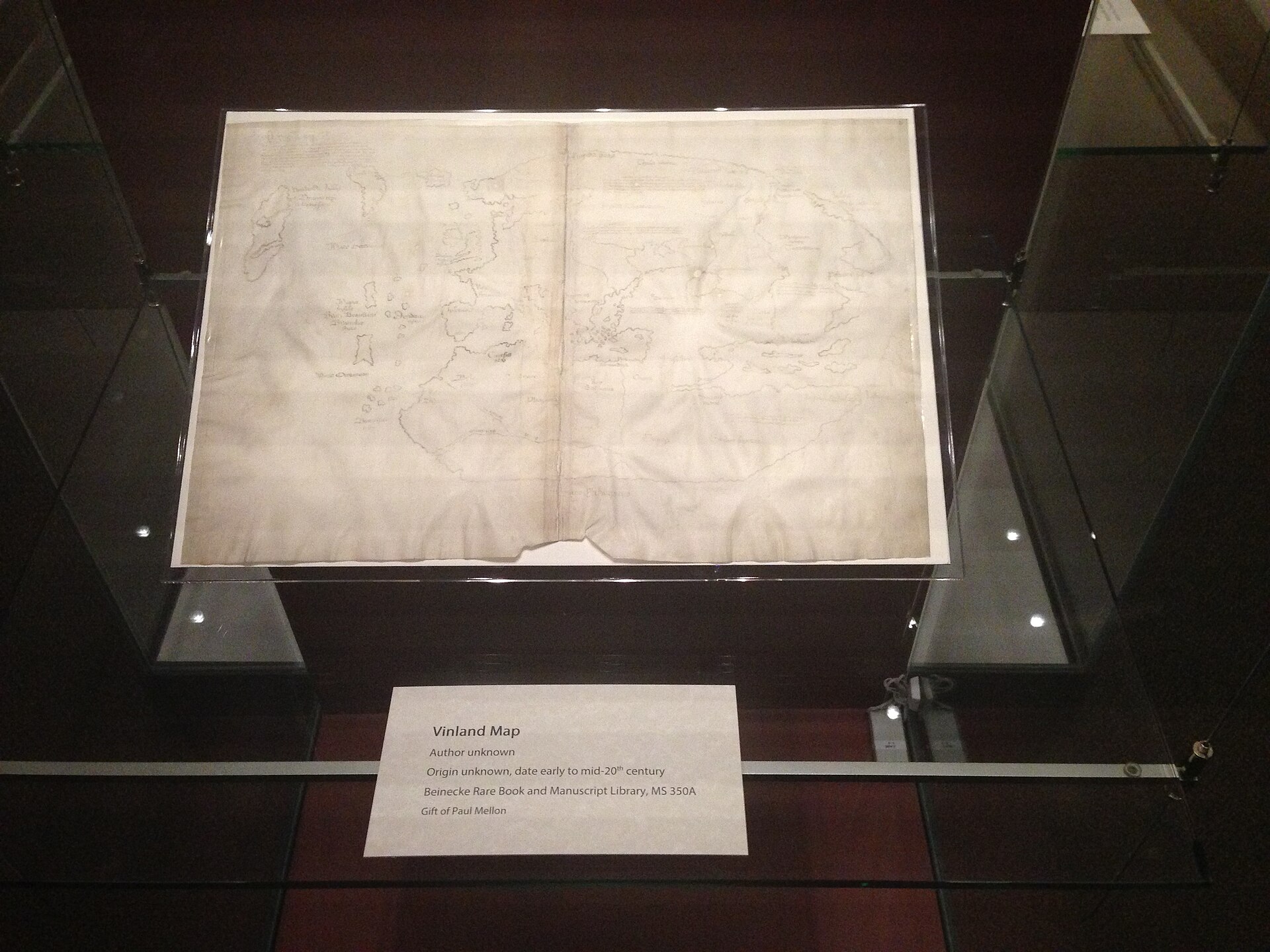
Yale has held the volume continuously since 1965 at the Beinecke Rare Book and Manuscript Library, and it has almost never left. Its only documented public exhibition outside New Haven was a loan to the Mystic Seaport Museum in Connecticut from May through October 2018, publicised at the time as the map's first public display in the United States outside New Haven in more than fifty years. Insurance valuations reported over the object's history have varied enormously with the state of the authenticity argument: over 750,000 dollars in the 1960s, and a claimed 25,000,000 dollars by 1996, near the peak of the case for authenticity.
Yale has not deaccessioned the map since declaring it a forgery. Clemens has said publicly that it will remain in the collection as, in effect, a historical object in its own right: not evidence of Norse America, but a document of one of the twentieth century's most consequential and most thoroughly investigated forgeries, still bound to a genuine medieval manuscript it was made to ride alongside.
The artist
Unidentified. No forger has ever been named on documentary evidence.
There is no maker's name attached to this object in any credible sense. The map was presented in 1965 as the anonymous work of an unknown 15th-century cartographer, a claim the accumulated chemistry no longer supports. What can be said instead is what the physical evidence constrains: when the map could earliest have been drawn, what its maker had access to, and which named candidate has been proposed and why that candidate does not fit the timeline.
Related works
| Work | Relation | Where it is |
|---|---|---|
| Hystoria Tartarorum (the Tartar Relation) Anonymous 13th-century compiler, C. de Bridia (attributed) | Genuine medieval companion manuscript bound with the map since 1957; its authenticity is not in dispute An account of the 1245-1247 Franciscan mission of Giovanni da Pian del Carpine into the Mongol Empire. | Beinecke Rare Book and Manuscript Library, Yale University (MS 350A) |
| Speculum Historiale (fragment, books 21-24) Vincent of Beauvais (compiler), copyist unrecorded | Companion manuscript acquired separately in 1958; its matching wormholes were the basis for the disputed three-volume binding claim A folio of this manuscript (223r) shows a probable mid-20th-century attempt to remove an ownership stamp before the item was offered to Yale. | Beinecke Rare Book and Manuscript Library, Yale University (MS 350) |
| World map of 1436 (and its 18th-century facsimile) Andrea Bianco (original); unidentified 18th-century engraver (facsimile) | Proposed direct cartographic model. The Vinland Map is argued to copy errors unique to a printed facsimile of Bianco's map published in the 1780s, not to Bianco's original If the model identification holds, it sets the earliest possible date the Vinland Map could have been drawn. | Biblioteca Nazionale Marciana, Venice (Bianco's original) |
Open questions
- Who actually drew the map? No forger has been identified on documentary evidence. Kirsten Seaver's candidate, Josef Fischer, died in 1944, apparently before a chemical intervention on the parchment datable no earlier than the early 1950s.
- Where was the map itself before 1957? John Paul Floyd's 1892-1893 exhibition catalogue documents a pre-1957 Zaragoza home for the Tartar Relation and Speculum Historiale fragment, but records no map bound with them. The map has no documented existence before Ferrajoli produced it.
- How does Ferrajoli's 1957 sale of the volume square with published theft chronologies for La Seo cathedral that date the thefts he was convicted of to 1960-1965, after the sale? This chronological tension is unresolved in the sources consulted.
- What exactly did Laurence Witten lie about in his 1974/1989 confession, beyond the general admission that he misrepresented the acquisition? The specifics of what was fabricated in his original account have not been fully published.
- Was the map ever genuinely bound with the Tartar Relation and Speculum Historiale as claimed in 1958, or was it introduced into an already-existing genuine two-volume Zaragoza set? The wormhole match that founded the three-volume claim has been disputed by later physical examinations.
- What price did Yale, via Paul Mellon, actually pay for the Speculum Historiale fragment specifically? Sources report figures from roughly 300,000 dollars (sometimes cited as covering the whole acquisition) to a separate sum in the high six figures approaching a million dollars, without agreement.
- Has Yale's 2021 elemental analysis been published as a peer-reviewed paper? At the time of the announcement the team stated an intention to publish in scholarly and cartographic journals; no such peer-reviewed paper reporting that dataset was located during this research.
- What became of Enzo Ferrajoli after his release from prison? He is reported to have died in Switzerland within a few years, but at least one source treats that account as possibly fabricated.
- Does a current, itemised insurance valuation exist for the object now that Yale has declared it a forgery, and if so, on what basis is a proven forgery still valued for insurance purposes?
Questions about this object
What is The Vinland Map?
The Vinland Map is a map, dated uncertain. The parchment itself radiocarbon-dates to circa 1411-1468 and is genuinely medieval. The ink and drawing on it were added later: they copy specific errors found only in an 18th-century (1782 or 1783, sources differ) facsimile reprint of Andrea Bianco's 1436 world map, which sets a firm earliest possible date, and the ink's titanium dioxide pigment (anatase) was not manufactured in its synthetic rounded form before roughly the 1920s. A chemical wash or coating applied to the parchment has also been read as bearing trace fallout markers that would place that treatment no earlier than the early 1950s. Yale's working position since 2021 is that the map was drawn in the 20th century on a genuine but unrelated piece of 15th-century parchment.. Medium: Ink (a black carbon overlay on a yellow anatase-bearing line, bound in a collagen/gelatin medium) drawn onto a genuine 15th-century parchment bifolium.
Who made The Vinland Map, and is the attribution settled?
The attribution to Unidentified maker (probable modern forger) is recorded here as disputed. Presented at its unveiling in 1965 as a genuine circa-1440 Norse-era world map. Yale's own conservation science department declared it a modern forgery in 2021 after decades of contested chemical testing, and this is now the holding institution's official position and the overwhelming consensus of the published literature. A minority of scientists (Thomas Cahill in the 1980s, Jacqueline Olin and Garman Harbottle into the 2000s) published peer-reviewed work arguing the ink evidence was consistent with a medieval origin. That minority position has not been withdrawn in print, which is why this record grades attribution disputed rather than simply closed, even though the weight of evidence and the institution's own current judgment fall entirely on the forgery side.
Where is The Vinland Map now?
Beinecke Rare Book and Manuscript Library, Yale University, New Haven, Connecticut. Inventory number Beinecke MS 350A (the map, bound with the Tartar Relation / Hystoria Tartarorum); the companion Speculum Historiale fragment held separately as Beinecke MS 350. Last confirmed 13 August 2026. Continuous Yale custody since Paul Mellon's 1965 gift. Retained by Yale after its own 2021 forgery finding as a documented object of study rather than deaccessioned or withdrawn from the collection.
What is still unknown about The Vinland Map?
Who actually drew the map? No forger has been identified on documentary evidence. Kirsten Seaver's candidate, Josef Fischer, died in 1944, apparently before a chemical intervention on the parchment datable no earlier than the early 1950s.
Sources
- 1Wikipedia, 'Vinland Map'. en.wikipedia.org/wiki/...
- 2Yale University Library, 'Beinecke Library's Vinland Map determined to be a fake' (2021). library.yale.edu/news/...
- 3Yale News, 'Analysis unlocks secret of the Vinland Map -- it's a fake' (1 September 2021). news.yale.edu/2021/...
- 4NPR, 'Vinland Map, Thought To Be The Oldest Map Of America, Is Officially A Fake' (30 September 2021). npr.org/2021/...
- 5Smithsonian Magazine, 'Vinland Map Identified as 20th-Century Forgery'. smithsonianmag.com/history/...
- 6McCrone Research Institute, 'The Vinland Map' (case history of Walter McCrone's 1972-1974 analysis). mccroneinstitute.org/research/...
- 7Cahill, T.A., Schwab, R.N., Kusko, B.H. et al., 'The Vinland Map, Revisited: New Compositional Evidence on Its Inks and Parchment', Analytical Chemistry 59(6), 1987, pp. 829-833. pubs.acs.org/doi/...
- 8Brown, K.L. and Clark, R.J.H., 'Analysis of Pigmentary Materials on the Vinland Map and Tartar Relation by Raman Microprobe Spectroscopy', Analytical Chemistry 74(15), 2002. pubs.acs.org/doi/...
- 9Towe, K.M., 'The Vinland Map Ink Is NOT Medieval', Analytical Chemistry 76(3), 2004, pp. 863-865. pubs.acs.org/doi/...
- 10Clark, R.J.H., 'The Vinland Map, Still a 20th Century Forgery', Analytical Chemistry 76(8), 2004, p. 2423. pubs.acs.org/doi/...
- 11Towe, K.M., Clark, R.J.H. and Seaver, K.A., 'Analysing the Vinland Map: A Critical Review of a Critical Review', Archaeometry 50(5), 2008. onlinelibrary.wiley.com/doi/...
- 12Donahue, D.J., Olin, J.S. and Harbottle, G., 'Determination of the Radiocarbon Age of Parchment of the Vinland Map', Radiocarbon 44(1), 2002, pp. 45-52. cambridge.org/core/...
- 13Olin, J.S., 'Evidence That the Vinland Map Is Medieval', Analytical Chemistry 75(23), 2003. Argues for a natural, medieval-consistent origin of the ink's anatase; superseded in this record's synthesis by later Yale findings but recorded as part of the genuine published dispute. pubs.acs.org/doi/...
- 14Fine Books & Collections Magazine, 'The Vinland Map Saga: An Interview with Author John Paul Floyd'. finebooksmagazine.com/blog/...
- 15vinlandmap.info, 'The Vinland Map: Hoaxes within hoaxes' (detailed sourced timeline site, Clues 1-75). Independent research site; flagged for cross-checking against archival sources where cited for specific dates. vinlandmap.info/clues1-75.htm
- 16Wikipedia, 'Laurence Claiborne Witten II'. en.wikipedia.org/wiki/...
- 17Anton Castro, 'El robo de los libros de la Seo' (2006), on the La Seo cathedral library thefts and Enzo Ferrajoli di Ry's biography, conviction and reported death. antoncastro.blogia.com/2006/...
- 18Kathleen McCook, 'Zaragoza Manuscripts', on the chronology and scale of the La Seo cathedral library thefts (approximately 583 items, 1960-1965, roughly 110 attributed to Ferrajoli). Secondary source; flagged for cross-checking against the Spanish judicial record given the chronology tension noted in open_questions. kathleenmccook.substack.com/p/...
- 19Yale University Library Digital Collections, catalog records for the Vinland Map (Beinecke MS 350A), the Speculum Historiale (Beinecke MS 350) and the Hystoria Tartarorum. collections.library.yale.edu/catalog/...
- 20Mystic Seaport Museum, press materials on the 2018 exhibition 'Science, Myth & Mystery: The Vinland Map Saga', on loan from the Beinecke Library. mysticseaport.org/press-release/...
- 21Washington Post, 'Norse Map or German Hoax? Still No Rest for Vinland' (16 February 2004), on the Josef Fischer forger theory. washingtonpost.com/archive/...
- 22Royal Society, 'Robin Jon Hawes Clark. 16 February 1935 - 6 December 2018', Biographical Memoirs of Fellows of the Royal Society, 2020. royalsocietypublishing.org/doi/...
- 23Taylor & Francis Online, review essay 'The Vinland Map, R. A. Skelton and Josef Fischer', discussing Kirsten Seaver's forger theory and the radiocarbon evidence for a post-1953 chemical intervention on the parchment. tandfonline.com/doi/...
- 24Wikimedia Commons file metadata (/LicenseShortName records) for each image used in this record's gallery. commons.wikimedia.org/wiki/...
- 25Biblio.com / AbeBooks bibliographic listings for Skelton, R.A., Marston, T.E. and Painter, G.D., The Vinland Map and the Tartar Relation (New Haven: Yale University Press, 1965), confirming authorship, publisher and publication date. biblio.com/book/...
Last verified · Published
Change log
13 August 2026 - Record created at the house standard: researched narrative, technical evidence, maker dossier, graded provenance chain, prices with hammer and premium separated, related works, open questions and sources.